 |
|
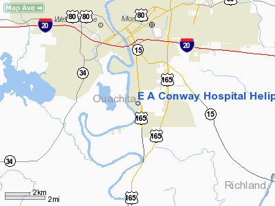
E A Conway Hospital Heliport |
Location &
QuickFacts
|
FAA
Information Effective: |
2008-09-25 |
|
Airport
Identifier: |
LS30 |
|
Airport
Status: |
Operational |
|
Longitude/Latitude: |
092-06-30.4840W/32-27-15.5250N
-92.108468/32.454313 (Estimated) |
|
Elevation: |
79 ft / 24.08 m (Estimated) |
|
Land: |
1 acres |
|
From
nearest city: |
0 nautical miles S of Monroe, LA |
|
Location: |
Ouachita Parish, LA |
|
Magnetic Variation: |
04E (1985) |
Owner & Manager
|
Ownership: |
Privately owned |
|
Owner: |
E.a.conway Hospital |
|
Address: |
Po Box 1881
Monroe, LA 71210 |
|
Phone
number: |
318-388-7000 |
|
Manager: |
Aryon Mcguire |
|
Address: |
P.o. Box 1881
Monroe, LA 71210 |
|
Phone number: |
318-330-7596 |
Airport Operations and Facilities
|
Airport
Use: |
Private
MEDICAL. |
|
Wind
indicator: |
Yes |
|
Segmented Circle: |
No |
|
Control
Tower: |
No |
|
Lighting
Schedule: |
PHONE REQ
FOR PERIMETER LGTS PHONE 318-388-7008. |
|
Sectional chart: |
Memphis |
|
Region: |
ASW - Southwest |
|
Boundary
ARTCC: |
ZFW - Fort Worth |
|
Tie-in
FSS: |
DRI - De Ridder |
|
FSS Toll
Free: |
1-800-WX-BRIEF |
|
Runway Information
Helipad H1
|
Dimension: |
65 x 65 ft / 19.8 x 19.8 m |
|
Surface: |
CONC, |
|
|
Runway H1
|
Runway
|
|
Traffic
Pattern: |
Left |
Left |
|
Radio Navigation Aids
|
ID |
Type |
Name |
Ch |
Freq |
Var |
Dist |
|
MRK |
NDB |
Molly Ridge |
|
338.00 |
02E |
17.3 nm |
|
BQP |
NDB |
Bastrop |
|
329.00 |
03E |
21.4 nm |
|
TUF |
NDB |
Stuckey |
|
350.00 |
03E |
24.6 nm |
|
ROQ |
NDB |
Ruston |
|
368.00 |
03E |
26.0 nm |
|
JBL |
NDB |
Hodge |
|
256.00 |
04E |
34.9 nm |
|
IFJ |
NDB |
Winnfield |
|
402.00 |
04E |
40.6 nm |
|
HMQ |
NDB |
Homer |
|
212.00 |
02E |
49.5 nm |
|
SWB |
VOR/DME |
Sawmill |
84Y |
113.75 |
02E |
40.9 nm |
|
MLU |
VORTAC |
Monroe |
119X |
117.20 |
03E |
5.3 nm |
E A Conway Hospital Heliport
Address:
Ouachita Parish, LA
Tel:
318-388-7000,
318-330-7596
Images
and information placed above are from
http://www.airport-data.com/airport/LS30/
We
thank them for the data!
|
General Info |
| Country |
United
States |
| State |
LOUISIANA |
| FAA ID |
LS30
|
| Latitude |
32-27-15.525N |
|
Longitude |
092-06-30.484W |
|
Elevation |
79 feet
|
| Near
City |
MONROE
|
We don't guarantee the information is fresh and accurate. The data may
be wrong or outdated.
For more up-to-date information please refer to other sources.
|
|


