 |
|
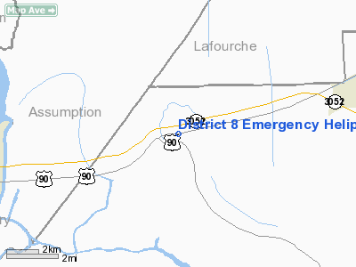
District 8 Emergency Heliport |
Location &
QuickFacts
|
FAA
Information Effective: |
2008-09-25 |
|
Airport
Identifier: |
LS64 |
|
Airport
Status: |
Operational |
|
Longitude/Latitude: |
090-59-14.3500W/29-41-18.7510N
-90.987319/29.688542 (Estimated) |
|
Elevation: |
0 ft / 0.00 m (Estimated) |
|
Land: |
2 acres |
|
From
nearest city: |
0 nautical miles N of Gibson, LA |
|
Location: |
Terrebonne Parish, LA |
|
Magnetic Variation: |
04E (1985) |
Owner & Manager
|
Ownership: |
Publicly owned |
|
Owner: |
Gibson Fire Department |
|
Address: |
Po Box 104
Gibson, LA 70356 |
|
Phone
number: |
985-575-2655
EMERGENCY TELEPHONE 985-575-8065 |
|
Manager: |
Chief Jonny Bush |
|
Address: |
5121 Bayou Black Dr.
Gibson, LA 70356 |
|
Phone number: |
985-575-8065 |
Airport Operations and Facilities
|
Airport
Use: |
Private
EMERGENCY USE ONLY. |
|
Wind
indicator: |
Yes |
|
Segmented Circle: |
Yes |
|
Control
Tower: |
No |
|
Lighting
Schedule: |
PHONE REQ
FOR LGTS CALL 504-575-3211. |
|
Sectional chart: |
New Orleans |
|
Region: |
ASW - Southwest |
|
Boundary
ARTCC: |
ZHU - Houston |
|
Tie-in
FSS: |
DRI - De Ridder |
|
FSS Toll
Free: |
1-800-WX-BRIEF |
|
Runway Information
Helipad H1
|
Dimension: |
30 x 30 ft / 9.1 x 9.1 m |
|
Surface: |
CONC, |
|
|
Runway H1
|
Runway
|
|
Traffic
Pattern: |
Left |
Left |
|
Markings: |
Basic, |
, |
|
Radio Navigation Aids
|
ID |
Type |
Name |
Ch |
Freq |
Var |
Dist |
|
PTN |
NDB |
Patterson |
|
245.00 |
01E |
18.3 nm |
|
MS |
NDB |
Kinte |
|
338.00 |
03E |
36.7 nm |
|
AR |
NDB |
Acadi |
|
269.00 |
03E |
48.4 nm |
|
RQR |
VOR/DME |
Reserve |
045X |
110.80 |
02E |
31.7 nm |
|
TBD |
VORTAC |
Tibby |
057X |
112.00 |
02E |
8.4 nm |
Based Aircraft
|
Aircraft based
on field: |
1 |
|
Helicopters: |
1 |
District 8 Emergency Heliport
Address:
Terrebonne Parish, LA
Tel:
985-575-2655,
985-575-8065
Images
and information placed above are from
http://www.airport-data.com/airport/LS64/
We
thank them for the data!
|
General Info |
| Country |
United
States |
| State |
LOUISIANA |
| FAA ID |
LS64
|
| Latitude |
29-41-18.751N |
|
Longitude |
090-59-14.350W |
|
Elevation |
0 feet
|
| Near
City |
GIBSON
|
We don't guarantee the information is fresh and accurate. The data may
be wrong or outdated.
For more up-to-date information please refer to other sources.
|
|


