 |
|
|
|
|
|
Location &
QuickFacts
|
FAA
Information Effective: |
2008-09-25 |
|
Airport
Identifier: |
0M9 |
|
Airport
Status: |
Operational |
|
Longitude/Latitude: |
091-29-54.6600W/32-24-37.7500N
-91.498517/32.410486 (Estimated) |
|
Elevation: |
91 ft / 27.74 m (Surveyed) |
|
Land: |
26 acres |
|
From
nearest city: |
3 nautical miles S of Delhi, LA |
|
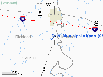
Location: |
Richland Parish, LA |
|
Magnetic Variation: |
04E (1985) |
Owner & Manager
|
Ownership: |
Publicly owned |
|
Owner: |
Town Of Delhi |
|
Address: |
Po Box 275
Delhi, LA 71232 |
|
Phone number: |
318-878-3792 |
|
Manager: |
Steve Britton |
|
Address: |
602 Littlejohn
Delhi, LA 71232 |
|
Phone number: |
318-878-5613 |
Airport
Operations and Facilities
|
Airport
Use: |
Open to public |
|
Wind
indicator: |
Yes |
|
Segmented Circle: |
No |
|
Control
Tower: |
No |
|
Lighting
Schedule: |
DUSK-DAWN |
|
Beacon
Color: |
Clear-Green (lighted land airport) |
|
Landing
fee charge: |
No |
|
Sectional chart: |
Memphis |
|
Region: |
ASW - Southwest |
|
Boundary
ARTCC: |
ZME - Memphis |
|
Responsible ARTCC: |
ZFW - Fort Worth |
|
Tie-in
FSS: |
DRI - De Ridder |
|
FSS on
Airport: |
No |
|
FSS Toll
Free: |
1-800-WX-BRIEF |
|
NOTAMs
Facility: |
DRI (NOTAM-d service avaliable) |
Airport Communications
|
Runway Information
Runway 18/36
|
Dimension: |
3000 x 75 ft / 914.4 x 22.9 m |
|
Surface: |
ASPH, Good Condition
RY CRACKED WITH GRASS IN CRACKS. |
|
Weight Limit: |
Single wheel: 5000 lbs. |
|
Edge Lights: |
Medium |
|
|
Runway 18
|
Runway 36
|
|
Longitude: |
091-29-54.8600W |
091-29-54.4500W |
|
Latitude: |
32-24-52.5900N |
32-24-22.9000N |
|
Traffic
Pattern: |
Left |
Left |
|
Markings: |
Basic, Fair Condition
RY 18/36 MARKINGS SLIGHTLY FADED. |
Basic, Fair Condition |
|
Obstruction: |
10 ft trees, 230.0 ft from runway, 123 ft left of
centerline, 3:1 slope to clear
8 FT TREES 123 FT L OF CNTRLN 180-200 FT FM RY END. |
15 ft tree, 340.0 ft from runway, 123 ft right of
centerline, 9:1 slope to clear
10 FT TREES 123 FT R OF CNTRLN 180-200 FT FM RY END. |
|
Radio Navigation Aids
|
ID |
Type |
Name |
Ch |
Freq |
Var |
Dist |
|
MRK |
NDB |
Molly Ridge |
|
338.00 |
02E |
13.9 nm |
|
TV |
NDB |
Savry |
|
344.00 |
02E |
26.0 nm |
|
BQP |
NDB |
Bastrop |
|
329.00 |
03E |
28.4 nm |
|
BLE |
NDB |
Lake Providence |
|
278.00 |
03E |
29.7 nm |
|
VKS |
NDB |
Vicksburg |
|
382.00 |
03E |
31.0 nm |
|
HAH |
NDB |
Natchez-adams County |
|
388.00 |
03E |
44.5 nm |
|
HEZ |
VOR/DME |
Natchez |
037X |
110.00 |
03E |
48.7 nm |
|
MLU |
VORTAC |
Monroe |
119X |
117.20 |
03E |
28.0 nm |
Remarks
-
RY 18/36 4 FT
FENCE 123 FT FM CNTRLN ON BOTH SIDES OF RY.
-
PCL OTS INDEFLY.
-
MAY BE EXEMPT
UNDER GRANDFATHER CLAUSE.
Based Aircraft
|
Aircraft based
on field: |
3 |
|
Single Engine
Airplanes: |
2 |
|
Multi Engine
Airplanes: |
1 |
Operational Statistics
Time Period: 2006-10-17 - 2007-10-16
|
Aircraft
Operations: |
154/Week |
|
General
Aviation Local: |
50.0% |
|
General
Aviation Itinerant: |
50.0% |
Delhi Municipal Airport
Address:
Richland Parish, LA
Tel:
318-878-3792, 318-878-5613
Images
and information placed above are from
http://www.airport-data.com/airport/0M9/
We
thank them for the data!
|
General Info |
| Country |
United
States |
| State |
LOUISIANA |
| FAA ID |
0M9
|
| Latitude |
32-24-38.517N |
|
Longitude |
091-29-55.425W |
|
Elevation |
91 feet
|
| Near
City |
DELHI
|
We don't guarantee the information is fresh and accurate. The data may
be wrong or outdated.
For more up-to-date information please refer to other sources.
|
|


