 |
|
|
|
|
|
Location &
QuickFacts
|
FAA
Information Effective: |
2008-09-25 |
|
Airport
Identifier: |
0R5 |
|
Airport
Status: |
Operational |
|
Longitude/Latitude: |
092-39-36.9380W/31-57-49.1840N
-92.660261/31.963662 (Estimated) |
|
Elevation: |
146 ft / 44.50 m (Surveyed) |
|
Land: |
210 acres |
|
From
nearest city: |
3 nautical miles NW of Winnfield, LA |
|
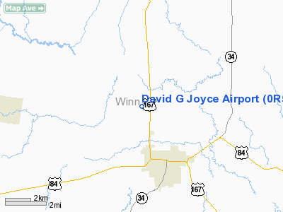
Location: |
Winn Parish, LA |
|
Magnetic Variation: |
05E (1980) |
Owner & Manager
|
Ownership: |
Publicly owned |
|
Owner: |
City Of Winnfield |
|
Address: |
Po Box 509
Joyce, LA 71483 |
|
Phone number: |
318-628-3939 |
|
Manager: |
Ms. Kim Brantley |
|
Address: |
Po Box 509
Winnfield, LA 71483 |
|
Phone number: |
318-628-3619 |
Airport
Operations and Facilities
|
Airport
Use: |
Open to public |
|
Wind
indicator: |
Yes |
|
Segmented Circle: |
No |
|
Control
Tower: |
No |
|
Lighting
Schedule: |
DUSK-DAWN
MIRL RY 08/26 & REIL RYS 08 & 26 PRESET LOW INTST; TO INCR INTST ACTVT
- CTAF. |
|
Beacon
Color: |
Clear-Green (lighted land airport) |
|
Landing
fee charge: |
No |
|
Sectional chart: |
Houston |
|
Region: |
ASW - Southwest |
|
Boundary
ARTCC: |
ZHU - Houston |
|
Tie-in
FSS: |
DRI - De Ridder |
|
FSS on
Airport: |
No |
|
FSS Toll
Free: |
1-800-WX-BRIEF |
|
NOTAMs
Facility: |
DRI (NOTAM-d service avaliable) |
|
Federal Agreements: |
N |
Airport Communications
|
CTAF: |
122.700 |
|
Unicom: |
122.700 |
Airport Services
|
Airframe
Repair: |
NONE |
|
Power
Plant Repair: |
NONE |
|
Bottled
Oxygen: |
NONE |
|
Bulk
Oxygen: |
NONE |
|
Runway Information
Runway 08/26
|
Dimension: |
3002 x 100 ft / 915.0 x 30.5 m |
|
Surface: |
ASPH, Fair Condition |
|
Weight Limit: |
Single wheel: 4000 lbs. |
|
Edge Lights: |
Medium
MIRL OTS INDEFLY. |
|
|
Runway 08
|
Runway 26
|
|
Longitude: |
092-39-54.3850W |
092-39-19.5350W |
|
Latitude: |
31-57-49.0730N |
31-57-49.3820N |
|
Elevation: |
146.00 ft |
118.00 ft |
|
Alignment: |
89 |
127 |
|
Traffic
Pattern: |
Left |
Left |
|
Markings: |
Non-precision instrument, Fair Condition
RY 08/26 MARKINGS FADED. |
Non-precision instrument, Fair Condition |
|
Crossing
Height: |
45.00 ft |
62.00 ft |
|
VASI: |
2-light PAPI on left side |
2-light PAPI on left side |
|
Visual
Glide Angle: |
3.00° |
3.45° |
|
Runway End
Identifier: |
Yes |
Yes |
|
Obstruction: |
100 ft trees, 2500.0 ft from runway, 23:1 slope to clear |
65 ft tree, 1300.0 ft from runway, 240 ft left of
centerline, 16:1 slope to clear |
|
Radio Navigation Aids
|
ID |
Type |
Name |
Ch |
Freq |
Var |
Dist |
|
IFJ |
NDB |
Winnfield |
|
402.00 |
04E |
0.2 nm |
|
JBL |
NDB |
Hodge |
|
256.00 |
04E |
14.7 nm |
|
TUF |
NDB |
Stuckey |
|
350.00 |
03E |
27.0 nm |
|
IE |
NDB |
Campi |
|
407.00 |
04E |
28.2 nm |
|
ROQ |
NDB |
Ruston |
|
368.00 |
03E |
38.9 nm |
|
SWB |
VOR/DME |
Sawmill |
84Y |
113.75 |
02E |
1.0 nm |
|
AEX |
VORTAC |
Alexandria |
108X |
116.10 |
03E |
43.3 nm |
|
MLU |
VORTAC |
Monroe |
119X |
117.20 |
03E |
46.0 nm |
Remarks
Based Aircraft
|
Aircraft based
on field: |
4 |
|
Single Engine
Airplanes: |
4 |
Operational Statistics
Time Period: 2007-05-01 - 2008-04-29
|
Aircraft
Operations: |
87/Week |
|
General
Aviation Local: |
44.4% |
|
General
Aviation Itinerant: |
55.6% |
David G Joyce Airport
Address:
Winn Parish, LA
Tel:
318-628-3939, 318-628-3619
Images
and information placed above are from
http://www.airport-data.com/airport/0R5/
We
thank them for the data!
|
General Info |
| Country |
United
States |
| State |
LOUISIANA |
| FAA ID |
0R5
|
| Latitude |
31-57-49.184N |
|
Longitude |
092-39-36.938W |
|
Elevation |
146 feet
|
| Near
City |
WINNFIELD |
We don't guarantee the information is fresh and accurate. The data may
be wrong or outdated.
For more up-to-date information please refer to other sources.
|
|


