 |
|
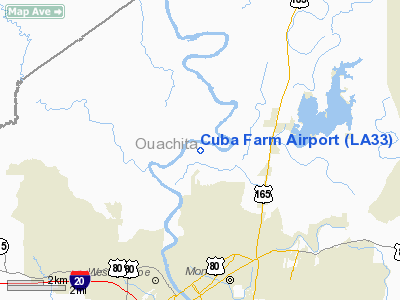
Location &
QuickFacts
|
FAA
Information Effective: |
2008-09-25 |
|
Airport
Identifier: |
LA33 |
|
Airport
Status: |
Operational |
|
Longitude/Latitude: |
092-06-49.4830W/32-34-35.5110N
-92.113745/32.576531 (Estimated) |
|
Elevation: |
80 ft / 24.38 m (Estimated) |
|
Land: |
15 acres |
|
From
nearest city: |
6 nautical miles NW of Monroe, LA |
|
Location: |
Ouachita Parish, LA |
|
Magnetic Variation: |
03E (1990) |
Owner & Manager
|
Ownership: |
Privately owned |
|
Owner: |
Harris Brown |
|
Address: |
Po Box 2470
Monroe, LA 71207 |
|
Phone number: |
318-388-2500 |
|
Manager: |
Harris Brown |
|
Address: |
Po Box 2470
Monroe, LA 71207 |
|
Phone number: |
318-388-2500 |
Airport
Operations and Facilities
|
Airport
Use: |
Private |
|
Wind
indicator: |
Yes |
|
Segmented Circle: |
No |
|
Control
Tower: |
No |
|
Sectional chart: |
Memphis |
|
Region: |
ASW - Southwest |
|
Boundary
ARTCC: |
ZFW - Fort Worth |
|
Tie-in
FSS: |
DRI - De Ridder |
|
FSS on
Airport: |
No |
|
FSS Toll
Free: |
1-800-WX-BRIEF |
|
Runway Information
Runway 09/27
|
Dimension: |
1500 x 150 ft / 457.2 x 45.7 m |
|
Surface: |
TURF, |
|
|
Runway 09
|
Runway 27
|
|
Traffic
Pattern: |
Left |
Left |
|
Obstruction: |
50 ft , 750.0 ft from runway |
50 ft trees, 2000.0 ft from runway |
|
Radio Navigation Aids
|
ID |
Type |
Name |
Ch |
Freq |
Var |
Dist |
|
BQP |
NDB |
Bastrop |
|
329.00 |
03E |
15.8 nm |
|
MRK |
NDB |
Molly Ridge |
|
338.00 |
02E |
20.1 nm |
|
ROQ |
NDB |
Ruston |
|
368.00 |
03E |
24.1 nm |
|
TUF |
NDB |
Stuckey |
|
350.00 |
03E |
26.1 nm |
|
JBL |
NDB |
Hodge |
|
256.00 |
04E |
38.4 nm |
|
IFJ |
NDB |
Winnfield |
|
402.00 |
04E |
46.1 nm |
|
HMQ |
NDB |
Homer |
|
212.00 |
02E |
46.7 nm |
|
BLE |
NDB |
Lake Providence |
|
278.00 |
03E |
49.2 nm |
|
SWB |
VOR/DME |
Sawmill |
84Y |
113.75 |
02E |
46.2 nm |
|
MLU |
VORTAC |
Monroe |
119X |
117.20 |
03E |
5.3 nm |
Remarks
-
STANDING WATER
MAY BE ON RY AFT RAIN.
-
CATTLE & DEER ON RY.
Based Aircraft
|
Aircraft based
on field: |
2 |
|
Single Engine
Airplanes: |
2 |
Cuba Farm Airport
Address:
Ouachita Parish, LA
Tel:
318-388-2500
Images
and information placed above are from
http://www.airport-data.com/airport/LA33/
We
thank them for the data!
|
General Info |
| Country |
United
States |
| State |
LOUISIANA |
| FAA ID |
LA33
|
| Latitude |
32-34-35.511N |
|
Longitude |
092-06-49.483W |
|
Elevation |
80 feet
|
| Near
City |
MONROE
|
We don't guarantee the information is fresh and accurate. The data may
be wrong or outdated.
For more up-to-date information please refer to other sources.
|
|


