 |
|
Location &
QuickFacts
|
FAA
Information Effective: |
2008-09-25 |
|
Airport
Identifier: |
15LA |
|
Airport
Status: |
Operational |
|
Longitude/Latitude: |
093-11-02.6000W/29-47-24.7000N
-93.184056/29.790194 (Estimated) |
|
Elevation: |
11 ft / 3.35 m (Estimated) |
|
Land: |
0 acres |
|
From
nearest city: |
7 nautical miles E of Oak Grove, LA |
|
Location: |
Cameron Parish, LA |
|
Magnetic Variation: |
03E (2000) |
Owner & Manager
|
Ownership: |
Privately owned |
|
Owner: |
Air Logistics, Llc |
|
Address: |
4605 Industrial Drive
New Iberia, LA 70560 |
|
Phone
number: |
337-365-6771 |
|
Manager: |
David Nezat |
|
Address: |
4605 Industrial Drive
New Iberia, LA 70560 |
|
Phone number: |
337-365-6771 |
Airport Operations and Facilities
|
Airport
Use: |
Private |
|
Segmented Circle: |
No |
|
Control
Tower: |
No |
|
Lighting
Schedule: |
PHONE REQ
FOR PERIMETER LGTS CALL 337-365-6771. |
|
Sectional chart: |
Houston |
|
Region: |
ASW - Southwest |
|
Boundary
ARTCC: |
ZHU - Houston |
|
Tie-in
FSS: |
DRI - De Ridder |
|
FSS Toll
Free: |
1-800-WX-BRIEF |
|
Runway Information
Helipad H1
|
Dimension: |
835 x 102 ft / 254.5 x 31.1 m |
|
Surface: |
CONC, |
|
|
Runway H1
|
Runway
|
|
Traffic
Pattern: |
Left |
Left |
|
Radio Navigation Aids
|
ID |
Type |
Name |
Ch |
Freq |
Var |
Dist |
|
UX |
NDB |
Sulfy |
|
278.00 |
04E |
27.5 nm |
|
ORG |
NDB |
Orange |
|
211.00 |
05E |
36.0 nm |
|
DQU |
NDB |
De Quincy |
|
410.00 |
05E |
41.5 nm |
|
LLA |
VOR/DME |
White Lake |
041X |
110.40 |
04E |
43.0 nm |
|
BPT |
VOR/DME |
Beaumont |
092X |
114.50 |
07E |
44.4 nm |
|
SBI |
VOR/DME |
Sabine Pass |
101X |
115.40 |
07E |
45.0 nm |
|
LCH |
VORTAC |
Lake Charles |
081X |
113.40 |
07E |
21.5 nm |
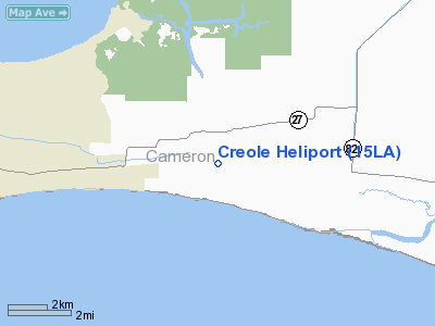
Creole Heliport
Address:
Cameron Parish, LA
Tel:
337-365-6771
Images
and information placed above are from
http://www.airport-data.com/airport/15LA/
We
thank them for the data!
|
General Info |
| Country |
United
States |
| State |
LOUISIANA |
| FAA ID |
15LA
|
| Latitude |
29-47-24.700N |
|
Longitude |
093-11-02.600W |
|
Elevation |
11 feet
|
| Near
City |
OAK
GROVE |
We don't guarantee the information is fresh and accurate. The data may
be wrong or outdated.
For more up-to-date information please refer to other sources.
|
|


