 |
|
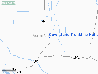
Cow Island Trunkline Heliport |
Location &
QuickFacts
|
FAA
Information Effective: |
2008-09-25 |
|
Airport
Identifier: |
2LA9 |
|
Airport
Status: |
Operational |
|
Longitude/Latitude: |
092-16-20.4670W/29-53-07.7530N
-92.272352/29.885487 (Estimated) |
|
Elevation: |
8 ft / 2.44 m (Estimated) |
|
Land: |
0 acres |
|
From
nearest city: |
7 nautical miles S of Kaplan, LA |
|
Location: |
Vermilion Parish, LA |
|
Magnetic Variation: |
04E (1985) |
Owner & Manager
|
Ownership: |
Privately owned |
|
Owner: |
Trunkline Gas Co |
|
Address: |
Po Box 190
Kaplan, LA 70548 |
|
Phone number: |
713-627-5400 |
|
Manager: |
N. Gaspard |
|
Address: |
Box 190
Kaplan, LA 70548 |
|
Phone number: |
318-643-8847 |
Airport Operations and Facilities
|
Airport Use: |
Private |
|
Wind indicator: |
Yes |
|
Segmented Circle: |
No |
|
Control Tower: |
No |
|
Landing fee charge: |
No |
|
Sectional chart: |
Houston |
|
Region: |
ASW - Southwest |
|
Boundary ARTCC: |
ZHU - Houston |
|
Tie-in FSS: |
DRI - De Ridder |
|
FSS on Airport: |
No |
|
FSS Toll Free: |
1-800-WX-BRIEF |
Airport Services
|
Airframe
Repair: |
NONE |
|
Power
Plant Repair: |
NONE |
|
Runway Information
Helipad H1
|
Dimension: |
30 x 30 ft / 9.1 x 9.1 m |
|
Surface: |
CONC,
A 30' X 30' CONC PAD WITHIN A 150' X 50' TURF LANDING AREA. |
|
|
Runway H1
|
Runway
|
|
Traffic
Pattern: |
Left |
Left |
|
Radio Navigation Aids
|
ID |
Type |
Name |
Ch |
Freq |
Var |
Dist |
|
AR |
NDB |
Acadi |
|
269.00 |
03E |
21.7 nm |
|
ECY |
NDB |
Eunice |
|
263.00 |
02E |
41.5 nm |
|
OPL |
NDB |
St Landry |
|
335.00 |
04E |
47.2 nm |
|
PTN |
NDB |
Patterson |
|
245.00 |
01E |
49.9 nm |
|
LLA |
VOR/DME |
White Lake |
041X |
110.40 |
04E |
14.4 nm |
|
LFT |
VORTAC |
Lafayette |
035X |
109.80 |
03E |
23.6 nm |
|
LCH |
VORTAC |
Lake Charles |
081X |
113.40 |
07E |
46.0 nm |
Cow Island Trunkline Heliport
Address:
Vermilion Parish, LA
Tel:
713-627-5400, 318-643-8847
Images
and information placed above are from
http://www.airport-data.com/airport/2LA9/
We
thank them for the data!
|
General Info |
| Country |
United
States |
| State |
LOUISIANA |
| FAA ID |
2LA9
|
| Latitude |
29-53-07.753N |
|
Longitude |
092-16-20.467W |
|
Elevation |
8 feet
|
| Near
City |
KAPLAN
|
We don't guarantee the information is fresh and accurate. The data may
be wrong or outdated.
For more up-to-date information please refer to other sources.
|
|


