 |
|
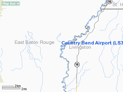
Location &
QuickFacts
|
FAA
Information Effective: |
2008-09-25 |
|
Airport
Identifier: |
LS39 |
|
Airport
Status: |
Operational |
|
Longitude/Latitude: |
090-59-04.3690W/30-35-21.6730N
-90.984547/30.589354 (Estimated) |
|
Elevation: |
49 ft / 14.94 m (Estimated) |
|
Land: |
30 acres |
|
From
nearest city: |
1 nautical miles E of Watson, LA |
|
Location: |
Livingston Parish, LA |
|
Magnetic Variation: |
03E (1985) |
Owner & Manager
|
Ownership: |
Privately owned |
|
Owner: |
Carl N. Rushing |
|
Address: |
34945 Newsom Lane
Denham Spring, LA 70726 |
|
Phone
number: |
504-664-4724 |
|
Manager: |
Carl N. Rushing |
|
Address: |
34945 Newsom Lane
Denham Spring, LA 70726 |
|
Phone number: |
504-664-4724 |
Airport Operations and Facilities
|
Airport
Use: |
Private |
|
Wind
indicator: |
Yes |
|
Segmented Circle: |
No |
|
Control
Tower: |
No |
|
Sectional chart: |
New Orleans |
|
Region: |
ASW - Southwest |
|
Boundary
ARTCC: |
ZHU - Houston |
|
Tie-in
FSS: |
DRI - De Ridder |
|
FSS Toll
Free: |
1-800-WX-BRIEF |
|
Runway Information
Runway 05/23
|
Dimension: |
3000 x 50 ft / 914.4 x 15.2 m |
|
Surface: |
TURF, |
|
|
Runway 05
|
Runway 23
|
|
Traffic
Pattern: |
Left |
Left |
|
Displaced
threshold: |
400.00 ft |
400.00 ft |
|
Obstruction: |
60 ft trees, 1200.0 ft from runway |
35 ft pline, 25.0 ft from runway |
|
Radio Navigation Aids
|
ID |
Type |
Name |
Ch |
Freq |
Var |
Dist |
|
HZ |
NDB |
Hazer |
|
356.00 |
04E |
26.2 nm |
|
MS |
NDB |
Kinte |
|
338.00 |
03E |
45.5 nm |
|
MC |
NDB |
Ferni |
|
413.00 |
03E |
46.9 nm |
|
HMU |
VOR |
Hammond |
|
109.60 |
03E |
29.7 nm |
|
RQR |
VOR/DME |
Reserve |
045X |
110.80 |
02E |
36.5 nm |
|
BTR |
VORTAC |
Baton Rouge |
112X |
116.50 |
06E |
17.2 nm |
Country Bend Airport
Address:
Livingston Parish, LA
Tel:
504-664-4724
Images
and information placed above are from
http://www.airport-data.com/airport/LS39/
We
thank them for the data!
|
General Info |
| Country |
United
States |
| State |
LOUISIANA |
| FAA ID |
LS39
|
| Latitude |
30-35-21.673N |
|
Longitude |
090-59-04.369W |
|
Elevation |
49 feet
|
| Near
City |
WATSON
|
We don't guarantee the information is fresh and accurate. The data may
be wrong or outdated.
For more up-to-date information please refer to other sources.
|
|


