 |
|
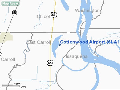
Location &
QuickFacts
|
FAA
Information Effective: |
2008-09-25 |
|
Airport
Identifier: |
6LA1 |
|
Airport
Status: |
Operational |
|
Longitude/Latitude: |
091-12-21.3960W/32-59-02.4480N
-91.205943/32.984013 (Estimated) |
|
Elevation: |
120 ft / 36.58 m (Estimated) |
|
Land: |
300 acres |
|
From
nearest city: |
10 nautical miles N of Lake Providence, LA |
|
Location: |
East Carroll Parish, LA |
|
Magnetic Variation: |
03E (1985) |
Owner & Manager
|
Ownership: |
Privately owned |
|
Owner: |
Cottonwood Farms Llc |
|
Address: |
2829 Lakewood Dr, Suite 1600
Jackson, MS 39232 |
|
Phone
number: |
318-559-2100 |
|
Manager: |
Jamie Street |
|
Address: |
Route 2 Box 153b
Lake Providence, LA 71254 |
|
Phone number: |
318-559-2100 |
Airport Operations and Facilities
|
Airport
Use: |
Private |
|
Wind
indicator: |
Yes |
|
Segmented Circle: |
No |
|
Control
Tower: |
No |
|
Sectional chart: |
Memphis |
|
Region: |
ASW - Southwest |
|
Boundary
ARTCC: |
ZME - Memphis |
|
Tie-in
FSS: |
DRI - De Ridder |
|
FSS Toll
Free: |
1-800-WX-BRIEF |
|
Runway Information
Runway 03/21
|
Dimension: |
3500 x 75 ft / 1066.8 x 22.9 m |
|
Surface: |
TURF, |
|
|
Runway 03
|
Runway 21
|
|
Traffic
Pattern: |
Left |
Left |
|
Radio Navigation Aids
|
ID |
Type |
Name |
Ch |
Freq |
Var |
Dist |
|
BLE |
NDB |
Lake Providence |
|
278.00 |
03E |
9.3 nm |
|
MTQ |
NDB |
Metcalf |
|
359.00 |
03E |
28.8 nm |
|
BQP |
NDB |
Bastrop |
|
329.00 |
03E |
36.9 nm |
|
IDL |
NDB |
Indianola |
|
284.00 |
03E |
40.0 nm |
|
MRK |
NDB |
Molly Ridge |
|
338.00 |
02E |
45.0 nm |
|
TV |
NDB |
Savry |
|
344.00 |
02E |
45.3 nm |
|
VKS |
NDB |
Vicksburg |
|
382.00 |
03E |
47.3 nm |
|
GLH |
VOR/DME |
Greenville |
039X |
110.20 |
04E |
34.3 nm |
|
MON |
VOR/DME |
Monticello |
053X |
111.60 |
04E |
43.2 nm |
Cottonwood Airport
Address:
East Carroll Parish, LA
Tel:
318-559-2100
Images
and information placed above are from
http://www.airport-data.com/airport/6LA1/
We
thank them for the data!
|
General Info |
| Country |
United
States |
| State |
LOUISIANA |
| FAA ID |
6LA1
|
| Latitude |
32-59-02.448N |
|
Longitude |
091-12-21.396W |
|
Elevation |
120 feet
|
| Near
City |
LAKE
PROVIDENCE |
We don't guarantee the information is fresh and accurate. The data may
be wrong or outdated.
For more up-to-date information please refer to other sources.
|
|


