 |
|
|
|
|
|
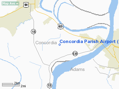
Location &
QuickFacts
|
FAA
Information Effective: |
2008-09-25 |
|
Airport
Identifier: |
0R4 |
|
Airport
Status: |
Operational |
|
Longitude/Latitude: |
091-30-22.7800W/31-33-42.0200N
-91.506328/31.561672 (Estimated) |
|
Elevation: |
54 ft / 16.46 m (Estimated) |
|
Land: |
83 acres |
|
From
nearest city: |
4 nautical miles W of Vidalia, LA |
|
Location: |
Concordia Parish, LA |
|
Magnetic Variation: |
04E (1985) |
Owner & Manager
|
Ownership: |
Publicly owned |
|
Owner: |
Concordia Parish Police Jury |
|
Address: |
4001 Carter St, P. O. Box 638
Vidalia, LA 71373 |
|
Phone
number: |
318-336-7151 |
|
Manager: |
Carl D. Sayers |
|
Address: |
P. O. Box 638
Vidalia, LA 71373 |
|
Phone number: |
601-597-2930 |
Airport Operations and Facilities
|
Airport
Use: |
Open to public |
|
Wind
indicator: |
Yes
WIND SOCK & WIND TEE LGTS OTS INDEFLY. |
|
Segmented Circle: |
No |
|
Control
Tower: |
No |
|
Lighting
Schedule: |
DUSK-DAWN
MIRL RY 14/32 PRESET LOW INTST; TO INCR INTST & ACTVT REIL RY 14 -
CTAF. |
|
Beacon
Color: |
Clear-Green (lighted land airport)
ROTG BCN OTS INDEFLY. |
|
Landing
fee charge: |
No |
|
Sectional chart: |
Houston |
|
Region: |
ASW - Southwest |
|
Boundary
ARTCC: |
ZHU - Houston |
|
Tie-in
FSS: |
DRI - De Ridder |
|
FSS on
Airport: |
No |
|
FSS Toll
Free: |
1-800-WX-BRIEF |
|
NOTAMs
Facility: |
DRI (NOTAM-d service avaliable) |
|
Federal Agreements: |
NGY |
Airport Communications
|
CTAF: |
122.800 |
|
Unicom: |
122.800 |
Airport Services
|
Fuel
available: |
100LLMOGAS
FOR FUEL AFT HRS CALL 601-597-2930. |
|
Bottled
Oxygen: |
NONE |
|
Bulk
Oxygen: |
NONE |
|
Runway Information
Runway 14/32
|
Dimension: |
3700 x 75 ft / 1127.8 x 22.9 m |
|
Surface: |
ASPH, Good Condition |
|
Weight Limit: |
Single wheel: 12000 lbs. |
|
Edge Lights: |
Medium
MIRL OTS INDEFLY. |
|
|
Runway 14
|
Runway 32
|
|
Longitude: |
091-30-35.4100W |
091-30-10.1400W |
|
Latitude: |
31-33-56.8000N |
31-33-27.2400N |
|
Traffic
Pattern: |
Left |
Left |
|
Markings: |
Nonstandard, Good Condition
THRESHOLD BAR NSTD. |
Nonstandard, Good Condition
THRESHOLD BAR NSTD. |
|
Crossing
Height: |
17.00 ft |
0.00 ft |
|
VASI: |
2-box SAVASI on left side
SAVSI OTS INDEFLY. |
|
|
Visual
Glide Angle: |
4.00° |
0.00° |
|
Runway End
Identifier: |
Yes
REIL OTS INDEFLY. |
|
|
Obstruction: |
60 ft trees, 2300.0 ft from runway, 35:1 slope to clear |
60 ft pline, 2000.0 ft from runway, 30:1 slope to clear |
|
Radio Navigation Aids
|
ID |
Type |
Name |
Ch |
Freq |
Var |
Dist |
|
HAH |
NDB |
Natchez-adams County |
|
388.00 |
03E |
13.4 nm |
|
MKV |
NDB |
Marksville |
|
347.00 |
02E |
40.4 nm |
|
TV |
NDB |
Savry |
|
344.00 |
02E |
47.9 nm |
|
HEZ |
VOR/DME |
Natchez |
037X |
110.00 |
03E |
11.1 nm |
Remarks
-
400' TWR LCTD 2
MILES NORTH OF RWY 14/32.
-
RY 14/32 75 FT
TREES EAST OF RY PENETRATE TRANSITION SLOPE.
-
CONST ACTIVITY
ALONG NORTHERN PARKING APRON, EXERCISE CAUTION WHILE TAXIING TO PARKING.
-
ARPT CLSD MON-THU
INDEFLY. PAEW ON RY & TWYS; USE EXTREME CARE.
Based Aircraft
|
Aircraft based
on field: |
16 |
|
Single Engine
Airplanes: |
16 |
Operational Statistics
Time Period: 2007-02-20 - 2008-02-19
|
Aircraft
Operations: |
174/Week |
|
General
Aviation Local: |
66.7% |
|
General
Aviation Itinerant: |
33.3% |
Concordia Parish Airport
Address:
Concordia Parish, LA
Tel:
318-336-7151,
601-597-2930
Images
and information placed above are from
http://www.airport-data.com/airport/0R4/
We
thank them for the data!
|
General Info |
| Country |
United
States |
| State |
LOUISIANA |
| FAA ID |
0R4
|
| Latitude |
31-34-00.598N |
|
Longitude |
091-30-00.428W |
|
Elevation |
54 feet
|
| Near
City |
VIDALIA
|
We don't guarantee the information is fresh and accurate. The data may
be wrong or outdated.
For more up-to-date information please refer to other sources.
|
|


