 |
|
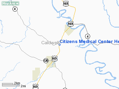
Citizens Medical Center Heliport |
|
|
Location &
QuickFacts
|
FAA
Information Effective: |
2008-09-25 |
|
Airport
Identifier: |
LA23 |
|
Airport
Status: |
Operational |
|
Longitude/Latitude: |
092-05-39.0000W/32-04-41.0000N
-92.094167/32.078056 (Estimated) |
|
Elevation: |
190 ft / 57.91 m (Estimated) |
|
Land: |
0 acres |
|
From
nearest city: |
2 nautical miles N of Columbia, LA |
|
Location: |
Caldwell Parish, LA |
|
Magnetic Variation: |
03E (1995) |
Owner & Manager
|
Ownership: |
Privately owned |
|
Owner: |
Citizens Medical Center |
|
Address: |
7939 U.s. Hwy 165 Po Box 1079
Columbia, LA 71418 |
|
Phone
number: |
318-649-6106 |
|
Manager: |
Steve Barbo |
|
Address: |
7939 U.s. Hwy 165 Po Box 1079
Columbia, LA 71418 |
|
Phone number: |
318-649-6106 |
Airport Operations and Facilities
|
Airport
Use: |
Private
MEDICAL. |
|
Wind
indicator: |
Yes |
|
Segmented Circle: |
No |
|
Control
Tower: |
No |
|
Lighting
Schedule: |
DUSK-DAWN
FOR PERIMETER LGTS CALL 318-649-6106. |
|
Beacon
Color: |
Clear-Green-Yellow (heliport) |
|
Sectional chart: |
Memphis |
|
Region: |
ASW - Southwest |
|
Boundary
ARTCC: |
ZHU - Houston |
|
Tie-in
FSS: |
DRI - De Ridder |
|
FSS Toll
Free: |
1-800-WX-BRIEF |
|
Runway Information
Helipad H1
|
Dimension: |
40 x 40 ft / 12.2 x 12.2 m |
|
Surface: |
CONC, |
|
|
Runway H1
|
Runway
|
|
Traffic
Pattern: |
Left |
Left |
|
Radio Navigation Aids
|
ID |
Type |
Name |
Ch |
Freq |
Var |
Dist |
|
MRK |
NDB |
Molly Ridge |
|
338.00 |
02E |
25.6 nm |
|
IFJ |
NDB |
Winnfield |
|
402.00 |
04E |
29.5 nm |
|
TUF |
NDB |
Stuckey |
|
350.00 |
03E |
32.1 nm |
|
JBL |
NDB |
Hodge |
|
256.00 |
04E |
33.0 nm |
|
ROQ |
NDB |
Ruston |
|
368.00 |
03E |
40.6 nm |
|
BQP |
NDB |
Bastrop |
|
329.00 |
03E |
42.1 nm |
|
HAH |
NDB |
Natchez-adams County |
|
388.00 |
03E |
47.1 nm |
|
SWB |
VOR/DME |
Sawmill |
84Y |
113.75 |
02E |
30.4 nm |
|
HEZ |
VOR/DME |
Natchez |
037X |
110.00 |
03E |
49.1 nm |
|
MLU |
VORTAC |
Monroe |
119X |
117.20 |
03E |
26.5 nm |
Citizens Medical Center Heliport
Address:
Caldwell Parish, LA
Tel:
318-649-6106
Images
and information placed above are from
http://www.airport-data.com/airport/LA23/
We
thank them for the data!
|
General Info |
| Country |
United
States |
| State |
LOUISIANA |
| FAA ID |
LA23
|
| Latitude |
32-04-41.000N |
|
Longitude |
092-05-39.000W |
|
Elevation |
190 feet
|
| Near
City |
COLUMBIA
|
We don't guarantee the information is fresh and accurate. The data may
be wrong or outdated.
For more up-to-date information please refer to other sources.
|
|


