 |
|
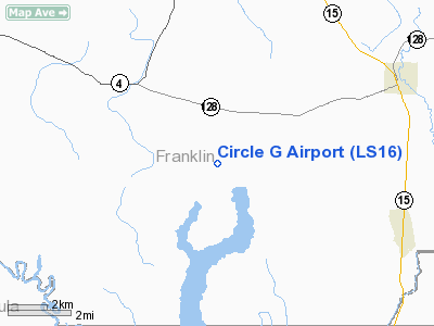
Location &
QuickFacts
|
FAA
Information Effective: |
2008-09-25 |
|
Airport
Identifier: |
LS16 |
|
Airport
Status: |
Operational |
|
Longitude/Latitude: |
091-45-18.4570W/32-00-40.5660N
-91.755127/32.011268 (Estimated) |
|
Elevation: |
75 ft / 22.86 m (Estimated) |
|
Land: |
5 acres |
|
From
nearest city: |
2 nautical miles S of Jigger, LA |
|
Location: |
Franklin Parish, LA |
|
Magnetic Variation: |
04E (1985) |
Owner & Manager
|
Ownership: |
Privately owned |
|
Owner: |
James R. Guillot |
|
Address: |
712 Hwy 874
Winnsboro, LA 71295 |
|
Phone number: |
318-723-5581 |
|
Address: |
|
Airport Operations and Facilities
|
Airport Use: |
Private |
|
Wind indicator: |
Yes |
|
Segmented Circle: |
No |
|
Control Tower: |
No |
|
Lighting Schedule: |
PHONE REQ |
|
Sectional chart: |
Memphis |
|
Region: |
ASW - Southwest |
|
Boundary ARTCC: |
ZHU - Houston |
|
Tie-in FSS: |
DRI - De Ridder |
|
FSS on Airport: |
No |
|
FSS Toll Free: |
1-800-WX-BRIEF |
Airport Services
|
Fuel
available: |
100LLMOGAS |
|
Runway Information
Runway 09/27
|
Dimension: |
2640 x 50 ft / 804.7 x 15.2 m |
|
Surface: |
TURF, |
|
|
Runway 09
|
Runway 27
|
|
Traffic
Pattern: |
Left |
Left |
|
Obstruction: |
|
30 ft pline, 50.0 ft from runway |
|
Runway 18/36
|
Dimension: |
1320 x 50 ft / 402.3 x 15.2 m |
|
Surface: |
TURF, |
|
|
Runway 18
|
Runway 36
|
|
Traffic
Pattern: |
Left |
Left |
|
Obstruction: |
30 ft pline, 50.0 ft from runway |
|
|
Radio Navigation Aids
|
ID |
Type |
Name |
Ch |
Freq |
Var |
Dist |
|
MRK |
NDB |
Molly Ridge |
|
338.00 |
02E |
23.8 nm |
|
HAH |
NDB |
Natchez-adams County |
|
388.00 |
03E |
30.5 nm |
|
TV |
NDB |
Savry |
|
344.00 |
02E |
39.7 nm |
|
VKS |
NDB |
Vicksburg |
|
382.00 |
03E |
44.2 nm |
|
BQP |
NDB |
Bastrop |
|
329.00 |
03E |
45.2 nm |
|
IFJ |
NDB |
Winnfield |
|
402.00 |
04E |
46.1 nm |
|
TUF |
NDB |
Stuckey |
|
350.00 |
03E |
48.7 nm |
|
HEZ |
VOR/DME |
Natchez |
037X |
110.00 |
03E |
33.2 nm |
|
SWB |
VOR/DME |
Sawmill |
84Y |
113.75 |
02E |
47.1 nm |
|
MLU |
VORTAC |
Monroe |
119X |
117.20 |
03E |
33.6 nm |
Based Aircraft
|
Aircraft based
on field: |
2 |
|
Single Engine
Airplanes: |
2 |
Circle G Airport
Address:
Franklin Parish, LA
Tel:
318-723-5581
Images
and information placed above are from
http://www.airport-data.com/airport/LS16/
We
thank them for the data!
|
General Info |
| Country |
United
States |
| State |
LOUISIANA |
| FAA ID |
LS16
|
| Latitude |
32-00-40.566N |
|
Longitude |
091-45-18.457W |
|
Elevation |
75 feet
|
| Near
City |
JIGGER
|
We don't guarantee the information is fresh and accurate. The data may
be wrong or outdated.
For more up-to-date information please refer to other sources.
|
|


