 |
|
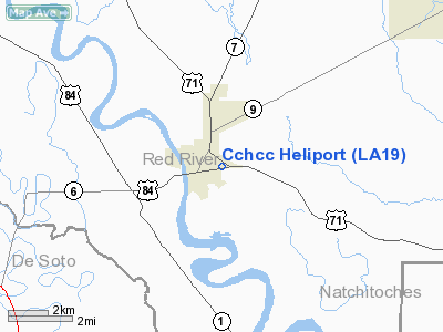
Christus Coushatta Health Care Center Heliport |
Location &
QuickFacts
|
FAA
Information Effective: |
2008-09-25 |
|
Airport
Identifier: |
LA19 |
|
Airport
Status: |
Operational |
|
Longitude/Latitude: |
093-20-00.0000W/32-01-00.0000N
-93.333333/32.016667 (Estimated) |
|
Elevation: |
102 ft / 31.09 m (Estimated) |
|
Land: |
0 acres |
|
From
nearest city: |
0 nautical miles N of Coushatta, LA |
|
Location: |
Red River Parish, LA |
|
Magnetic Variation: |
03E (2000) |
Owner & Manager
|
Ownership: |
Privately owned |
|
Owner: |
Christus Coushatta Health Care Ctr |
|
Address: |
1635 Marvel Street
Coushatta, LA 71019 |
|
Phone number: |
318-932-2199 |
|
Manager: |
Karen Mixon/debbie Dalton |
|
Address: |
1635 Marvel Street
Coushatta, LA 71019 |
|
Phone number: |
318-932-2199 |
Airport
Operations and Facilities
|
Airport
Use: |
Private
MEDICAL. |
|
Wind
indicator: |
Yes |
|
Segmented Circle: |
No |
|
Control
Tower: |
No |
|
Lighting
Schedule: |
DUSK-DAWN |
|
Sectional chart: |
Memphis |
|
Region: |
ASW - Southwest |
|
Boundary
ARTCC: |
ZFW - Fort Worth |
|
Tie-in
FSS: |
DRI - De Ridder |
|
FSS Toll
Free: |
1-800-WX-BRIEF |
|
Runway Information
Helipad H1
|
Dimension: |
50 x 50 ft / 15.2 x 15.2 m |
|
Surface: |
ASPH, |
|
|
Runway H1
|
Runway
|
|
Traffic
Pattern: |
Left |
Left |
|
Radio Navigation Aids
|
ID |
Type |
Name |
Ch |
Freq |
Var |
Dist |
|
MSD |
NDB |
Mansfield |
|
414.00 |
04E |
22.2 nm |
|
IE |
NDB |
Campi |
|
407.00 |
04E |
25.2 nm |
|
MMY |
NDB |
Many |
|
272.00 |
04E |
28.8 nm |
|
JBL |
NDB |
Hodge |
|
256.00 |
04E |
32.9 nm |
|
IFJ |
NDB |
Winnfield |
|
402.00 |
04E |
34.6 nm |
|
MNE |
NDB |
Minden |
|
201.00 |
04E |
37.6 nm |
|
CZJ |
NDB |
Amason |
|
341.00 |
04E |
43.3 nm |
|
TUF |
NDB |
Stuckey |
|
350.00 |
03E |
44.6 nm |
|
HMQ |
NDB |
Homer |
|
212.00 |
02E |
49.5 nm |
|
BAD |
TACAN |
Barksdale |
105X |
|
05E |
33.8 nm |
|
DTN |
VOR |
Downtown |
|
108.60 |
07E |
37.7 nm |
|
SWB |
VOR/DME |
Sawmill |
84Y |
113.75 |
02E |
33.6 nm |
|
EMG |
VORTAC |
Elm Grove |
049X |
111.20 |
07E |
26.6 nm |
|
SHV |
VOT |
Shreveport Regional |
|
108.20 |
|
44.1 nm |
Christus Coushatta Health Care Center
Heliport
Address:
Red River Parish, LA
Tel:
318-932-2199
Images
and information placed above are from
http://www.airport-data.com/airport/LA19/
We
thank them for the data!
|
General Info |
| Country |
United
States |
| State |
LOUISIANA |
| FAA ID |
LA19
|
| Latitude |
32-01-00.000N |
|
Longitude |
093-20-00.000W |
|
Elevation |
102 feet
|
| Near
City |
COUSHATTA |
We don't guarantee the information is fresh and accurate. The data may
be wrong or outdated.
For more up-to-date information please refer to other sources.
|
|


