 |
|
|
|
|
|
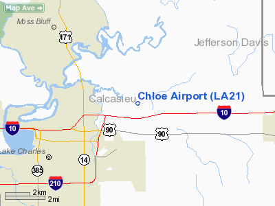
Location &
QuickFacts
|
FAA
Information Effective: |
2008-09-25 |
|
Airport
Identifier: |
LA21 |
|
Airport
Status: |
Operational |
|
Longitude/Latitude: |
093-08-06.5470W/30-15-17.7410N
-93.135152/30.254928 (Estimated) |
|
Elevation: |
10 ft / 3.05 m (Estimated) |
|
Land: |
15 acres |
|
From
nearest city: |
4 nautical miles NE of Lake Charles, LA |
|
Location: |
Calcasieu Parish, LA |
|
Magnetic Variation: |
05E (1985) |
Owner & Manager
|
Ownership: |
Privately owned |
|
Owner: |
Charles L. Jones |
|
Address: |
Route 10, Box 406
Lake Charles, LA 70601 |
|
Phone
number: |
318-436-4846 |
|
Manager: |
Charles L. Jones |
|
Address: |
Route 10, Box 406
Lake Charles, LA 70601 |
|
Phone number: |
318-436-4846 |
Airport Operations and Facilities
|
Airport Use: |
Private |
|
Wind indicator: |
No |
|
Segmented Circle: |
No |
|
Control Tower: |
No |
|
Landing fee charge: |
No |
|
Sectional chart: |
Houston |
|
Region: |
ASW - Southwest |
|
Boundary ARTCC: |
ZHU - Houston |
|
Tie-in FSS: |
DRI - De Ridder |
|
FSS on Airport: |
No |
|
FSS Toll Free: |
1-800-WX-BRIEF |
Airport Services
|
Airframe
Repair: |
NONE |
|
Power
Plant Repair: |
NONE |
|
Bottled
Oxygen: |
NONE |
|
Bulk
Oxygen: |
NONE |
|
Runway Information
Runway 15/33
|
Dimension: |
4000 x 70 ft / 1219.2 x 21.3 m |
|
Surface: |
TURF, Fair Condition |
|
|
Runway 15
|
Runway 33
|
|
Traffic
Pattern: |
Left |
Right |
|
Obstruction: |
60 ft trees, 50.0 ft from runway |
50 ft trees, 50.0 ft from runway, 1:1 slope to clear |
|
Radio Navigation Aids
|
ID |
Type |
Name |
Ch |
Freq |
Var |
Dist |
|
POE |
FAN MARKER |
South |
|
|
07E |
43.5 nm |
|
UX |
NDB |
Sulfy |
|
278.00 |
04E |
15.2 nm |
|
DQU |
NDB |
De Quincy |
|
410.00 |
05E |
20.3 nm |
|
DR |
NDB |
Idder |
|
385.00 |
04E |
31.6 nm |
|
LRR |
NDB |
Allen Parish |
|
379.00 |
03E |
32.8 nm |
|
ORG |
NDB |
Orange |
|
211.00 |
05E |
36.0 nm |
|
ECY |
NDB |
Eunice |
|
263.00 |
02E |
40.1 nm |
|
GUV |
NDB |
Gator |
|
359.00 |
05E |
46.6 nm |
|
BPT |
VOR/DME |
Beaumont |
092X |
114.50 |
07E |
49.4 nm |
|
LCH |
VORTAC |
Lake Charles |
081X |
113.40 |
07E |
7.0 nm |
Based Aircraft
|
Aircraft based
on field: |
3 |
|
Single Engine
Airplanes: |
2 |
|
Helicopters: |
1 |
Operational Statistics
Time Period: 1991-02-14 - 1992-02-13
|
Aircraft
Operations: |
20/Week |
|
General
Aviation Local: |
60.0% |
|
General
Aviation Itinerant: |
40.0% |
Chloe Airport
Address:
Calcasieu Parish, LA
Tel:
318-436-4846
Images
and information placed above are from
http://www.airport-data.com/airport/LA21/
We
thank them for the data!
|
General Info |
| Country |
United
States |
| State |
LOUISIANA |
| FAA ID |
LA21
|
| Latitude |
30-15-17.741N |
|
Longitude |
093-08-06.547W |
|
Elevation |
10 feet
|
| Near
City |
LAKE
CHARLES |
We don't guarantee the information is fresh and accurate. The data may
be wrong or outdated.
For more up-to-date information please refer to other sources.
|
|


