 |
|
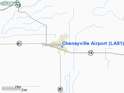
Location &
QuickFacts
|
FAA
Information Effective: |
2008-09-25 |
|
Airport
Identifier: |
LA81 |
|
Airport
Status: |
Operational |
|
Longitude/Latitude: |
092-16-48.4650W/30-00-05.7410N
-92.280129/30.001595 (Estimated) |
|
Elevation: |
63 ft / 19.20 m (Surveyed) |
|
Land: |
0 acres |
|
From
nearest city: |
1 nautical miles SE of Cheneyville, LA |
|
Location: |
Rapides Parish, LA |
|
Magnetic Variation: |
04E (1985) |
Owner & Manager
|
Ownership: |
Privately owned |
|
Owner: |
Jarod & Michael Lemoine |
|
Address: |
1320 Levi Gremillion Rd.
Plancheville, LA 71362
FARMERS DUSTING CO. |
|
Phone number: |
318-922-3870
318-452-8512 (CELL) |
|
Address: |
|
Airport Operations and Facilities
|
Airport Use: |
Private |
|
Segmented Circle: |
No |
|
Control Tower: |
No |
|
Landing fee charge: |
No |
|
Sectional chart: |
Houston |
|
Region: |
ASW - Southwest |
|
Boundary ARTCC: |
ZHU - Houston |
|
Tie-in FSS: |
DRI - De Ridder |
|
FSS on Airport: |
No |
|
FSS Toll Free: |
1-800-WX-BRIEF |
Airport Services
|
Fuel
available: |
100LLA |
|
Airframe
Repair: |
NONE |
|
Power
Plant Repair: |
NONE |
|
Runway Information
Runway 18/36
|
Dimension: |
5100 x 85 ft / 1554.5 x 25.9 m |
|
Surface: |
ASPH-TURF,
FIRST 2500 FT BLACKTOP 22 FT WIDE. |
|
|
Runway 18
|
Runway 36
|
|
Traffic
Pattern: |
Left |
Left |
|
Obstruction: |
25 ft bldg, 160.0 ft from runway |
|
|
Radio Navigation Aids
|
ID |
Type |
Name |
Ch |
Freq |
Var |
Dist |
|
AR |
NDB |
Acadi |
|
269.00 |
03E |
21.9 nm |
|
ECY |
NDB |
Eunice |
|
263.00 |
02E |
34.7 nm |
|
OPL |
NDB |
St Landry |
|
335.00 |
04E |
40.4 nm |
|
LRR |
NDB |
Allen Parish |
|
379.00 |
03E |
43.9 nm |
|
LLA |
VOR/DME |
White Lake |
041X |
110.40 |
04E |
20.9 nm |
|
LFT |
VORTAC |
Lafayette |
035X |
109.80 |
03E |
18.9 nm |
|
LCH |
VORTAC |
Lake Charles |
081X |
113.40 |
07E |
43.8 nm |
Based Aircraft
|
Aircraft based
on field: |
9 |
|
Single Engine
Airplanes: |
9 |
Cheneyville Airport
Address:
Rapides Parish, LA
Tel:
318-922-3870, 318-452-8512
Images
and information placed above are from
http://www.airport-data.com/airport/LA81/
We
thank them for the data!
|
General Info |
| Country |
United
States |
| State |
LOUISIANA |
| FAA ID |
LA81
|
| Latitude |
30-00-05.741N |
|
Longitude |
092-16-48.465W |
|
Elevation |
63 feet
|
| Near
City |
CHENEYVILLE |
We don't guarantee the information is fresh and accurate. The data may
be wrong or outdated.
For more up-to-date information please refer to other sources.
|
|


