 |
|
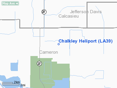
Location &
QuickFacts
|
FAA
Information Effective: |
2008-09-25 |
|
Airport
Identifier: |
LA39 |
|
Airport
Status: |
Operational |
|
Longitude/Latitude: |
093-03-04.7600W/30-00-38.5500N
-93.051322/30.010708 (Estimated) |
|
Elevation: |
5 ft / 1.52 m (Estimated) |
|
Land: |
0 acres |
|
From
nearest city: |
13 nautical miles W of Bell City, LA |
|
Location: |
Cameron Parish, LA |
|
Magnetic Variation: |
04E (1990) |
Owner & Manager
|
Ownership: |
Privately owned |
|
Owner: |
Exxon Co Usa |
|
Address: |
Po Box 61707
New Orleans, LA 70161-1707 |
|
Phone
number: |
504-561-4314 |
|
Manager: |
Robert G Williams |
|
Address: |
Po Box 61707
New Orleans, LA 70161-1707 |
|
Phone number: |
504-561-4314 |
Airport Operations and Facilities
|
Airport
Use: |
Private |
|
Wind
indicator: |
Yes |
|
Segmented Circle: |
No |
|
Control
Tower: |
No |
|
Sectional chart: |
Houston |
|
Region: |
ASW - Southwest |
|
Boundary
ARTCC: |
ZHU - Houston |
|
Tie-in
FSS: |
DRI - De Ridder |
|
FSS on
Airport: |
No |
|
FSS Toll
Free: |
1-800-WX-BRIEF |
|
Runway Information
Helipad H1
|
Dimension: |
35 x 35 ft / 10.7 x 10.7 m |
|
Surface: |
CONC, |
|
|
Runway H1
|
Runway
|
|
Traffic
Pattern: |
Left |
Left |
|
Radio Navigation Aids
|
ID |
Type |
Name |
Ch |
Freq |
Var |
Dist |
|
UX |
NDB |
Sulfy |
|
278.00 |
04E |
22.3 nm |
|
DQU |
NDB |
De Quincy |
|
410.00 |
05E |
33.4 nm |
|
ORG |
NDB |
Orange |
|
211.00 |
05E |
38.9 nm |
|
LRR |
NDB |
Allen Parish |
|
379.00 |
03E |
42.3 nm |
|
ECY |
NDB |
Eunice |
|
263.00 |
02E |
45.5 nm |
|
DR |
NDB |
Idder |
|
385.00 |
04E |
46.9 nm |
|
LLA |
VOR/DME |
White Lake |
041X |
110.40 |
04E |
41.0 nm |
|
LCH |
VORTAC |
Lake Charles |
081X |
113.40 |
07E |
8.4 nm |
Based Aircraft
|
Aircraft based
on field: |
1 |
|
Helicopters: |
1 |
Chalkley Heliport
Address:
Cameron Parish, LA
Tel:
504-561-4314
Images
and information placed above are from
http://www.airport-data.com/airport/LA39/
We
thank them for the data!
|
General Info |
| Country |
United
States |
| State |
LOUISIANA |
| FAA ID |
LA39
|
| Latitude |
30-00-38.550N |
|
Longitude |
093-03-04.760W |
|
Elevation |
5 feet
|
| Near
City |
BELL
CITY |
We don't guarantee the information is fresh and accurate. The data may
be wrong or outdated.
For more up-to-date information please refer to other sources.
|
|


