 |
|
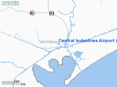
Central Industries Airport |
Location &
QuickFacts
|
FAA
Information Effective: |
2008-09-25 |
|
Airport
Identifier: |
2LA0 |
|
Airport
Status: |
Operational |
|
Longitude/Latitude: |
092-09-23.4580W/29-47-22.7570N
-92.156516/29.789655 (Estimated) |
|
Elevation: |
2 ft / 0.61 m (Estimated) |
|
Land: |
0 acres |
|
From
nearest city: |
1 nautical miles N of Intracoastal City, LA |
|
Location: |
Vermilion Parish, LA |
|
Magnetic Variation: |
04E (1985) |
Owner & Manager
|
Ownership: |
Privately owned |
|
Owner: |
Central Industries Inc |
|
Address: |
329 Westgate Road
Lafayette, LA 70506 |
|
Phone number: |
318-233-3171 |
|
Manager: |
W. F. Stevenson Iii |
|
Address: |
329 Westgate Road
Lafayette, LA 70506 |
|
Phone number: |
318-233-3171 |
Airport
Operations and Facilities
|
Airport
Use: |
Private |
|
Wind
indicator: |
Yes |
|
Segmented Circle: |
No |
|
Control
Tower: |
No |
|
Landing
fee charge: |
No |
|
Sectional chart: |
Houston |
|
Region: |
ASW - Southwest |
|
Boundary
ARTCC: |
ZHU - Houston |
|
Tie-in
FSS: |
DRI - De Ridder |
|
FSS on
Airport: |
No |
|
FSS Toll
Free: |
1-800-WX-BRIEF |
|
Runway Information
Runway 06/24
|
Dimension: |
3100 x 75 ft / 944.9 x 22.9 m |
|
Surface: |
TURF-DIRT, |
|
|
Runway 06
|
Runway 24
|
|
Traffic
Pattern: |
Left |
Left |
|
Obstruction: |
30 ft pline, 150.0 ft from runway |
518 ft twr, 3000.0 ft from runway |
|
Radio Navigation Aids
|
ID |
Type |
Name |
Ch |
Freq |
Var |
Dist |
|
AR |
NDB |
Acadi |
|
269.00 |
03E |
18.3 nm |
|
PTN |
NDB |
Patterson |
|
245.00 |
01E |
43.0 nm |
|
ECY |
NDB |
Eunice |
|
263.00 |
02E |
48.7 nm |
|
LLA |
VOR/DME |
White Lake |
041X |
110.40 |
04E |
13.6 nm |
|
LFT |
VORTAC |
Lafayette |
035X |
109.80 |
03E |
25.7 nm |
Remarks
-
FOR APT USE
CONTACT PETROLEUM HELICOPTERS ON 122.85 WITH INTENTIONS.
-
DUE HELIPORTS
LCTN 1/8 MI SE & 1 MI E PROPOSED SITE. 518' TWR 300' NE RWY 24, 30' PLINE LCTD
IMMED W RWY 06 PENETRATING ARPT IMMAGINARY SFCS.
Central Industries Airport
Address:
Vermilion Parish, LA
Tel:
318-233-3171
Images
and information placed above are from
http://www.airport-data.com/airport/2LA0/
We
thank them for the data!
|
General Info |
| Country |
United
States |
| State |
LOUISIANA |
| FAA ID |
2LA0
|
| Latitude |
29-47-22.757N |
|
Longitude |
092-09-23.458W |
|
Elevation |
2 feet
|
| Near
City |
INTRACOASTAL CITY |
We don't guarantee the information is fresh and accurate. The data may
be wrong or outdated.
For more up-to-date information please refer to other sources.
|
|


