 |
|
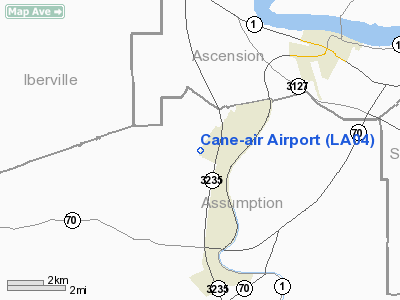
Location &
QuickFacts
|
FAA
Information Effective: |
2008-09-25 |
|
Airport
Identifier: |
LA04 |
|
Airport
Status: |
Operational |
|
Longitude/Latitude: |
091-04-00.3630W/30-03-00.7190N
-91.066767/30.050200 (Estimated) |
|
Elevation: |
17 ft / 5.18 m (Estimated) |
|
Land: |
15 acres |
|
From
nearest city: |
2 nautical miles W of Belle Rose, LA |
|
Location: |
Assumption Parish, LA |
|
Magnetic Variation: |
04E (1985) |
Owner & Manager
|
Ownership: |
Privately owned |
|
Owner: |
Savoie Industries |
|
Address: |
Po Box 361
Belle Rose, LA 70341 |
|
Phone
number: |
225-473-7910 |
|
Manager: |
Ronny Smith |
|
Address: |
6850 Cane Air Road
Belle Rose, LA 70341 |
|
Phone number: |
225-473-7910 |
Airport Operations and Facilities
|
Airport
Use: |
Private |
|
Wind
indicator: |
Yes |
|
Segmented Circle: |
No |
|
Control
Tower: |
No |
|
Landing
fee charge: |
No |
|
Sectional chart: |
Houston |
|
Region: |
ASW - Southwest |
|
Boundary
ARTCC: |
ZHU - Houston |
|
Tie-in
FSS: |
DRI - De Ridder |
|
FSS on
Airport: |
No |
|
FSS Toll
Free: |
1-800-WX-BRIEF |
|
Runway Information
Runway 11/29
|
Dimension: |
2650 x 27 ft / 807.7 x 8.2 m
27 FT WIDE ASPH CENTERED ON 40 FT WIDE TRTD DIRT LNDG AREA. |
|
Surface: |
ASPH, Fair Condition |
|
|
Runway 11
|
Runway 29
|
|
Traffic
Pattern: |
Left |
Left |
|
Radio Navigation Aids
|
ID |
Type |
Name |
Ch |
Freq |
Var |
Dist |
|
PTN |
NDB |
Patterson |
|
245.00 |
01E |
24.6 nm |
|
MS |
NDB |
Kinte |
|
338.00 |
03E |
34.7 nm |
|
HZ |
NDB |
Hazer |
|
356.00 |
04E |
41.3 nm |
|
AR |
NDB |
Acadi |
|
269.00 |
03E |
41.8 nm |
|
HMU |
VOR |
Hammond |
|
109.60 |
03E |
43.9 nm |
|
RQR |
VOR/DME |
Reserve |
045X |
110.80 |
02E |
25.0 nm |
|
TBD |
VORTAC |
Tibby |
057X |
112.00 |
02E |
26.3 nm |
|
BTR |
VORTAC |
Baton Rouge |
112X |
116.50 |
06E |
28.7 nm |
|
LFT |
VORTAC |
Lafayette |
035X |
109.80 |
03E |
48.9 nm |
Remarks
-
250 FT SMOKESTACK
& 150 FT WATER TOWER 1500 FT NE OF RY 11. 15 FT DITCH CROSSING 40 FT FROM THLD
RY 29.
-
MAY PRE DATE THE
ACT.
Based Aircraft
|
Aircraft based
on field: |
4 |
|
Single Engine
Airplanes: |
3 |
|
Helicopters: |
1 |
Cane-air Airport
Address:
Assumption Parish, LA
Tel:
225-473-7910
Images
and information placed above are from
http://www.airport-data.com/airport/LA04/
We
thank them for the data!
|
General Info |
| Country |
United
States |
| State |
LOUISIANA |
| FAA ID |
LA04
|
| Latitude |
30-03-00.719N |
|
Longitude |
091-04-00.363W |
|
Elevation |
17 feet
|
| Near
City |
BELLE
ROSE |
We don't guarantee the information is fresh and accurate. The data may
be wrong or outdated.
For more up-to-date information please refer to other sources.
|
|


