 |
|
|
|
|
|
Location &
QuickFacts
|
FAA
Information Effective: |
2008-09-25 |
|
Airport
Identifier: |
LA74 |
|
Airport
Status: |
Operational |
|
Longitude/Latitude: |
091-13-20.3730W/29-42-16.7480N
-91.222326/29.704652 (Estimated) |
|
Elevation: |
13 ft / 3.96 m (Estimated) |
|
Land: |
0 acres |
|
From
nearest city: |
0 nautical miles N of Berwick, LA |
|
Location: |
St Mary Parish, LA |
|
Magnetic Variation: |
04E (1985) |
Owner & Manager
|
Ownership: |
Privately owned |
|
Owner: |
Cacg Conoco, Inc. |
|
Address: |
202 Rue Iberville
Lafayette, LA 70508 |
|
Phone number: |
318-236-5138 |
|
Manager: |
Charles Fox |
|
Address: |
202 Rue Iberville
Lafayette, LA 70508 |
|
Phone number: |
318-236-5138 |
Airport Operations and Facilities
|
Airport Use: |
Private |
|
Wind indicator: |
Yes |
|
Segmented Circle: |
No |
|
Control Tower: |
No |
|
Landing fee charge: |
No |
|
Sectional chart: |
Houston |
|
Region: |
ASW - Southwest |
|
Boundary ARTCC: |
ZHU - Houston |
|
Tie-in FSS: |
DRI - De Ridder |
|
FSS on Airport: |
No |
|
FSS Toll Free: |
1-800-WX-BRIEF |
Airport
Communications
|
Unicom: |
123.050
USED FOR TRAFFIC ADVISORIES IN MORGAN CITY AREA |
Airport Services
|
Airframe
Repair: |
NONE |
|
Power
Plant Repair: |
NONE |
|
Runway Information
Helipad H1
|
Dimension: |
30 x 30 ft / 9.1 x 9.1 m |
|
Surface: |
GRVL, |
|
|
Runway H1
|
Runway
|
|
Traffic
Pattern: |
Left |
Left |
|
Radio Navigation Aids
|
ID |
Type |
Name |
Ch |
Freq |
Var |
Dist |
|
PTN |
NDB |
Patterson |
|
245.00 |
01E |
6.0 nm |
|
AR |
NDB |
Acadi |
|
269.00 |
03E |
36.7 nm |
|
MS |
NDB |
Kinte |
|
338.00 |
03E |
47.0 nm |
|
RQR |
VOR/DME |
Reserve |
045X |
110.80 |
02E |
40.3 nm |
|
TBD |
VORTAC |
Tibby |
057X |
112.00 |
02E |
20.7 nm |
|
BTR |
VORTAC |
Baton Rouge |
112X |
116.50 |
06E |
47.1 nm |
|
LFT |
VORTAC |
Lafayette |
035X |
109.80 |
03E |
49.7 nm |
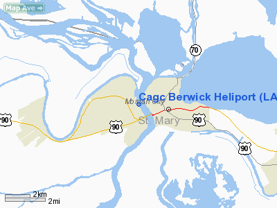
Cagc Berwick Heliport
Address:
St Mary Parish, LA
Tel:
318-236-5138
Images
and information placed above are from
http://www.airport-data.com/airport/LA74/
We
thank them for the data!
|
General Info |
| Country |
United
States |
| State |
LOUISIANA |
| FAA ID |
LA74
|
| Latitude |
29-42-16.748N |
|
Longitude |
091-13-20.373W |
|
Elevation |
13 feet
|
| Near
City |
BERWICK
|
We don't guarantee the information is fresh and accurate. The data may
be wrong or outdated.
For more up-to-date information please refer to other sources.
|
|


