 |
|
|
|
|
|
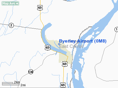
Location &
QuickFacts
|
FAA
Information Effective: |
2008-09-25 |
|
Airport
Identifier: |
0M8 |
|
Airport
Status: |
Operational |
|
Longitude/Latitude: |
091-11-15.5940W/32-49-33.1650N
-91.187665/32.825879 (Estimated) |
|
Elevation: |
106 ft / 32.31 m (Surveyed) |
|
Land: |
60 acres |
|
From
nearest city: |
2 nautical miles N of Lake Providence, LA |
|
Location: |
East Carroll Parish, LA |
|
Magnetic Variation: |
03E (1985) |
Owner & Manager
|
Ownership: |
Publicly owned |
|
Owner: |
East Carroll Parish |
|
Address: |
400 1st Street
Lake Providence, LA 71254 |
|
Phone
number: |
318-559-2256 |
|
Manager: |
Lamar Perry |
|
Address: |
400 First Courthouse Bldg
Lake Providence, LA 71254 |
|
Phone number: |
318-559-2256 |
Airport Operations and Facilities
|
Airport
Use: |
Open to public |
|
Wind
indicator: |
Yes |
|
Segmented Circle: |
No |
|
Control
Tower: |
No |
|
Lighting
Schedule: |
DUSK-DAWN |
|
Beacon
Color: |
Clear-Green (lighted land airport)
ROTG BCN OTS INDEFLY. |
|
Landing
fee charge: |
No |
|
Sectional chart: |
Memphis |
|
Region: |
ASW - Southwest |
|
Boundary
ARTCC: |
ZME - Memphis |
|
Tie-in
FSS: |
DRI - De Ridder |
|
FSS on
Airport: |
No |
|
FSS Toll
Free: |
1-800-WX-BRIEF |
|
NOTAMs
Facility: |
DRI (NOTAM-d service avaliable) |
|
Federal Agreements: |
N1 |
Airport Communications
|
Runway Information
Runway 17/35
|
Dimension: |
3196 x 75 ft / 974.1 x 22.9 m |
|
Surface: |
ASPH, Good Condition |
|
Weight Limit: |
Single wheel: 4000 lbs. |
|
Edge Lights: |
Medium
MIRL OTS INDEFLY. |
|
|
Runway 17
|
Runway 35
|
|
Longitude: |
091-11-17.3110W |
091-11-13.9720W |
|
Latitude: |
32-49-48.9220N |
32-49-17.4250N |
|
Elevation: |
103.00 ft |
103.00 ft |
|
Alignment: |
127 |
127 |
|
Traffic
Pattern: |
Left |
Left |
|
Markings: |
Nonstandard, Good Condition
RY 17/35 MARKINGS FADED. |
Non-precision instrument, Good Condition
NO HOLD SHORT LINE EAST SIDE OF RY 35. |
|
Crossing
Height: |
0.00 ft |
18.00 ft |
|
Displaced
threshold: |
175.00 ft
DSPLCD THLD NOT LIGHTED. |
530.00 ft
DSPLCD THLD NOT LIGHTED. |
|
VASI: |
|
2-box SAVASI on left side |
|
Visual
Glide Angle: |
0.00° |
3.60° |
|
Runway End
Identifier: |
Yes
REIL OTS INDEFLY. |
|
|
Obstruction: |
15 ft road, 285.0 ft from runway, 5:1 slope to clear
APCH RATIO 30:1 FM DSPLCD THLD.
4 FT FENCE 127 FT FM RY CNTRLN. |
70 ft tree, 250.0 ft from runway, 175 ft left of
centerline
APCH RATIO 11:1 FM DSPLCD THLD.
74 FT FENCE 180 FT FM END OF RY. |
|
Radio Navigation Aids
|
ID |
Type |
Name |
Ch |
Freq |
Var |
Dist |
|
BLE |
NDB |
Lake Providence |
|
278.00 |
03E |
0.3 nm |
|
BQP |
NDB |
Bastrop |
|
329.00 |
03E |
35.4 nm |
|
TV |
NDB |
Savry |
|
344.00 |
02E |
35.8 nm |
|
MTQ |
NDB |
Metcalf |
|
359.00 |
03E |
37.5 nm |
|
VKS |
NDB |
Vicksburg |
|
382.00 |
03E |
38.0 nm |
|
MRK |
NDB |
Molly Ridge |
|
338.00 |
02E |
38.9 nm |
|
IDL |
NDB |
Indianola |
|
284.00 |
03E |
47.0 nm |
|
GLH |
VOR/DME |
Greenville |
039X |
110.20 |
04E |
43.2 nm |
|
MLU |
VORTAC |
Monroe |
119X |
117.20 |
03E |
46.8 nm |
Remarks
Based Aircraft
|
Aircraft based
on field: |
5 |
|
Single Engine
Airplanes: |
5 |
Operational Statistics
Time Period: 2006-10-18 - 2007-10-17
|
Aircraft
Operations: |
135/Week |
|
General
Aviation Local: |
71.4% |
|
General
Aviation Itinerant: |
28.6% |
Byerley Airport
Address:
East Carroll Parish, LA
Tel:
318-559-2256
Images
and information placed above are from
http://www.airport-data.com/airport/0M8/
We
thank them for the data!
|
General Info |
| Country |
United
States |
| State |
LOUISIANA |
| FAA ID |
0M8
|
| Latitude |
32-49-33.165N |
|
Longitude |
091-11-15.594W |
|
Elevation |
106 feet
|
| Near
City |
LAKE
PROVIDENCE |
We don't guarantee the information is fresh and accurate. The data may
be wrong or outdated.
For more up-to-date information please refer to other sources.
|
|


