 |
|
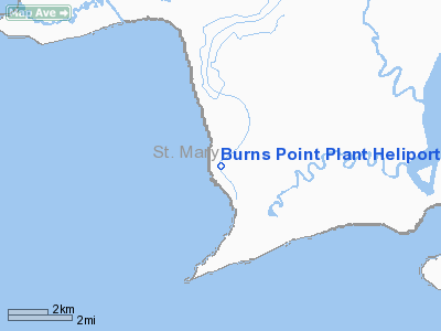
Burns Point Plant Heliport |
Location &
QuickFacts
|
FAA
Information Effective: |
2008-09-25 |
|
Airport
Identifier: |
LS62 |
|
Airport
Status: |
Operational |
|
Longitude/Latitude: |
091-31-55.4040W/29-34-17.7680N
-91.532057/29.571602 (Estimated) |
|
Elevation: |
2 ft / 0.61 m (Estimated) |
|
Land: |
0 acres |
|
From
nearest city: |
12 nautical miles S of Centerville, LA |
|
Location: |
St Mary Parish, LA |
|
Magnetic Variation: |
04E (1985) |
Owner & Manager
|
Ownership: |
Privately owned |
|
Owner: |
Marathon Oil Company |
|
Address: |
200 Corporate Boulevard
Lafayette, LA 70508 |
|
Phone
number: |
318-233-8240 |
|
Manager: |
Wayne Young
CONTACT: H.R. LOTT @ 337-408-7216 FOR ALL QUIESTIONS REGARDING
AIRPORT. |
|
Address: |
200 Corporate Boulevard
Lafayette, LA 70508 |
|
Phone number: |
318-233-8240 |
Airport
Operations and Facilities
|
Airport
Use: |
Private |
|
Wind
indicator: |
Yes |
|
Segmented Circle: |
No |
|
Control
Tower: |
No |
|
Sectional chart: |
Houston |
|
Region: |
ASW - Southwest |
|
Boundary
ARTCC: |
ZHU - Houston |
|
Tie-in
FSS: |
DRI - De Ridder |
|
FSS Toll
Free: |
1-800-WX-BRIEF |
|
Runway Information
Helipad H1
|
Dimension: |
50 x 50 ft / 15.2 x 15.2 m |
|
Surface: |
CONC, |
|
|
Runway H1
|
Runway
|
|
Traffic
Pattern: |
Left |
Left |
|
Radio Navigation Aids
|
ID |
Type |
Name |
Ch |
Freq |
Var |
Dist |
|
PTN |
NDB |
Patterson |
|
245.00 |
01E |
13.3 nm |
|
AR |
NDB |
Acadi |
|
269.00 |
03E |
28.9 nm |
|
LLA |
VOR/DME |
White Lake |
041X |
110.40 |
04E |
44.3 nm |
|
TBD |
VORTAC |
Tibby |
057X |
112.00 |
02E |
37.2 nm |
|
LFT |
VORTAC |
Lafayette |
035X |
109.80 |
03E |
44.4 nm |
Burns Point Plant Heliport
Address:
St Mary Parish, LA
Tel:
318-233-8240
Images
and information placed above are from
http://www.airport-data.com/airport/LS62/
We
thank them for the data!
|
General Info |
| Country |
United
States |
| State |
LOUISIANA |
| FAA ID |
LS62
|
| Latitude |
29-34-17.768N |
|
Longitude |
091-31-55.404W |
|
Elevation |
2 feet
|
| Near
City |
CENTERVILLE |
We don't guarantee the information is fresh and accurate. The data may
be wrong or outdated.
For more up-to-date information please refer to other sources.
|
|


