 |
|
Location &
QuickFacts
|
FAA
Information Effective: |
2008-09-25 |
|
Airport
Identifier: |
LS54 |
|
Airport
Status: |
Operational |
|
Longitude/Latitude: |
091-11-15.3880W/30-41-30.6650N
-91.187608/30.691851 (Estimated) |
|
Elevation: |
65 ft / 19.81 m (Estimated) |
|
Land: |
3 acres |
|
From
nearest city: |
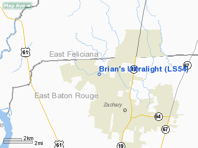
5 nautical miles NW of Zachary, LA |
|
Location: |
East Baton Rouge Parish, LA |
|
Magnetic Variation: |
04E (1985) |
Owner & Manager
|
Ownership: |
Privately owned |
|
Owner: |
Ronald Brian |
|
Address: |
23494 Brian Rd
Zachary, LA 70791 |
|
Phone number: |
504-654-9485 |
|
Manager: |
Ronald Brian |
|
Address: |
23494 Brian Rd
Zachary, LA 70791 |
|
Phone number: |
504-654-9485 |
Airport Operations and Facilities
|
Airport Use: |
Private |
|
Wind indicator: |
Yes |
|
Segmented Circle: |
No |
|
Control Tower: |
No |
|
Sectional chart: |
New Orleans |
|
Region: |
ASW - Southwest |
|
Boundary ARTCC: |
ZHU - Houston |
|
Tie-in FSS: |
DRI - De Ridder |
|
FSS Toll Free: |
1-800-WX-BRIEF |
Airport
Communications
|
Runway Information
Runway 04/22
|
Dimension: |
1500 x 60 ft / 457.2 x 18.3 m |
|
Surface: |
TURF, |
|
|
Runway 04
|
Runway 22
|
|
Traffic
Pattern: |
Left |
Left |
|
Radio Navigation Aids
|
ID |
Type |
Name |
Ch |
Freq |
Var |
Dist |
|
HZ |
NDB |
Hazer |
|
356.00 |
04E |
16.0 nm |
|
OPL |
NDB |
St Landry |
|
335.00 |
04E |
47.1 nm |
|
MC |
NDB |
Ferni |
|
413.00 |
03E |
48.6 nm |
|
HMU |
VOR |
Hammond |
|
109.60 |
03E |
41.2 nm |
|
RQR |
VOR/DME |
Reserve |
045X |
110.80 |
02E |
47.8 nm |
|
BTR |
VORTAC |
Baton Rouge |
112X |
116.50 |
06E |
13.6 nm |
Based Aircraft
|
Aircraft based
on field: |
3 |
|
Ultralights: |
3 |
Brian's Ultralight
Address:
East Baton Rouge Parish, LA
Tel:
504-654-9485
Images
and information placed above are from
http://www.airport-data.com/airport/LS54/
We
thank them for the data!
|
General Info |
| Country |
United
States |
| State |
LOUISIANA |
| FAA ID |
LS54
|
| Latitude |
30-41-30.665N |
|
Longitude |
091-11-15.388W |
|
Elevation |
65 feet
|
| Near
City |
ZACHARY
|
We don't guarantee the information is fresh and accurate. The data may
be wrong or outdated.
For more up-to-date information please refer to other sources.
|
|


