|
|
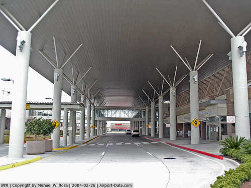
Baton Rouge Metropolitan - Ryan Field Airport |
Baton Rouge Metropolitan Airport
Ryan Field |
| IATA: BTR â ICAO: KBTR â FAA LID: BTR |
| Summary |
| Airport type |
Public |
| Owner |
Baton Rouge Airport Authority |
| Serves |
Baton Rouge, Louisiana |
| Location |
Baton Rouge, Louisiana |
| Elevation AMSL |
70 ft / 21 m |
| Coordinates |
30°31â²58â³N 091°09â²00â³W / 30.53278°N 91.15°W / 30.53278; -91.15Coordinates: 30°31â²58â³N 091°09â²00â³W / 30.53278°N 91.15°W / 30.53278; -91.15 |
| Website |
www.flybtr.com |
| Runways |
| Direction |
Length |
Surface |
| ft |
m |
| 4L/22R |
7,500 |
2,286 |
Concrete |
| 4R/22L |
3,799 |
1,158 |
Asphalt |
| 13/31 |
7,004 |
2,135 |
Asphalt |
| Statistics (2008) |
| Aircraft operations |
111,257 |
| Based aircraft |
148 |
| Source: Federal Aviation Administration |
Baton Rouge Metropolitan Airport (IATA: BTR, ICAO: KBTR, FAA LID: BTR), also known as Ryan Field, is a public use airport located four nautical miles (7 km) north of the central business district of Baton Rouge, a city in East Baton Rouge Parish, Louisiana, United States.
The airport was originally Harding Army Air Field during World War II and was used by the United States Army Air Force Technical Service Command as a maintenance and supply base. Today other than the runways, virtually no traces remain of the military installation. Facilities and aircraft
The airport covers an area of 1,250 acres (506 ha) at an elevation of 70 feet (21 m) above mean sea level. It has three runways: 4L/22R is 7,500 by 150 feet (2,286 Ã 46 m) with a concrete surface; 4R/22L is 3,799 by 75 feet (1,158 Ã 23 m) with an asphalt surface; 13/31 is 7,004 by 150 feet (2,135 Ã 46 m) with an asphalt surface.
Air Traffic Services are provided by dedicated Air Traffic Controllers in the tower and the Terminal Radar Approach Control.
For the 12-month period ending November 30, 2008, the airport had 111,257 aircraft operations, an average of 304 per day: 67% general aviation, 20% air taxi, 7% military and 6% scheduled commercial. At that time there were 148 aircraft based at this airport: 61% single-engine, 21% multi-engine, 11% jet and 7% helicopter.
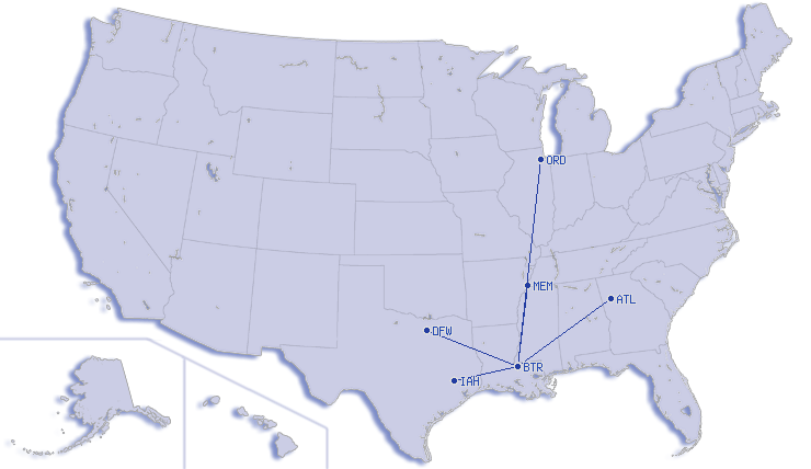
Passenger airlines and destinations
 | |
Destinations served from Baton Rouge Metropolitan Airport (as of August 2008)
|
Baton Rouge Metropolitan Airport has two concourses: Concourse A (gates A1-A4), and Concourse B (gates B1-B3).
| Airlines |
Destinations |
Concourse |
| American Eagle |
Dallas/Fort Worth |
B |
| Continental Express operated by ExpressJet Airlines |
Houston-Intercontinental |
A |
| Continental Express operated by Chautauqua Airlines |
Houston-Intercontinental |
A |
| Delta Connection operated by Atlantic Southeast Airlines |
Atlanta |
A |
| Delta Connection operated by Pinnacle Airlines |
Memphis |
A |
| US Airways Express operated by PSA Airlines |
Charlotte |
B |
Cargo airlines
Baton Rouge Metropolitan Airport has a 33,000-square-foot (3,100 m) cargo facility. It is currently being expanded to 68,000 square feet (6,300 m).
Struggles
Baton Rouge Metropolitan Airport is relatively small for a city and metro area of its size due mainly to its proximity to New Orleans' Armstrong International Airport. Despite aggressive advertising campaigns encouraging catchment area residents to utilize the airport, passenger numbers are somewhat low (below 800,000 passengers per year).
In the wake of Hurricane Katrina, and the ensuing increase in Baton Rouge's (temporary and permanent) population, BTR saw its destination portfolio expanded dramatically. New services were initiated to Cincinnati, New York City (both Newark, New Jersey and LaGuardia airports), Chicago-O'Hare, Denver, Washington-Reagan, St. Louis, and Orlando. The new destinations were discontinued by the end of 2008 as New Orleans air service returned to pre-Katrina levels. After experiencing record fuel prices in 2008 and the subsequent recession, the carriers returned their focus to the most efficient hub options for BTR, resulting in the current service schedule of daily jet flights to five major hubs.
All of the service at the airport is provided by regional jets. The regularly scheduled service includes operations by Delta Air Lines to Atlanta (1 CRJ700 a day) and Memphis (CRJ200), Continental Airlines to Houston (ERJ 135 / ERJ 145), and American Airlines to Dallas/Fort Worth (ERJ 145). In June, 2010 US Airways added new regional jet service to its largest hub in Charlotte, N.C.
Expansion and development
Louisiana Aircraft Inc., a fixed base operation on the south side of the airport has been purchased by a real estate developer. The developer has plans to build more hangar space and has purchased the old Capitol Jet Center / LuxJet FBO located on the east side of the airport. Future plans include a ramp and hangars on the north side of the airfield. The increase in hangar space is most noticeable during the College Football season. This future expansion is causing the Army National Guard armory of the 769th Combat Engineer Battalion to relocate to the other side of Baton Rouge.
On June 24, 2010, US Airways commenced operations to several regional destinations from BTR.
The above content comes from Wikipedia and is published under free licenses – click here to read more.
|
 |
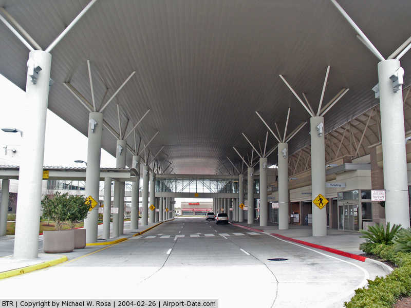
(Click on the photo to enlarge) |
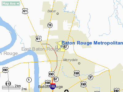
Location &
QuickFacts
|
FAA
Information Effective: |
2008-09-25 |
|
Airport
Identifier: |
BTR |
|
Airport
Status: |
Operational |
|
Longitude/Latitude: |
091-08-59.5567W/30-31-58.4608N
-91.149877/30.532906 (Estimated) |
|
Elevation: |
70 ft / 21.34 m (Surveyed) |
|
Land: |
1250 acres |
|
From
nearest city: |
4 nautical miles N of Baton Rouge, LA |
|
Location: |
East Baton Rouge Parish, LA |
|
Magnetic Variation: |
03E (1995) |
Owner & Manager
|
Ownership: |
Publicly owned |
|
Owner: |
East Baton Rouge Parish
CITY OF BATON ROUGE AND PARISH OF EAST BATON ROUGE. |
|
Address: |
Po Box 1471
Baton Rouge, LA 70821 |
|
Manager: |
Anthony Marino |
|
Address: |
9430 Jackie Cochran Dr. Ste 300
Baton Rouge, LA 70807 |
|
Phone number: |
225-355-0333 |
Airport Operations and Facilities
|
Airport
Use: |
Open to public |
|
Wind
indicator: |
Yes |
|
Segmented Circle: |
Yes |
|
Control
Tower: |
Yes |
|
Lighting
Schedule: |
DUSK-DAWN
ACTVT MALSR RYS 22R & 13 AND MALS RY 31 - CTAF. WHEN ATCT CLSD HIRL
RYS 13/31 & 04L/22R PRESET LOW INTST; TO INCR INTST ACTVT - CTAF.
MIRL RY 04R/22L NOT AVBL. |
|
Beacon
Color: |
Clear-Green (lighted land airport) |
|
Landing
fee charge: |
No |
|
Sectional chart: |
Houston |
|
Region: |
ASW - Southwest |
|
Boundary
ARTCC: |
ZHU - Houston |
|
Tie-in
FSS: |
DRI - De Ridder |
|
FSS on
Airport: |
No |
|
FSS Toll
Free: |
1-800-WX-BRIEF |
|
NOTAMs
Facility: |
BTR (NOTAM-d service avaliable) |
|
Certification type/date: |
I C S 05/1973
24 HRS PPR FOR UNSKED ACR OPNS WITH MORE THAN 30 PSGR SEATS 0000-0500
CALL AMGR 225-355-2068/0333. |
|
Federal Agreements: |
NGPY3 |
Airport Communications
|
CTAF: |
118.450 |
|
Unicom: |
122.950 |
Airport Services
|
Fuel
available: |
100LLA |
|
Airframe
Repair: |
MAJOR |
|
Power
Plant Repair: |
MAJOR |
|
Bottled
Oxygen: |
HIGH |
|
Bulk
Oxygen: |
HIGH |
|
Runway Information
Runway 04L/22R
|
Dimension: |
7500 x 150 ft / 2286.0 x 45.7 m |
|
Surface: |
CONC, |
|
Surface
Treatment: |
Saw-cut or plastic Grooved |
|
Weight Limit: |
Single wheel: 120000 lbs.
Dual wheel: 170000 lbs.
Dual tandem wheel: 300000 lbs. |
|
Edge Lights: |
High |
|
|
Runway 04L
|
Runway 22R
|
|
Longitude: |
091-09-26.7055W |
091-08-27.7104W |
|
Latitude: |
30-31-28.3538N |
30-32-22.2286N |
|
Elevation: |
66.00 ft |
70.00 ft |
|
Alignment: |
43 |
127 |
|
ILS Type: |
|
ILS/DME |
|
Traffic
Pattern: |
Left |
Right |
|
Markings: |
Non-precision instrument, Good Condition |
Precision instrument, Good Condition |
|
Crossing
Height: |
52.00 ft |
52.00 ft |
|
Displaced
threshold: |
600.00 ft |
424.00 ft |
|
VASI: |
4-box on left side |
4-box on left side |
|
Visual
Glide Angle: |
3.00° |
3.00° |
|
RVR
Equipment: |
|
touchdown |
|
Approach
lights: |
|
MALSR |
|
Runway End
Identifier: |
No |
|
|
Centerline
Lights: |
Yes |
Yes |
|
Touchdown
Lights: |
No |
Yes |
|
Obstruction: |
52 ft pole, 2200.0 ft from runway, 125 ft left of
centerline, 38:1 slope to clear |
27 ft trees, 654.0 ft from runway, 404 ft left of
centerline, 16:1 slope to clear
+64 FT TREES 1598 FT 647 FT RIGHT, APCH RATIO 28:1 BASED ON DSPLCD THLD.
10 FT ROAD 200 FT 474 FT L APCH RATIO 0:1. |
|
Decleard
distances: |
Take off run available 7500.00 ft
Take off distance available 7500.00 ft
Actual stop distance available 7500.00 ft
Landing distance available 6900.00 ft |
Take off run available 7500.00 ft
Take off distance available 7500.00 ft
Actual stop distance available 7500.00 ft
Landing distance available 7076.00 ft |
|
Runway 04R/22L
|
Dimension: |
3799 x 75 ft / 1157.9 x 22.9 m |
|
Surface: |
ASPH, Fair Condition |
|
Weight Limit: |
Single wheel: 30000 lbs.
Dual wheel: 45000 lbs. |
|
Edge Lights: |
Medium |
|
|
Runway 04R
|
Runway 22L
|
|
Longitude: |
091-08-59.5588W |
091-08-29.6664W |
|
Latitude: |
30-31-43.0825N |
30-32-10.3649N |
|
Elevation: |
67.00 ft |
69.00 ft |
|
Alignment: |
43 |
127 |
|
Traffic
Pattern: |
Right |
Left |
|
Markings: |
Basic, Good Condition |
Basic, Good Condition |
|
VASI: |
2-light PAPI on left side |
2-light PAPI on left side |
|
Obstruction: |
88 ft tree, 2213.0 ft from runway, 277 ft right of
centerline, 22:1 slope to clear |
27 ft tree, 842.0 ft from runway, 125 ft left of
centerline, 23:1 slope to clear |
|
Decleard
distances: |
Take off run available 3799.00 ft
Take off distance available 3799.00 ft
Actual stop distance available 3799.00 ft
Landing distance available 3799.00 ft |
Take off run available 3799.00 ft
Take off distance available 3799.00 ft
Actual stop distance available 3799.00 ft
Landing distance available 3799.00 ft |
|
Runway 13/31
|
Dimension: |
7004 x 150 ft / 2134.8 x 45.7 m |
|
Surface: |
ASPH, Good Condition |
|
Surface
Treatment: |
Saw-cut or plastic Grooved |
|
Weight Limit: |
Single wheel: 120000 lbs.
Dual wheel: 170000 lbs.
Dual tandem wheel: 300000 lbs. |
|
Edge Lights: |
High |
|
|
Runway 13
|
Runway 31
|
|
Longitude: |
091-09-39.2400W |
091-08-41.1150W |
|
Latitude: |
30-32-26.6446N |
30-31-38.9493N |
|
Elevation: |
66.00 ft |
70.00 ft |
|
Alignment: |
127 |
127 |
|
ILS Type: |
ILS/DME |
|
|
Traffic
Pattern: |
Left |
Left |
|
Markings: |
Precision instrument, Good Condition |
Non-precision instrument, Good Condition |
|
Crossing
Height: |
0.00 ft |
52.00 ft |
|
Displaced
threshold: |
597.00 ft |
315.00 ft |
|
VASI: |
|
4-box on left side |
|
Visual
Glide Angle: |
0.00° |
3.00° |
|
Approach
lights: |
MALSR |
MALS |
|
Obstruction: |
76 ft pole, 2345.0 ft from runway, 103 ft right of
centerline, 28:1 slope to clear
+72 FT POLE 2345 FT 103 RIGHT, APCH RATIO 38:1 BASED ON DSPLCD THLD.
+7 FT FENCE 200 FT 406 FT LEFT, APCH RATIO 0:1. |
11 ft road, 230.0 ft from runway, 503 ft right of
centerline, 2:1 slope to clear
+68 FT TREE, 1578 FT, 516 RIGHT, APCH RATIO 24:1 BASED ON DSPLCD THLD.
+5 FT FENCE 200 FT 496 FT RIGHT, APCH RATIO 0:1. |
|
Decleard
distances: |
Take off run available 7004.00 ft
Take off distance available 7004.00 ft
Actual stop distance available 7004.00 ft
Landing distance available 6407.00 ft |
Take off run available 7004.00 ft
Take off distance available 7004.00 ft
Actual stop distance available 7004.00 ft
Landing distance available 6691.00 ft |
|
Radio Navigation Aids
|
ID |
Type |
Name |
Ch |
Freq |
Var |
Dist |
|
HZ |
NDB |
Hazer |
|
356.00 |
04E |
18.6 nm |
|
MS |
NDB |
Kinte |
|
338.00 |
03E |
49.5 nm |
|
OPL |
NDB |
St Landry |
|
335.00 |
04E |
49.6 nm |
|
HMU |
VOR |
Hammond |
|
109.60 |
03E |
37.9 nm |
|
RQR |
VOR/DME |
Reserve |
045X |
110.80 |
02E |
39.6 nm |
|
BTR |
VORTAC |
Baton Rouge |
112X |
116.50 |
06E |
8.0 nm |
|
LFT |
VORTAC |
Lafayette |
035X |
109.80 |
03E |
48.2 nm |
Remarks
-
WHEN ATCT CLSD
USE FREQ 121.9 TO CTC ARFF FOR EMERG REQ.
-
MIGRATORY BIRDS
ON & INVOF ARPT DURING MONTHS OF MAR/APR/SEP & OCT.
-
TWY M CLSD INDEFLY.
-
TWY E WEIGHT
RESTRICTIONS: SINGLE 44,000 LBS; DUAL 55,000 LBS; DUAL TANDEM 93,000 LBS.
-
RAMP & TWY LANE
ADJ TO THE COMMERICAL AIR CARRIER TERMINAL BLDG IS LMTD TO COMMERICAL AIR
CARRIER AND PSGR AIRTAXI ACFT ONLY.
-
RY 04R/22L NOT
AVBL FOR ACR OPNS WITH MORE THAN 30 PSGR SEATS.
-
TWY L WEIGHT
RESTRICTIONS: SINGLE 68,000 LBS; DUAL 75,000 LBS; DUAL TANDEM 106,000 LBS.
Based Aircraft
|
Aircraft based
on field: |
126 |
|
Single Engine
Airplanes: |
70 |
|
Multi Engine
Airplanes: |
35 |
|
Jet Engine
Airplanes: |
17 |
|
Helicopters: |
4 |
Major Carriers Serving
This Airport
|
American Eagle Airlines Inc. |
33.6% |
|
Expressjet Airlines Inc. |
32.4% |
|
Atlantic Southeast Airlines |
18.3% |
|
Northwest Airlines Inc. |
9.9% |
|
Continental Air Lines Inc. |
3.0% |
|
Comair Inc. |
2.9% |
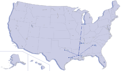
Most Popular
Destinations
|
George Bush Intercontinental/houston (IAH) |
35.4% |
|
Dallas/fort Worth Intl (DFW) |
30.1% |
|
Hartsfield - Jackson Atlanta Intl (ATL) |
14.9% |
|
Memphis Intl (MEM) |
9.9% |
|
Chicago O'hare Intl (ORD) |
3.4% |
|
Cincinnati/northern Kentucky Intl (CVG) |
3.3% |
|
Ronald Reagan Washington National (DCA) |
2.9% |
Most Popular Aircraft
|
N801AE |
1.6% |
|
N821AE |
1.6% |
|
N805AE |
1.4% |
|
N810AE |
1.2% |
|
N841AE |
1.2% |
|
N856AE |
1.1% |
|
N831AE |
1.0% |
|
N843AE |
1.0% |
|
N854AE |
0.9% |
|
N834AE |
0.8% |
Operational Statistics
Time Period: 2006-12-01 - 2007-11-30
|
Aircraft
Operations: |
247/Day |
|
Commerical: |
5.2% |
|
Air Taxi: |
29.3% |
|
General
Aviation Local: |
12.9% |
|
General
Aviation Itinerant: |
49.8% |
|
Military: |
2.8% |
Baton Rouge Metropolitan, Ryan Field
Airport
Address:
East Baton Rouge Parish, LA
Tel:
225-355-0333
Images
and information placed above are from
http://www.airport-data.com/airport/BTR/
We
thank them for the data!
|
General Info |
| Country |
United
States |
| State |
LOUISIANA |
| FAA ID |
BTR
|
| Latitude |
30-31-59.379N |
|
Longitude |
091-08-58.684W |
|
Elevation |
70 feet
|
| Near
City |
BATON
ROUGE |
We don't guarantee the information is fresh and accurate. The data may
be wrong or outdated.
For more up-to-date information please refer to other sources.
|
|