 |
|
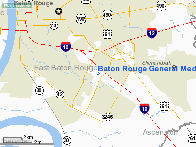
Baton Rouge General Medical Center Heliport |
|
|
Location &
QuickFacts
|
FAA
Information Effective: |
2008-09-25 |
|
Airport
Identifier: |
LA00 |
|
Airport
Status: |
Operational |
|
Longitude/Latitude: |
091-05-40.2000W/30-23-41.7300N
-91.094500/30.394925 (Estimated) |
|
Elevation: |
36 ft / 10.97 m (Estimated) |
|
Land: |
0 acres |
|
From
nearest city: |
2 nautical miles W of Baton Rouge, LA |
|
Location: |
East Baton Rouge Parish, LA |
|
Magnetic Variation: |
02E (2000) |
Owner & Manager
|
Ownership: |
Privately owned |
|
Owner: |
Baton Rouge General - Bluebonnet |
|
Address: |
8585, Picardy Ave
Baton Rouge, LA 70809 |
|
Phone
number: |
225-387-7767 |
|
Manager: |
Peyton Grant, Vp Facilities Mgmt |
|
Address: |
3600 Florida Boulevard
Baton Rouge, LA 70806 |
|
Phone number: |
225-381-6287 |
Airport Operations and Facilities
|
Airport
Use: |
Private
MEDICAL. |
|
Segmented Circle: |
No |
|
Control
Tower: |
No |
|
Lighting
Schedule: |
DUSK-DAWN |
|
Beacon
Color: |
Clear-Green-Yellow (heliport) |
|
Sectional chart: |
Houston |
|
Region: |
ASW - Southwest |
|
Boundary
ARTCC: |
ZHU - Houston |
|
Tie-in
FSS: |
DRI - De Ridder |
|
FSS Toll
Free: |
1-800-WX-BRIEF |
|
Runway Information
Helipad H1
|
Dimension: |
50 x 50 ft / 15.2 x 15.2 m |
|
Surface: |
CONC, |
|
|
Runway H1
|
Runway
|
|
Traffic
Pattern: |
Left |
Left |
|
Radio Navigation Aids
|
ID |
Type |
Name |
Ch |
Freq |
Var |
Dist |
|
HZ |
NDB |
Hazer |
|
356.00 |
04E |
25.0 nm |
|
MS |
NDB |
Kinte |
|
338.00 |
03E |
42.4 nm |
|
PTN |
NDB |
Patterson |
|
245.00 |
01E |
42.8 nm |
|
AR |
NDB |
Acadi |
|
269.00 |
03E |
47.9 nm |
|
HMU |
VOR |
Hammond |
|
109.60 |
03E |
35.9 nm |
|
RQR |
VOR/DME |
Reserve |
045X |
110.80 |
02E |
32.1 nm |
|
BTR |
VORTAC |
Baton Rouge |
112X |
116.50 |
06E |
11.7 nm |
|
TBD |
VORTAC |
Tibby |
057X |
112.00 |
02E |
46.0 nm |
|
LFT |
VORTAC |
Lafayette |
035X |
109.80 |
03E |
48.2 nm |
Baton Rouge General Medical Center Heliport
Address:
East Baton Rouge Parish, LA
Tel:
225-387-7767,
225-381-6287
Images
and information placed above are from
http://www.airport-data.com/airport/LA00/
We
thank them for the data!
|
General Info |
| Country |
United
States |
| State |
LOUISIANA |
| FAA ID |
LA00
|
| Latitude |
30-23-41.730N |
|
Longitude |
091-05-40.200W |
|
Elevation |
36 feet
|
| Near
City |
BATON
ROUGE |
We don't guarantee the information is fresh and accurate. The data may
be wrong or outdated.
For more up-to-date information please refer to other sources.
|
|


