 |
|
Location &
QuickFacts
|
FAA
Information Effective: |
2008-09-25 |
|
Airport
Identifier: |
LS12 |
|
Airport
Status: |
Operational |
|
Longitude/Latitude: |
089-36-51.2200W/29-18-50.8000N
-89.614228/29.314111 (Estimated) |
|
Elevation: |
10 ft / 3.05 m (Estimated) |
|
Land: |
0 acres |
|
From
nearest city: |
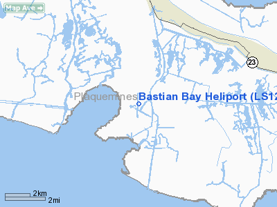
6 nautical miles NE of Buras, LA |
|
Location: |
Plaquemines Parish, LA |
|
Magnetic Variation: |
02E (1990) |
Owner & Manager
|
Ownership: |
Privately owned |
|
Owner: |
Tx Eastern Transmission Corp |
|
Address: |
5400 Westheimer Court
Houston, TX 77056 |
|
Phone number: |
713-627-4490 |
|
Manager: |
Jerome Snyder |
|
Address: |
Po Box 640
Boura, LA 70343 |
|
Phone number: |
985-876-6761 |
Airport
Operations and Facilities
|
Airport
Use: |
Private |
|
Segmented Circle: |
No |
|
Control
Tower: |
No |
|
Sectional chart: |
New Orleans |
|
Region: |
ASW - Southwest |
|
Boundary
ARTCC: |
ZHU - Houston |
|
Tie-in
FSS: |
DRI - De Ridder |
|
FSS on
Airport: |
No |
|
FSS Toll
Free: |
1-800-WX-BRIEF |
|
Runway Information
Helipad H1
|
Dimension: |
24 x 24 ft / 7.3 x 7.3 m |
|
Surface: |
CONC, |
|
|
Runway H1
|
Runway
|
|
Traffic
Pattern: |
Left |
Left |
|
Radio Navigation Aids
|
ID |
Type |
Name |
Ch |
Freq |
Var |
Dist |
|
LEV |
VORTAC |
Leeville |
082X |
113.50 |
02E |
27.0 nm |
|
HRV |
VORTAC |
Harvey |
088X |
114.10 |
02E |
38.1 nm |
|
NEW |
VOT |
New Orleans Lakefront |
|
111.00 |
|
48.6 nm |
Remarks
-
AIRSPACE DETERMINATION
PENDING.
Bastian Bay Heliport
Address:
Plaquemines Parish, LA
Tel:
713-627-4490, 985-876-6761
Images
and information placed above are from
http://www.airport-data.com/airport/LS12/
We
thank them for the data!
|
General Info |
| Country |
United
States |
| State |
LOUISIANA |
| FAA ID |
LS12
|
| Latitude |
29-18-50.800N |
|
Longitude |
089-36-51.220W |
|
Elevation |
10 feet
|
| Near
City |
BURAS
|
We don't guarantee the information is fresh and accurate. The data may
be wrong or outdated.
For more up-to-date information please refer to other sources.
|
|


