 |
|
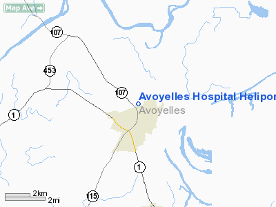
Avoyelles Hospital Heliport |
Location &
QuickFacts
|
FAA
Information Effective: |
2008-09-25 |
|
Airport
Identifier: |
LS67 |
|
Airport
Status: |
Operational |
|
Longitude/Latitude: |
092-03-41.4480W/31-08-38.6730N
-92.061513/31.144076 (Estimated) |
|
Elevation: |
75 ft / 22.86 m (Estimated) |
|
Land: |
0 acres |
|
From
nearest city: |
2 nautical miles N of Marksville, LA |
|
Location: |
Avoyelles Parish, LA |
|
Magnetic Variation: |
04E (1985) |
Owner & Manager
|
Ownership: |
Privately owned |
|
Owner: |
Avoyelles Hospital |
|
Address: |
Po Box 249
Marksville, LA 71351 |
|
Phone
number: |
318-253-8611 |
|
Manager: |
Executive Director
CONTACT: DIRECTOR OF ENGINEERING, MIKE JOHNSON 318-253-8611 |
|
Address: |
Po Box 249
Marksville, LA 71351 |
|
Phone number: |
318-253-8611 |
Airport
Operations and Facilities
|
Airport
Use: |
Private
MEDICAL |
|
Wind
indicator: |
Yes |
|
Segmented Circle: |
No |
|
Control
Tower: |
No |
|
Sectional chart: |
Houston |
|
Region: |
ASW - Southwest |
|
Boundary
ARTCC: |
ZHU - Houston |
|
Tie-in
FSS: |
DRI - De Ridder |
|
FSS Toll
Free: |
1-800-WX-BRIEF |
|
Runway Information
Helipad H1
|
Dimension: |
40 x 40 ft / 12.2 x 12.2 m |
|
Surface: |
CONC, |
|
|
Runway H1
|
Runway
|
|
Traffic
Pattern: |
Left |
Left |
|
Radio Navigation Aids
|
ID |
Type |
Name |
Ch |
Freq |
Var |
Dist |
|
MKV |
NDB |
Marksville |
|
347.00 |
02E |
3.0 nm |
|
BWK |
NDB |
Bunkie |
|
397.00 |
03E |
19.0 nm |
|
OPL |
NDB |
St Landry |
|
335.00 |
04E |
29.4 nm |
|
ECY |
NDB |
Eunice |
|
263.00 |
02E |
40.4 nm |
|
HZ |
NDB |
Hazer |
|
356.00 |
04E |
42.6 nm |
|
LRR |
NDB |
Allen Parish |
|
379.00 |
03E |
44.3 nm |
|
HEZ |
VOR/DME |
Natchez |
037X |
110.00 |
03E |
48.4 nm |
|
AEX |
VORTAC |
Alexandria |
108X |
116.10 |
03E |
23.6 nm |
Avoyelles Hospital Heliport
Address:
Avoyelles Parish, LA
Tel:
318-253-8611
Images
and information placed above are from
http://www.airport-data.com/airport/LS67/
We
thank them for the data!
|
General Info |
| Country |
United
States |
| State |
LOUISIANA |
| FAA ID |
LS67
|
| Latitude |
31-08-38.673N |
|
Longitude |
092-03-41.448W |
|
Elevation |
75 feet
|
| Near
City |
MARKSVILLE |
We don't guarantee the information is fresh and accurate. The data may
be wrong or outdated.
For more up-to-date information please refer to other sources.
|
|


