 |
|
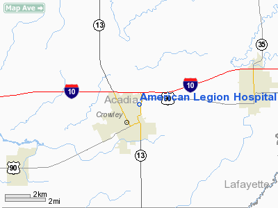
American Legion Hospital Heliport |
Location &
QuickFacts
|
FAA
Information Effective: |
2008-09-25 |
|
Airport
Identifier: |
LS42 |
|
Airport
Status: |
Operational |
|
Longitude/Latitude: |
092-21-49.4720W/30-13-36.7330N
-92.363742/30.226870 (Estimated) |
|
Elevation: |
24 ft / 7.32 m (Estimated) |
|
Land: |
0 acres |
|
From
nearest city: |
2 nautical miles NE of Crowley, LA |
|
Location: |
Acadia Parish, LA |
|
Magnetic Variation: |
04E (1985) |
Owner & Manager
|
Ownership: |
Privately owned |
|
Owner: |
American Legion Hospital |
|
Address: |
1305 Crowley Rayne Hwy
Crowley, LA 70526 |
|
Phone
number: |
337-783-3222 |
|
Manager: |
Terry W. Osborne
CEO |
|
Address: |
1305 Crowley Rayne Hwy
Crowley, LA 70526 |
|
Phone number: |
337-783-3222 |
Airport Operations and Facilities
|
Airport
Use: |
Private
MEDICAL |
|
Wind
indicator: |
Yes |
|
Segmented Circle: |
No |
|
Control
Tower: |
No |
|
Lighting
Schedule: |
DUSK-DAWN |
|
Beacon
Color: |
Clear-Green-Yellow (heliport) |
|
Sectional chart: |
Houston |
|
Region: |
ASW - Southwest |
|
Boundary
ARTCC: |
ZHU - Houston |
|
Tie-in
FSS: |
DRI - De Ridder |
|
FSS Toll
Free: |
1-800-WX-BRIEF |
|
Runway Information
Helipad H1
|
Dimension: |
60 x 60 ft / 18.3 x 18.3 m |
|
Surface: |
CONC, |
|
|
Runway H1
|
Runway
|
|
Traffic
Pattern: |
Left |
Left |
|
Radio Navigation Aids
|
ID |
Type |
Name |
Ch |
Freq |
Var |
Dist |
|
ECY |
NDB |
Eunice |
|
263.00 |
02E |
20.5 nm |
|
OPL |
NDB |
St Landry |
|
335.00 |
04E |
29.2 nm |
|
LRR |
NDB |
Allen Parish |
|
379.00 |
03E |
30.1 nm |
|
AR |
NDB |
Acadi |
|
269.00 |
03E |
30.7 nm |
|
BWK |
NDB |
Bunkie |
|
397.00 |
03E |
39.0 nm |
|
LLA |
VOR/DME |
White Lake |
041X |
110.40 |
04E |
33.9 nm |
|
LFT |
VORTAC |
Lafayette |
035X |
109.80 |
03E |
19.4 nm |
|
LCH |
VORTAC |
Lake Charles |
081X |
113.40 |
07E |
38.9 nm |
Remarks
-
SEE AIRSPACE
DETERMINATION LETTER DATED 05/20/87.
American Legion Hospital Heliport
Address:
Acadia Parish, LA
Tel:
337-783-3222
Images
and information placed above are from
http://www.airport-data.com/airport/LS42/
We
thank them for the data!
|
General Info |
| Country |
United
States |
| State |
LOUISIANA |
| FAA ID |
LS42
|
| Latitude |
30-13-36.733N |
|
Longitude |
092-21-49.472W |
|
Elevation |
24 feet
|
| Near
City |
CROWLEY
|
We don't guarantee the information is fresh and accurate. The data may
be wrong or outdated.
For more up-to-date information please refer to other sources.
|
|


