 |
|
Location &
QuickFacts
|
FAA
Information Effective: |
2008-09-25 |
|
Airport
Identifier: |
9LS9 |
|
Airport
Status: |
Operational |
|
Longitude/Latitude: |
091-20-55.4110W/32-24-35.5150N
-91.348725/32.409865 (Estimated) |
|
Elevation: |
80 ft / 24.38 m (Estimated) |
|
Land: |
25 acres |
|
From
nearest city: |
2 nautical miles SE of Tendal, LA |
|
Location: |
Madison Parish, LA |
|
Magnetic Variation: |
03E (1985) |
Owner & Manager
|
Ownership: |
Privately owned |
|
Owner: |
Jim Brown |
|
Address: |
Rte 2 Box 347
Tallulah, LA 71282 |
|
Address: |
|
|
Phone number: |
318-878-5249 |
Airport Operations and Facilities
|
Airport Use: |
Private |
|
Wind indicator: |
No |
|
Segmented Circle: |
No |
|
Control Tower: |
No |
|
Landing fee charge: |
No |
|
Sectional chart: |
Memphis |
|
Region: |
ASW - Southwest |
|
Boundary ARTCC: |
ZME - Memphis |
|
Tie-in FSS: |
DRI - De Ridder |
|
FSS on Airport: |
No |
|
FSS Toll Free: |
1-800-WX-BRIEF |
Airport Services
|
Airframe
Repair: |
NONE |
|
Power
Plant Repair: |
NONE |
|
Runway Information
Runway 10/28
|
Dimension: |
2360 x 100 ft / 719.3 x 30.5 m |
|
Surface: |
TURF, |
|
|
Runway 10
|
Runway 28
|
|
Traffic
Pattern: |
Left |
Left |
|
Radio Navigation Aids
|
ID |
Type |
Name |
Ch |
Freq |
Var |
Dist |
|
TV |
NDB |
Savry |
|
344.00 |
02E |
19.2 nm |
|
MRK |
NDB |
Molly Ridge |
|
338.00 |
02E |
21.5 nm |
|
VKS |
NDB |
Vicksburg |
|
382.00 |
03E |
23.9 nm |
|
BLE |
NDB |
Lake Providence |
|
278.00 |
03E |
26.5 nm |
|
BQP |
NDB |
Bastrop |
|
329.00 |
03E |
34.1 nm |
|
HAH |
NDB |
Natchez-adams County |
|
388.00 |
03E |
43.3 nm |
|
RYB |
NDB |
Raymond |
|
375.00 |
03E |
48.0 nm |
|
HEZ |
VOR/DME |
Natchez |
037X |
110.00 |
03E |
47.7 nm |
|
MLU |
VORTAC |
Monroe |
119X |
117.20 |
03E |
35.4 nm |
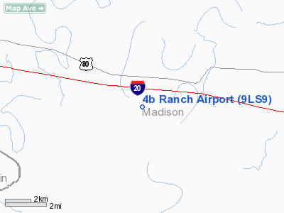
4b Ranch Airport
Address:
Madison Parish, LA
Tel:
318-878-5249
Images
and information placed above are from
http://www.airport-data.com/airport/9LS9/
We
thank them for the data!
|
General Info |
| Country |
United
States |
| State |
LOUISIANA |
| FAA ID |
9LS9
|
| Latitude |
32-24-35.515N |
|
Longitude |
091-20-55.411W |
|
Elevation |
80 feet
|
| Near
City |
TENDAL
|
We don't guarantee the information is fresh and accurate. The data may
be wrong or outdated.
For more up-to-date information please refer to other sources.
|
|


