 |
|
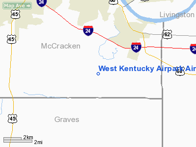
West Kentucky Airpark Airport |
|
|
|
Location &
QuickFacts
|
FAA
Information Effective: |
2008-09-25 |
|
Airport
Identifier: |
5KY3 |
|
Airport
Status: |
Operational |
|
Longitude/Latitude: |
088-33-54.9700W/36-58-03.1100N
-88.565269/36.967531 (Estimated) |
|
Elevation: |
338 ft / 103.02 m (Surveyed) |
|
Land: |
126 acres |
|
From
nearest city: |
7 nautical miles SE of Paducah, KY |
|
Location: |
Mc Cracken County, KY |
|
Magnetic Variation: |
04E (1980) |
Owner & Manager
|
Ownership: |
Privately owned |
|
Owner: |
Farrington Ltd Partnership |
|
Address: |
4100 Rustic Ave
Paducah, KY 42001 |
|
Phone
number: |
270-444-6611 |
|
Manager: |
Dr. Blain Grow
DR. GROW LEASES THE AIRPORT PROPERTY LAND FROM MRS.
CAROL
FARRINGTON. |
|
Address: |
530 Krebs Station Rd
Paducah, KY 42003 |
|
Phone number: |
270-441-4750 |
Airport Operations and Facilities
|
Airport Use: |
Private |
|
Wind indicator: |
Yes |
|
Segmented Circle: |
Yes |
|
Control Tower: |
No |
|
Lighting Schedule: |
DUSK-DAWN |
|
Landing fee charge: |
No |
|
Sectional chart: |
St Louis |
|
Region: |
ASO - Southern |
|
Boundary ARTCC: |
ZME - Memphis |
|
Tie-in FSS: |
LOU - Louisville |
|
FSS on Airport: |
No |
|
FSS Toll Free: |
1-800-WX-BRIEF |
Airport
Communications
Airport Services
|
Fuel
available: |
100LLMOGAS |
|
Airframe
Repair: |
MINOR |
|
Power
Plant Repair: |
MINOR |
|
Bottled
Oxygen: |
NONE |
|
Bulk
Oxygen: |
NONE |
|
Runway Information
Runway 04/22
|
Dimension: |
2915 x 60 ft / 888.5 x 18.3 m |
|
Surface: |
ASPH, Fair Condition |
|
|
Runway 04
|
Runway 22
|
|
Longitude: |
088-34-08.1700W |
088-33-41.7900W |
|
Latitude: |
36-57-53.3200N |
36-58-12.8800N |
|
Elevation: |
338.00 ft |
337.00 ft |
|
Alignment: |
47 |
127 |
|
Traffic
Pattern: |
Left |
Left |
|
Markings: |
Basic, Fair Condition |
Basic, Fair Condition |
|
Displaced
threshold: |
0.00 ft |
220.00 ft |
|
Runway End
Identifier: |
No |
No |
|
Centerline
Lights: |
No |
No |
|
Touchdown
Lights: |
No |
No |
|
Obstruction: |
60 ft trees, 2000.0 ft from runway, 200 ft left of
centerline, 30:1 slope to clear |
15 ft road, 200.0 ft from runway, 90 ft left of
centerline
28:1 TO DSPLCD THLD. |
|
Runway 04U/22U
|
Dimension: |
2900 x 60 ft / 883.9 x 18.3 m |
|
Surface: |
TURF, Good Condition |
|
|
Runway 04U
|
Runway 22U
|
|
Traffic
Pattern: |
Left |
Left |
|
Obstruction: |
60 ft trees, 2000.0 ft from runway, 100 ft left of
centerline, 33:1 slope to clear |
15 ft road, 600.0 ft from runway, 40:1 slope to clear |
|
Radio Navigation Aids
|
ID |
Type |
Name |
Ch |
Freq |
Var |
Dist |
|
BDD |
NDB |
Bellgrade |
|
254.00 |
00E |
11.8 nm |
|
GGK |
NDB |
Mayfield |
|
401.00 |
00E |
16.7 nm |
|
CIR |
NDB |
Cairo |
|
397.00 |
00E |
32.1 nm |
|
CHQ |
NDB |
Charleston |
|
208.00 |
01E |
38.7 nm |
|
TWT |
NDB |
Tradewater |
|
276.00 |
00E |
42.1 nm |
|
TIQ |
NDB |
Trainer |
|
410.00 |
00E |
43.8 nm |
|
UC |
NDB |
Obion |
|
212.00 |
00E |
45.3 nm |
|
CNG |
VORTAC |
Cunningham |
078X |
113.10 |
03E |
13.3 nm |
Remarks
-
-15' DRAINAGE
GULLEY 55' FROM THR END RWY 22.
-
-5' DRAINAGE
DITCH APRXLY 120' FROM THR END RWY 04.
-
ULTRALIGHT
ACTIVITY ON AND INVOF ARPT.
-
PARALLEL TURF RWY
NORTH OF EXISTING ASPH RWY.
-
ARPT CLSD AT NIGHT.
-
NO OBJECTION.
Based Aircraft
|
Aircraft based
on field: |
24 |
|
Single Engine
Airplanes: |
17 |
|
Multi Engine
Airplanes: |
1 |
|
Ultralights: |
6 |
Operational Statistics
Time Period: 2002-04-16 - 2003-04-15
|
Aircraft
Operations: |
111/Week |
|
Air Taxi: |
1.7% |
|
General
Aviation Local: |
69.6% |
|
General
Aviation Itinerant: |
27.8% |
|
Military: |
0.9% |
West Kentucky Airpark Airport
Address:
Mc Cracken County, KY
Tel:
270-444-6611,
270-441-4750
Images
and information placed above are from
http://www.airport-data.com/airport/5KY3/
We
thank them for the data!
|
|


