 |
|
|
|
|
|
|
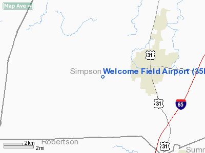
Location &
QuickFacts
|
FAA
Information Effective: |
2008-09-25 |
|
Airport
Identifier: |
35KY |
|
Airport
Status: |
Operational |
|
Longitude/Latitude: |
086-38-09.9850W/36-42-40.1490N
-86.636107/36.711153 (Estimated) |
|
Elevation: |
695 ft / 211.84 m (Estimated) |
|
Land: |
19 acres |
|
From
nearest city: |
3 nautical miles W of Franklin, KY |
|
Location: |
Simpson County, KY |
|
Magnetic Variation: |
01W (1985) |
Owner & Manager
|
Ownership: |
Privately owned |
|
Owner: |
Mr Carroll Smiley |
|
Address: |
40 Sulphur Spring Church Rd
Franklin, KY 42134 |
|
Phone
number: |
502-586-0612 |
|
Manager: |
Mr Carroll Smiley |
|
Address: |
40 Sulphur Spring Church Rd
Franklin, KY 42134 |
|
Phone number: |
502-586-0612 |
Airport Operations and Facilities
|
Airport
Use: |
Private |
|
Wind
indicator: |
Yes |
|
Segmented Circle: |
Yes |
|
Control
Tower: |
No |
|
Lighting
Schedule: |
PHONE REQ
FOR LIRL RWY 11/29 CALL 502-586-0244. |
|
Landing fee charge: |
No |
|
Sectional chart: |
St Louis |
|
Region: |
ASO - Southern |
|
Boundary ARTCC: |
ZME - Memphis |
|
Tie-in FSS: |
LOU - Louisville |
|
FSS on Airport: |
No |
|
FSS Toll Free: |
1-800-WX-BRIEF |
Airport Services
|
Bottled
Oxygen: |
NONE |
|
Bulk
Oxygen: |
NONE |
|
Runway Information
Runway 11/29
|
Dimension: |
2000 x 100 ft / 609.6 x 30.5 m |
|
Surface: |
TURF, Good Condition |
|
Edge Lights: |
Low |
|
|
Runway 11
|
Runway 29
|
|
Traffic
Pattern: |
Left |
Left |
|
Obstruction: |
73 ft trees, 2200.0 ft from runway, 120 ft left of
centerline, 30:1 slope to clear |
10 ft road, 150.0 ft from runway, 15:1 slope to clear |
|
Radio Navigation Aids
|
ID |
Type |
Name |
Ch |
Freq |
Var |
Dist |
|
PED |
NDB |
Needmore |
|
221.00 |
01W |
17.2 nm |
|
ON |
NDB |
Music |
|
279.00 |
03W |
23.4 nm |
|
LFB |
NDB |
Lafayette |
|
245.00 |
02W |
30.1 nm |
|
VI |
NDB |
Opery |
|
344.00 |
02W |
30.5 nm |
|
JUE |
NDB |
Lebanon |
|
414.00 |
02W |
34.9 nm |
|
HIX |
NDB |
Honey Grove |
|
356.00 |
01W |
35.3 nm |
|
BVQ |
NDB |
Beaver Creek |
|
260.00 |
02W |
35.3 nm |
|
FK |
NDB |
Airbe |
|
273.00 |
01W |
37.5 nm |
|
GMH |
NDB |
Muhlenberg |
|
362.00 |
01E |
39.9 nm |
|
SWZ |
NDB |
Sewart |
|
391.00 |
02W |
46.1 nm |
|
FQW |
NDB |
Walter Hill |
|
371.00 |
02W |
46.9 nm |
|
HXW |
TACAN |
Screaming Eagle |
096X |
|
01W |
41.5 nm |
|
CKV |
VOR/DME |
Clarksville |
043X |
110.60 |
01W |
37.8 nm |
|
BWG |
VORTAC |
Bowling Green |
126X |
117.90 |
02E |
16.0 nm |
|
BNA |
VORTAC |
Nashville |
088X |
114.10 |
02W |
34.6 nm |
|
BNA |
VOT |
Nashville Metropoln |
|
108.60 |
|
35.2 nm |
|
MQY |
VOT |
Smyrna |
|
110.20 |
|
42.8 nm |
Remarks
Based Aircraft
|
Aircraft based
on field: |
6 |
|
Single Engine
Airplanes: |
4 |
|
Ultralights: |
2 |
Operational Statistics
Time Period: 1990-04-12 - 1991-04-11
|
Aircraft
Operations: |
29/Week |
|
General
Aviation Local: |
49.0% |
|
General
Aviation Itinerant: |
49.0% |
|
Military: |
2.0% |
Welcome Field Airport
Address:
Simpson County, KY
Tel:
502-586-0612
Images
and information placed above are from
http://www.airport-data.com/airport/35KY/
We
thank them for the data!
|
General Info |
| Country |
United
States |
| State |
KENTUCKY
|
| FAA ID |
35KY
|
| Latitude |
36-42-40.149N |
|
Longitude |
086-38-09.985W |
|
Elevation |
695 feet
|
| Near
City |
FRANKLIN
|
We don't guarantee the information is fresh and accurate. The data may
be wrong or outdated.
For more up-to-date information please refer to other sources.
|
|


