 |
|
|
Location &
QuickFacts
|
FAA
Information Effective: |
2008-09-25 |
|
Airport
Identifier: |
70KY |
|
Airport
Status: |
Operational |
|
Longitude/Latitude: |
085-57-52.8670W/37-48-57.2420N
-85.964685/37.815901 (Estimated) |
|
Elevation: |
680 ft / 207.26 m (Surveyed) |
|
Land: |
0 acres |
|
From
nearest city: |
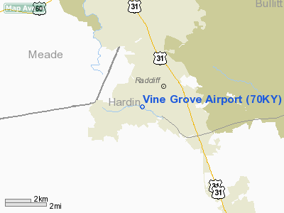
1 nautical miles NE of Vine Grove, KY |
|
Location: |
Hardin County, KY |
|
Magnetic Variation: |
02W (1985) |
Owner & Manager
|
Ownership: |
Privately owned |
|
Owner: |
Vine Grove Airport, Inc. |
|
Address: |
101 Airport Road
Vine Grove, KY 40175 |
|
Phone
number: |
502-877-0131 |
|
Manager: |
Robert Nall |
|
Address: |
101 Airport Road
Vine Grove, KY 40175 |
|
Phone number: |
502-877-0131 |
Airport Operations and Facilities
|
Airport Use: |
Private |
|
Wind indicator: |
Yes |
|
Segmented Circle: |
No |
|
Control Tower: |
No |
|
Landing fee charge: |
No |
|
Sectional chart: |
St Louis |
|
Region: |
ASO - Southern |
|
Boundary ARTCC: |
ZID - Indianapolis |
|
Tie-in FSS: |
LOU - Louisville |
|
FSS on Airport: |
No |
|
FSS Toll Free: |
1-800-WX-BRIEF |
Airport Services
|
Runway Information
Runway 11/29
|
Dimension: |
2700 x 60 ft / 823.0 x 18.3 m |
|
Surface: |
TURF, |
|
|
Runway 11
|
Runway 29
|
|
Traffic
Pattern: |
Left |
Left |
|
Obstruction: |
25 ft pline, 10.0 ft from runway |
|
|
Radio Navigation Aids
|
ID |
Type |
Name |
Ch |
Freq |
Var |
Dist |
|
GOI |
NDB |
Godman |
|
396.00 |
02W |
8.6 nm |
|
BRY |
NDB |
Bardstown/dcmsnd |
|
248.00 |
02W |
22.9 nm |
|
IKY |
NDB |
Springfield |
|
429.00 |
03W |
36.3 nm |
|
TEL |
NDB |
Tell City |
|
206.00 |
02W |
36.4 nm |
|
TYC |
NDB |
Taylor County |
|
272.00 |
02W |
42.4 nm |
|
BVQ |
NDB |
Beaver Creek |
|
260.00 |
02W |
48.0 nm |
|
FNZ |
NDB |
Ferdinand |
|
239.00 |
00E |
48.8 nm |
|
MYS |
VOR |
Mystic |
|
108.20 |
01W |
14.1 nm |
|
FTK |
VOR/DME |
Fort Knox |
033X |
109.60 |
01W |
5.5 nm |
|
EWO |
VOR/DME |
New Hope |
045X |
110.80 |
01E |
17.6 nm |
|
BQM |
VOR/DME |
Bowman |
059X |
112.20 |
01W |
28.7 nm |
|
IIU |
VORTAC |
Louisville |
095X |
114.80 |
01E |
25.2 nm |
|
ABB |
VORTAC |
Nabb |
071X |
112.40 |
01E |
49.0 nm |
|
SDF |
VOT |
Louisville Standifd |
|
111.00 |
|
24.3 nm |
Remarks
Based Aircraft
|
Aircraft based
on field: |
23 |
|
Single Engine
Airplanes: |
20 |
|
Ultralights: |
3 |
Vine Grove Airport
Address:
Hardin County, KY
Tel:
502-877-0131
Images
and information placed above are from
http://www.airport-data.com/airport/70KY/
We
thank them for the data!
|
General Info |
| Country |
United
States |
| State |
KENTUCKY
|
| FAA ID |
70KY
|
| Latitude |
37-48-57.242N |
|
Longitude |
085-57-52.867W |
|
Elevation |
680 feet
|
| Near
City |
VINE
GROVE |
We don't guarantee the information is fresh and accurate. The data may
be wrong or outdated.
For more up-to-date information please refer to other sources.
|
|


