 |
|
|
Location &
QuickFacts
|
FAA
Information Effective: |
2008-09-25 |
|
Airport
Identifier: |
54KY |
|
Airport
Status: |
Operational |
|
Longitude/Latitude: |
088-14-50.0000W/36-43-52.0000N
-88.247222/36.731111 (Estimated) |
|
Elevation: |
350 ft / 106.68 m (Estimated) |
|
Land: |
80 acres |
|
From
nearest city: |
11 nautical miles NE of Murray, KY |
|
Location: |
Calloway County, KY |
|
Magnetic Variation: |
00W () |
Owner & Manager
|
Ownership: |
Privately owned |
|
Owner: |
Jack D. Turner |
|
Address: |
351 Turner Airport Lane
Dexter, KY 42036 |
|
Phone
number: |
270-437-3940 |
|
Manager: |
Jack D. Turner |
|
Address: |
351 Turner Airport Lane
Dexter, KY 42036 |
|
Phone number: |
270-437-3940 |
Airport Operations and Facilities
|
Airport
Use: |
Private |
|
Segmented Circle: |
No |
|
Control
Tower: |
No |
|
Sectional chart: |
St Louis |
|
Region: |
ASO - Southern |
|
Boundary
ARTCC: |
ZME - Memphis |
|
Tie-in
FSS: |
LOU - Louisville |
|
FSS Toll
Free: |
1-800-WX-BRIEF |
|
Runway Information
Runway 10/28
|
Dimension: |
2750 x 60 ft / 838.2 x 18.3 m |
|
Surface: |
TURF, |
|
|
Runway 10
|
Runway 28
|
|
Traffic
Pattern: |
Left |
Left |
|
Displaced
threshold: |
0.00 ft |
100.00 ft
RY 28 DSPLCD THLD MKD WITH YELLOW TIRES. |
|
Obstruction: |
|
20 ft pline, 600.0 ft from runway |
|
Radio Navigation Aids
|
ID |
Type |
Name |
Ch |
Freq |
Var |
Dist |
|
GGK |
NDB |
Mayfield |
|
401.00 |
00E |
16.8 nm |
|
TIQ |
NDB |
Trainer |
|
410.00 |
00E |
30.1 nm |
|
BDD |
NDB |
Bellgrade |
|
254.00 |
00E |
32.2 nm |
|
HZD |
NDB |
Huntingdon |
|
217.00 |
00E |
40.1 nm |
|
FK |
NDB |
Airbe |
|
273.00 |
01W |
40.1 nm |
|
AEY |
NDB |
Waverly |
|
329.00 |
00E |
44.3 nm |
|
UC |
NDB |
Obion |
|
212.00 |
00E |
44.5 nm |
|
HIX |
NDB |
Honey Grove |
|
356.00 |
01W |
44.7 nm |
|
TWT |
NDB |
Tradewater |
|
276.00 |
00E |
46.5 nm |
|
HXW |
TACAN |
Screaming Eagle |
096X |
|
01W |
36.4 nm |
|
CKV |
VOR/DME |
Clarksville |
043X |
110.60 |
01W |
40.8 nm |
|
CNG |
VORTAC |
Cunningham |
078X |
113.10 |
03E |
32.9 nm |
Remarks
-
PRVDD VFR/PVT
USE, FOLLOW RESTRICTIONS IN LETTER OF AGREEMENT WITH NEARBY MURRAY-CALLOWAY
COUNTY AIRPORT.
Based Aircraft
|
Aircraft based
on field: |
9 |
|
Single Engine
Airplanes: |
3 |
|
Multi Engine
Airplanes: |
1 |
|
Helicopters: |
5 |
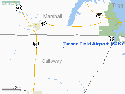
Turner Field Airport
Address:
Calloway County, KY
Tel:
270-437-3940
Images
and information placed above are from
http://www.airport-data.com/airport/54KY/
We
thank them for the data!
|
General Info |
| Country |
United
States |
| State |
KENTUCKY
|
| FAA ID |
54KY
|
| Latitude |
36-43-52.000N |
|
Longitude |
088-14-50.000W |
|
Elevation |
350 feet
|
| Near
City |
MURRAY
|
We don't guarantee the information is fresh and accurate. The data may
be wrong or outdated.
For more up-to-date information please refer to other sources.
|
|


