 |
|
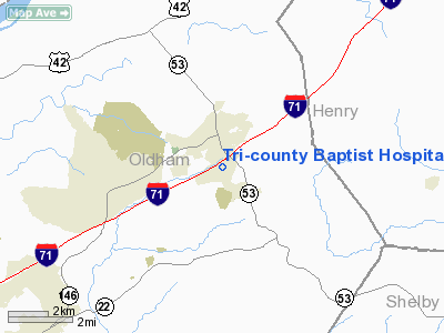
Tri-county Baptist Hospital Heliport |
|
Location &
QuickFacts
|
FAA
Information Effective: |
2008-09-25 |
|
Airport
Identifier: |
2KY9 |
|
Airport
Status: |
Operational |
|
Longitude/Latitude: |
085-22-36.0000W/38-23-38.0000N
-85.376667/38.393889 (Estimated) |
|
Elevation: |
792 ft / 241.40 m (Estimated) |
|
Land: |
0 acres |
|
From
nearest city: |
1 nautical miles SE of La Grange, KY |
|
Location: |
Oldham County, KY |
|
Magnetic Variation: |
03W (1995) |
Owner & Manager
|
Ownership: |
Privately owned |
|
Owner: |
Baptist Health Care Systems |
|
Address: |
Dba Tri-county Baptist Hospital, 1025 New Moody Lane
La Grange, KY 40031 |
|
Phone
number: |
502-222-5388 |
|
Manager: |
Joey Barnett |
|
Address: |
1025 New Moody Lane
La Grange, KY 40031 |
|
Phone number: |
502-222-3357 |
Airport Operations and Facilities
|
Airport
Use: |
Private |
|
Wind
indicator: |
Yes |
|
Segmented Circle: |
No |
|
Control
Tower: |
No |
|
Sectional chart: |
St Louis |
|
Region: |
ASO - Southern |
|
Boundary
ARTCC: |
ZID - Indianapolis |
|
Tie-in
FSS: |
LOU - Louisville |
|
FSS Toll
Free: |
1-800-WX-BRIEF |
|
Runway Information
Helipad H1
|
Dimension: |
50 x 50 ft / 15.2 x 15.2 m |
|
Surface: |
CONC, |
|
|
Runway H1
|
Runway
|
|
Traffic
Pattern: |
Left |
Left |
|
Radio Navigation Aids
|
ID |
Type |
Name |
Ch |
Freq |
Var |
Dist |
|
IMS |
NDB |
Madison |
|
404.00 |
03W |
22.4 nm |
|
FEU |
NDB |
Arnold |
|
521.00 |
03W |
28.4 nm |
|
BRY |
NDB |
Bardstown/dcmsnd |
|
248.00 |
02W |
33.2 nm |
|
GOI |
NDB |
Godman |
|
396.00 |
02W |
38.6 nm |
|
EQZ |
NDB |
Captain |
|
308.00 |
02W |
39.9 nm |
|
OVO |
NDB |
North Vernon |
|
374.00 |
02W |
40.8 nm |
|
LE |
NDB |
Blayd |
|
242.00 |
04W |
41.7 nm |
|
IKY |
NDB |
Springfield |
|
429.00 |
03W |
46.1 nm |
|
UR |
NDB |
Burln |
|
321.00 |
04W |
48.3 nm |
|
FFT |
VOR |
Frankfort |
|
109.40 |
03W |
25.5 nm |
|
BQM |
VOR/DME |
Bowman |
059X |
112.20 |
01W |
16.8 nm |
|
FTK |
VOR/DME |
Fort Knox |
033X |
109.60 |
01W |
40.6 nm |
|
EWO |
VOR/DME |
New Hope |
045X |
110.80 |
01E |
47.9 nm |
|
ABB |
VORTAC |
Nabb |
071X |
112.40 |
01E |
16.9 nm |
|
IIU |
VORTAC |
Louisville |
095X |
114.80 |
01E |
19.9 nm |
|
CVG |
VORTAC |
Cincinnati |
120X |
117.30 |
04W |
48.9 nm |
|
HYK |
VORTAC |
Lexington |
073X |
112.60 |
00E |
49.9 nm |
|
SDF |
VOT |
Louisville Standifd |
|
111.00 |
|
21.4 nm |
Remarks
-
30 FT LGT POLE 40
FT EAST, 80 FT TOWER 252 FT WEST OF HELIPAD.
-
PRVDD APCH/DEP
FROM 140 CLKWS 300, AREA MKD, WIND INDICATOR MAINTAINED.
Tri-county Baptist Hospital Heliport
Address:
Oldham County, KY
Tel:
502-222-5388,
502-222-3357
Images
and information placed above are from
http://www.airport-data.com/airport/2KY9/
We
thank them for the data!
|
General Info |
| Country |
United
States |
| State |
KENTUCKY
|
| FAA ID |
2KY9
|
| Latitude |
38-23-38.000N |
|
Longitude |
085-22-36.000W |
|
Elevation |
792 feet
|
| Near
City |
LA
GRANGE |
We don't guarantee the information is fresh and accurate. The data may
be wrong or outdated.
For more up-to-date information please refer to other sources.
|
|


