 |
|
|
Location &
QuickFacts
|
FAA
Information Effective: |
2008-09-25 |
|
Airport
Identifier: |
74KY |
|
Airport
Status: |
Operational |
|
Longitude/Latitude: |
088-50-48.2060W/36-53-55.2000N
-88.846724/36.898667 (Estimated) |
|
Elevation: |
370 ft / 112.78 m (Estimated) |
|
Land: |
2 acres |
|
From
nearest city: |
3 nautical miles SE of Cunningham, KY |
|
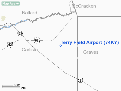
Location: |
Carlisle County, KY |
|
Magnetic Variation: |
01E (1985) |
Owner & Manager
|
Ownership: |
Privately owned |
|
Owner: |
Steven Terry |
|
Address: |
Rt 1
Cunningham, KY 42035 |
|
Phone number: |
502-642-2149 |
|
Manager: |
Steven Terry |
|
Address: |
Rt 1
Cunningham, KY 42035 |
|
Phone number: |
502-642-2515 |
Airport
Operations and Facilities
|
Airport
Use: |
Private |
|
Wind
indicator: |
Yes |
|
Segmented Circle: |
No |
|
Control
Tower: |
No |
|
Sectional chart: |
St Louis |
|
Region: |
ASO - Southern |
|
Boundary
ARTCC: |
ZME - Memphis |
|
Tie-in
FSS: |
LOU - Louisville |
|
FSS Toll
Free: |
1-800-WX-BRIEF |
|
NOTAMs
Facility: |
LOU |
|
Runway Information
Runway 18/36
|
Dimension: |
2500 x 40 ft / 762.0 x 12.2 m |
|
Surface: |
TURF, |
|
|
Runway 18
|
Runway 36
|
|
Traffic
Pattern: |
Left |
Left |
|
Radio Navigation Aids
|
ID |
Type |
Name |
Ch |
Freq |
Var |
Dist |
|
BDD |
NDB |
Bellgrade |
|
254.00 |
00E |
17.1 nm |
|
GGK |
NDB |
Mayfield |
|
401.00 |
00E |
17.5 nm |
|
CIR |
NDB |
Cairo |
|
397.00 |
00E |
20.6 nm |
|
CHQ |
NDB |
Charleston |
|
208.00 |
01E |
24.7 nm |
|
UC |
NDB |
Obion |
|
212.00 |
00E |
36.8 nm |
|
TIQ |
NDB |
Trainer |
|
410.00 |
00E |
44.2 nm |
|
CGI |
VOR/DME |
Cape Girardeau |
076X |
112.90 |
01E |
40.0 nm |
|
CNG |
VORTAC |
Cunningham |
078X |
113.10 |
03E |
6.6 nm |
Remarks
-
PRVDD VFR,
PRIVATE USE ONLY.
Terry Field Airport
Address:
Carlisle County, KY
Tel:
502-642-2149, 502-642-2515
Images
and information placed above are from
http://www.airport-data.com/airport/74KY/
We
thank them for the data!
|
General Info |
| Country |
United
States |
| State |
KENTUCKY
|
| FAA ID |
74KY
|
| Latitude |
36-53-55.200N |
|
Longitude |
088-50-48.206W |
|
Elevation |
370 feet
|
| Near
City |
CUNNINGHAM |
We don't guarantee the information is fresh and accurate. The data may
be wrong or outdated.
For more up-to-date information please refer to other sources.
|
|


