 |
|
Tennessee Gas Pipeline Heliport |
|
|
|
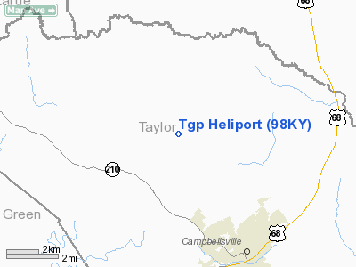
Location &
QuickFacts
|
FAA
Information Effective: |
2008-09-25 |
|
Airport Identifier: |
98KY |
|
Airport Status: |
Operational |
|
Longitude/Latitude: |
085-23-40.0000W/37-24-45.0000N
-85.394444/37.412500 (Estimated) |
|
Elevation: |
900 ft / 274.32 m (Estimated) |
|
Land: |
0 acres |
|
From
nearest city: |
5 nautical miles N of Campbellsville, KY |
|
Location: |
Taylor County, KY |
|
Magnetic Variation: |
02W (1990) |
Owner & Manager
|
Ownership: |
Privately owned |
|
Owner: |
Tennessee Gas Pipeline Co. |
|
Address: |
1380 Hobson Road
Campbellsville, KY 42718-9541 |
|
Phone number: |
502-465-6641 |
|
Manager: |
Charles R. Headley |
|
Address: |
1380 Hobson Road
Campbellsville, KY 42718-9541 |
|
Phone number: |
502-465-6641 |
Airport
Operations and Facilities
|
Airport Use: |
Private |
|
Segmented Circle: |
No |
|
Control Tower: |
No |
|
Sectional chart: |
St Louis |
|
Region: |
ASO - Southern |
|
Boundary ARTCC: |
ZID - Indianapolis |
|
Tie-in
FSS: |
LOU - Louisville |
|
FSS on
Airport: |
No |
|
FSS
Toll Free: |
1-800-WX-BRIEF |
|
Runway Information
Helipad H1
|
Dimension: |
40 x 40 ft / 12.2 x 12.2 m |
|
Surface: |
CONC, |
|
|
Runway H1
|
Runway
|
|
Traffic
Pattern: |
Left |
Left |
|
Radio Navigation
Aids
|
ID |
Type |
Name |
Ch |
Freq |
Var |
Dist |
|
TYC |
NDB |
Taylor County |
|
272.00 |
02W |
7.2 nm |
|
IKY |
NDB |
Springfield |
|
429.00 |
03W |
15.3 nm |
|
BRY |
NDB |
Bardstown/dcmsnd |
|
248.00 |
02W |
26.5 nm |
|
DVK |
NDB |
Goodall |
|
311.00 |
03W |
31.6 nm |
|
BVQ |
NDB |
Beaver Creek |
|
260.00 |
02W |
37.8 nm |
|
EKQ |
NDB |
Elk Spring |
|
290.00 |
03W |
42.3 nm |
|
CDX |
NDB |
Cumberland River |
|
388.00 |
05E |
42.3 nm |
|
GOI |
NDB |
Godman |
|
396.00 |
02W |
43.0 nm |
|
LE |
NDB |
Blayd |
|
242.00 |
04W |
49.1 nm |
|
MYS |
VOR |
Mystic |
|
108.20 |
01W |
49.7 nm |
|
EWO |
VOR/DME |
New Hope |
045X |
110.80 |
01E |
18.8 nm |
|
FTK |
VOR/DME |
Fort Knox |
033X |
109.60 |
01W |
40.5 nm |
|
IIU |
VORTAC |
Louisville |
095X |
114.80 |
01E |
42.4 nm |
|
SDF |
VOT |
Louisville Standifd |
|
111.00 |
|
48.8 nm |
Remarks
-
PROVIDED VFR/PR
USE; ALL APCH/DEP ROUTE HEL OPNS ARE FROM 040-340 DEG; AREA APPROPRIATELY
MKD; A WIND INDICATOR IN MNTND.
Tennessee Gas Pipeline Heliport
Address:
Taylor County, KY
Tel:
502-465-6641
Images
and information placed above are from
http://www.airport-data.com/airport/98KY/
We
thank them for the data!
|
General Info |
| Country |
United
States |
| State |
KENTUCKY
|
| FAA ID |
98KY
|
| Latitude |
37-24-45.000N |
|
Longitude |
085-23-40.000W |
|
Elevation |
900 feet
|
| Near
City |
CAMPBELLSVILLE |
We don't guarantee the information is fresh and accurate. The data may
be wrong or outdated.
For more up-to-date information please refer to other sources.
|
|


