 |
|
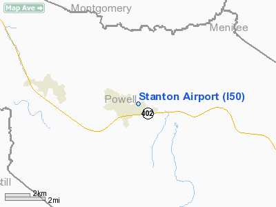
| Stanton Airport |
| IATA: none – ICAO: none – FAA LID: I50 |
| Summary |
| Airport type |
Public |
| Operator |
Powell County Airport Board |
| Location |
Stanton, Kentucky |
| Elevation AMSL |
651 ft / 198.4 m |
| Coordinates |
37°51′00″N 83°50′45″W / 37.85°N 83.84583°W / 37.85; -83.84583Coordinates: 37°51′00″N 83°50′45″W / 37.85°N 83.84583°W / 37.85; -83.84583 |
| Runways |
| Direction |
Length |
Surface |
| ft |
m |
| 6/24 |
3,000 |
914 |
Asphalt |
Stanton Airport (FAA LID: I50) is a public airport located one mile (1.6 km) east of the central business district (CBD) of Stanton, a city in Powell County, Kentucky, United States. It covers 69 acres (280,000 m) with two runways which see over 2500 planes a year.
The airport currently is undergoing renovations and is expected to be completed in 2007, with an additional hangar for three aircraft and an on-site flight school and airframe/mechanic school.
Runways
- Runway 6 - 2780' Asphalt in good condition
- Runway 24 - 3000' Asphalt in good condition
The above content comes from Wikipedia and is published under free licenses – click here to read more.
|
Location &
QuickFacts
|
FAA
Information Effective: |
2008-09-25 |
|
Airport
Identifier: |
I50 |
|
Airport
Status: |
Operational |
|
Longitude/Latitude: |
083-50-44.7070W/37-51-00.2940N
-83.845752/37.850082 (Estimated) |
|
Elevation: |
651 ft / 198.42 m (Surveyed) |
|
Land: |
45 acres |
|
From
nearest city: |
1 nautical miles E of Stanton, KY |
|
Location: |
Powell County, KY |
|
Magnetic Variation: |
04W (1985) |
Owner & Manager
|
Ownership: |
Publicly owned |
|
Owner: |
Powell Co Arpt Board |
|
Address: |
Po Box 3
Stanton, KY 40380 |
|
Phone
number: |
606-634-9688 |
|
Manager: |
Glenn Salyer
ARPT BOARD CHAIRMAN. |
|
Address: |
Po Box 3
Stanton, KY 40380 |
|
Phone number: |
606-634-9625 |
Airport
Operations and Facilities
|
Airport
Use: |
Open to public |
|
Wind
indicator: |
Yes |
|
Segmented Circle: |
Yes |
|
Control
Tower: |
No |
|
Lighting
Schedule: |
RDO-CTL
ACTVT MIRL RY 06/24, REIL RYS 06 & 24 - CTAF. |
|
Landing
fee charge: |
No |
|
Sectional chart: |
Cincinnati |
|
Region: |
ASO - Southern |
|
Boundary
ARTCC: |
ZID - Indianapolis |
|
Tie-in
FSS: |
LOU - Louisville |
|
FSS on
Airport: |
No |
|
FSS Toll
Free: |
1-800-WX-BRIEF |
|
NOTAMs
Facility: |
LOU (NOTAM-d service avaliable) |
|
Federal Agreements: |
N |
Airport Communications
|
CTAF: |
122.800 |
|
Unicom: |
122.800 |
Airport Services
|
Fuel
available: |
100LL |
|
Airframe
Repair: |
NONE |
|
Power
Plant Repair: |
NONE |
|
Bottled
Oxygen: |
NONE |
|
Bulk
Oxygen: |
NONE |
|
Runway Information
Runway 06/24
|
Dimension: |
3000 x 70 ft / 914.4 x 21.3 m |
|
Surface: |
ASPH, Good Condition |
|
Weight Limit: |
Single wheel: 8000 lbs. |
|
Edge Lights: |
Medium |
|
|
Runway 06
|
Runway 24
|
|
Traffic
Pattern: |
Left |
Left |
|
Markings: |
Basic, Good Condition |
Basic, Good Condition |
|
Displaced
threshold: |
220.00 ft |
0.00 ft |
|
Runway End
Identifier: |
Yes |
Yes |
|
Obstruction: |
53 ft trees, 900.0 ft from runway, 75 ft right of
centerline, 13:1 slope to clear
APCH SLOPE 20:1 TO DSPLCD THLD.
+6 FT FENCE 65 FT FROM RY END. |
10 ft road, 200.0 ft from runway
+30 FT TREE 140 FT FROM RY END 120 FT L. |
|
Radio Navigation Aids
|
ID |
Type |
Name |
Ch |
Freq |
Var |
Dist |
|
XYC |
NDB |
Seco |
|
393.00 |
03W |
10.4 nm |
|
IOB |
NDB |
Mount Sterling |
|
210.00 |
04W |
14.2 nm |
|
LE |
NDB |
Blayd |
|
242.00 |
04W |
39.5 nm |
|
XW |
NDB |
Flmng |
|
400.00 |
05W |
44.5 nm |
|
DVK |
NDB |
Goodall |
|
311.00 |
03W |
46.7 nm |
|
AZQ |
VOR/DME |
Hazard |
049X |
111.20 |
04W |
39.1 nm |
|
HYK |
VORTAC |
Lexington |
073X |
112.60 |
00E |
30.5 nm |
|
ECB |
VORTAC |
Newcombe |
041X |
110.40 |
02W |
48.0 nm |
Remarks
-
RY 24 50' TREES
ALSO VIOLATE 20:1 APCH, 1200' FM THR.
-
GLIDER AND
ULTRALIGHT ACTVTY ON WKENDS.
-
EXISTED PRIOR TO 1959.
Based Aircraft
|
Aircraft based
on field: |
12 |
|
Single Engine
Airplanes: |
11 |
|
Multi Engine
Airplanes: |
1 |
Operational Statistics
Time Period: 2006-09-19 - 2007-09-18
|
Aircraft
Operations: |
94/Week |
|
Air Taxi: |
4.3% |
|
General
Aviation Local: |
40.7% |
|
General
Aviation Itinerant: |
54.0% |
|
Military: |
1.0% |
Stanton Airport
Address:
Powell County, KY
Tel:
606-634-9688,
606-634-9625
Images
and information placed above are from
http://www.airport-data.com/airport/I50/
We
thank them for the data!
|
General Info |
| Country |
United
States |
| State |
KENTUCKY
|
| FAA ID |
I50
|
| Latitude |
37-51-00.294N |
|
Longitude |
083-50-44.707W |
|
Elevation |
651 feet
|
| Near
City |
STANTON
|
We don't guarantee the information is fresh and accurate. The data may
be wrong or outdated.
For more up-to-date information please refer to other sources.
|
|


