 |
|
|
|
|
|
|
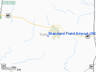
Location &
QuickFacts
|
FAA
Information Effective: |
2008-09-25 |
|
Airport
Identifier: |
5KY4 |
|
Airport
Status: |
Operational |
|
Longitude/Latitude: |
087-10-35.0000W/36-48-10.0000N
-87.176389/36.802778 (Estimated) |
|
Elevation: |
665 ft / 202.69 m (Estimated) |
|
Land: |
23 acres |
|
From
nearest city: |
1 nautical miles W of Elkton, KY |
|
Location: |
Todd County, KY |
|
Magnetic Variation: |
00W (1985) |
Owner & Manager
|
Ownership: |
Publicly owned |
|
Owner: |
Elkton-todd Arpt Board |
|
Address: |
101 Howard Circle
Elkton, KY 42220 |
|
Phone
number: |
270-885-2296 |
|
Manager: |
Keith Sharp
FBO; JOHNSON AERONAUTICAL; CALL (270) 265-9292. |
|
Address: |
101 Howard Circle
Elkton, KY 42220 |
|
Phone number: |
270-885-2296 |
Airport Operations and Facilities
|
Airport Use: |
Private |
|
Wind indicator: |
Yes |
|
Segmented Circle: |
No |
|
Control Tower: |
No |
|
Landing fee charge: |
No |
|
Sectional chart: |
St Louis |
|
Region: |
ASO - Southern |
|
Boundary ARTCC: |
ZME - Memphis |
|
Tie-in FSS: |
LOU - Louisville |
|
FSS on Airport: |
No |
|
FSS Toll Free: |
1-800-WX-BRIEF |
Airport Services
|
Airframe
Repair: |
MAJOR |
|
Power
Plant Repair: |
MAJOR |
|
Bottled
Oxygen: |
NONE |
|
Bulk
Oxygen: |
NONE |
|
Runway Information
Runway 13/31
|
Dimension: |
2930 x 75 ft / 893.1 x 22.9 m |
|
Surface: |
TURF, Good Condition |
|
|
Runway 13 |
Runway 31 |
|
Alignment: |
127 |
127 |
|
Traffic
Pattern: |
Left |
Left |
|
Obstruction: |
8 ft trees, 20.0 ft from runway, 122 ft left of
centerline, 2:1 slope to clear |
37 ft trees, 634.0 ft from runway, 15 ft right of
centerline, 17:1 slope to clear |
|
Radio Navigation Aids
|
ID |
Type |
Name |
Ch |
Freq |
Var |
Dist |
|
HIX |
NDB |
Honey Grove |
|
356.00 |
01W |
9.1 nm |
|
FK |
NDB |
Airbe |
|
273.00 |
01W |
12.1 nm |
|
PED |
NDB |
Needmore |
|
221.00 |
01W |
20.3 nm |
|
ON |
NDB |
Music |
|
279.00 |
03W |
23.0 nm |
|
GMH |
NDB |
Muhlenberg |
|
362.00 |
01E |
25.5 nm |
|
DMZ |
NDB |
Dickson |
|
203.00 |
01W |
42.4 nm |
|
VI |
NDB |
Opery |
|
344.00 |
02W |
44.0 nm |
|
AEY |
NDB |
Waverly |
|
329.00 |
00E |
49.5 nm |
|
HXW |
TACAN |
Screaming Eagle |
096X |
|
01W |
17.1 nm |
|
CKV |
VOR/DME |
Clarksville |
043X |
110.60 |
01W |
15.7 nm |
|
CCT |
VORTAC |
Central City |
035X |
109.80 |
01W |
35.1 nm |
|
BWG |
VORTAC |
Bowling Green |
126X |
117.90 |
02E |
36.1 nm |
|
BNA |
VORTAC |
Nashville |
088X |
114.10 |
02W |
46.5 nm |
|
BNA |
VOT |
Nashville Metropoln |
|
108.60 |
|
47.1 nm |
Remarks
-
RY 31 4 FT FENCE
519 FT FM THLD.
-
VARIABLE FIELD
COND, WILDLIFE ACTIVITY.
-
TURF EXPERIENCE
AND ARPT FAMILIARITY IS HIGHLY RECOMMENDED.
-
EXISTED PRIOR TO 1959.
Based Aircraft
|
Aircraft based
on field: |
13 |
|
Single Engine
Airplanes: |
9 |
|
Ultralights: |
4 |
Operational Statistics
Time Period: 2005-02-08 - 2006-02-07
|
Aircraft
Operations: |
38/Week |
|
General
Aviation Local: |
61.5% |
|
General
Aviation Itinerant: |
35.9% |
|
Military: |
2.6% |
Standard Field Airport
Address:
Todd County, KY
Tel:
270-885-2296
Images
and information placed above are from
http://www.airport-data.com/airport/5KY4/
We
thank them for the data!
|
|


