 |
|
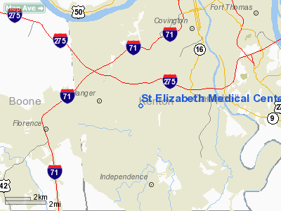
St. Elizabeth Medical Center South Heliport |
|
|
|
Location &
QuickFacts
|
FAA
Information Effective: |
2008-09-25 |
|
Airport
Identifier: |
32KY |
|
Airport
Status: |
Operational |
|
Longitude/Latitude: |
084-33-24.7940W/39-00-37.2190N
-84.556887/39.010339 (Estimated) |
|
Elevation: |
873 ft / 266.09 m (Estimated) |
|
Land: |
240 acres |
|
From
nearest city: |
0 nautical miles N of Edgewood, KY |
|
Location: |
Kenton County, KY |
|
Magnetic Variation: |
03W (1985) |
Owner & Manager
|
Ownership: |
Privately owned |
|
Owner: |
St Elizabeth Medical Cntr So |
|
Address: |
1 Medical Village Dr
Edgewood, KY 41017 |
|
Phone
number: |
606-344-2270 |
|
Manager: |
Gregory Popham |
|
Address: |
1 Medical Village Dr
Edgewood, KY 41017 |
|
Phone number: |
606-344-2090 |
Airport Operations and Facilities
|
Airport
Use: |
Private
MEDICAL. |
|
Wind
indicator: |
Yes |
|
Segmented Circle: |
Yes |
|
Control
Tower: |
No |
|
Lighting
Schedule: |
PHONE REQ |
|
Beacon
Color: |
Clear-Yellow (lighted seaplan base) |
|
Landing
fee charge: |
No |
|
Sectional chart: |
Cincinnati |
|
Region: |
ASO - Southern |
|
Boundary
ARTCC: |
ZID - Indianapolis |
|
Tie-in
FSS: |
LOU - Louisville |
|
FSS on
Airport: |
No |
|
FSS Toll
Free: |
1-800-WX-BRIEF |
|
Runway Information
Helipad H1
|
Dimension: |
50 x 50 ft / 15.2 x 15.2 m |
|
Surface: |
ASPH, |
|
|
Runway H1
|
Runway
|
|
Traffic
Pattern: |
Left |
Left |
|
Radio Navigation Aids
|
ID |
Type |
Name |
Ch |
Freq |
Var |
Dist |
|
UR |
NDB |
Burln |
|
321.00 |
04W |
10.3 nm |
|
LUK |
NDB |
Cincinnati |
|
335.00 |
04W |
13.5 nm |
|
MDE |
NDB |
Madeira |
|
379.00 |
04W |
15.9 nm |
|
ISZ |
NDB |
Cincinnati-blue Ash |
|
388.00 |
04W |
16.3 nm |
|
PWF |
NDB |
Sportys |
|
245.00 |
04W |
16.4 nm |
|
HAO |
NDB |
Hamilton |
|
260.00 |
04W |
21.8 nm |
|
HKF |
NDB |
Hook Field |
|
239.00 |
04W |
29.8 nm |
|
OXD |
NDB |
Oxford |
|
282.00 |
04W |
31.6 nm |
|
HW |
NDB |
Cubla |
|
299.00 |
04W |
37.8 nm |
|
HLB |
NDB |
Batesville |
|
254.00 |
02W |
38.5 nm |
|
IMS |
NDB |
Madison |
|
404.00 |
03W |
44.9 nm |
|
AMT |
NDB |
West Union |
|
359.00 |
04W |
47.4 nm |
|
IL |
NDB |
Airbo |
|
407.00 |
04W |
47.9 nm |
|
HOC |
NDB |
Hillsboro |
|
278.00 |
05W |
48.4 nm |
|
OVO |
NDB |
North Vernon |
|
374.00 |
02W |
48.8 nm |
|
FEU |
NDB |
Arnold |
|
521.00 |
03W |
49.4 nm |
|
FLM |
VOR/DME |
Falmouth |
117X |
117.00 |
04W |
24.6 nm |
|
MXQ |
VOR/DME |
Midwest |
076X |
112.90 |
04W |
43.3 nm |
|
CVG |
VORTAC |
Cincinnati |
120X |
117.30 |
04W |
6.8 nm |
|
RID |
VORTAC |
Richmond |
043X |
110.60 |
03W |
46.6 nm |
|
LUK |
VOT |
Cincinnati Muni/lunken |
|
108.40 |
|
9.7 nm |
Remarks
-
VFR/PVT USE.
COORD USE WITH LOUISVILLE GADO; COM PROCS COORDD WITH CHIEF GREATER CINCINNATI
ARPT ATCT.
St Elizabeth Medical Center South
Heliport
Address:
Kenton County, KY
Tel:
606-344-2270,
606-344-2090
Images
and information placed above are from
http://www.airport-data.com/airport/32KY/
We
thank them for the data!
|
General Info |
| Country |
United
States |
| State |
KENTUCKY
|
| FAA ID |
32KY
|
| Latitude |
39-00-37.219N |
|
Longitude |
084-33-24.794W |
|
Elevation |
873 feet
|
| Near
City |
EDGEWOOD
|
We don't guarantee the information is fresh and accurate. The data may
be wrong or outdated.
For more up-to-date information please refer to other sources.
|
|


