 |
|
|
|
|
|
|
Location &
QuickFacts
|
FAA
Information Effective: |
2008-09-25 |
|
Airport
Identifier: |
BRY |
|
Airport
Status: |
Operational |
|
Longitude/Latitude: |
085-29-58.7000W/37-48-51.6000N
-85.499639/37.814333 (Estimated) |
|
Elevation: |
669 ft / 203.91 m (Surveyed) |
|
Land: |
110 acres |
|
From
nearest city: |
2 nautical miles W of Bardstown, KY |
|
Location: |
Nelson County, KY |
|
Magnetic Variation: |
03W (1995) |
Owner & Manager
|
Ownership: |
Publicly owned |
|
Owner: |
Bardstown/nelson Co Arpt Bd |
|
Address: |
220 North 5th
Bardstown, KY 40004 |
|
Phone
number: |
502-348-5947 |
|
Manager: |
Shawn Honaker |
|
Address: |
Samuels Field/ Us 62w
Bardstown, KY 40004 |
|
Phone number: |
502-348-2099 |
Airport Operations and Facilities
|
Airport
Use: |
Open to public |
|
Wind
indicator: |
Yes |
|
Segmented Circle: |
Yes |
|
Control
Tower: |
No |
|
Lighting
Schedule: |
DUSK-DAWN
ACTVT MIRL RY 02/20 AND REIL RYS 02 & 20 - CTAF. |
|
Beacon
Color: |
Clear-Green (lighted land airport) |
|
Landing
fee charge: |
No |
|
Sectional chart: |
St Louis |
|
Region: |
ASO - Southern |
|
Boundary
ARTCC: |
ZID - Indianapolis |
|
Tie-in
FSS: |
LOU - Louisville |
|
FSS on
Airport: |
No |
|
FSS Toll
Free: |
1-800-WX-BRIEF |
|
NOTAMs
Facility: |
LOU (NOTAM-d service avaliable) |
|
Federal Agreements: |
NGY |
Airport Communications
|
CTAF: |
122.800 |
|
Unicom: |
122.800 |
Airport Services
|
Fuel
available: |
100LLA |
|
Airframe
Repair: |
MINOR |
|
Power
Plant Repair: |
MINOR |
|
Bottled
Oxygen: |
NONE |
|
Bulk
Oxygen: |
NONE |
|
Runway Information
Runway 02/20
|
Dimension: |
5003 x 75 ft / 1524.9 x 22.9 m |
|
Surface: |
ASPH, Fair Condition |
|
Weight Limit: |
Single wheel: 18000 lbs. |
|
Edge Lights: |
Medium |
|
|
Runway 02
|
Runway 20
|
|
Longitude: |
085-30-10.1316W |
085-29-47.2639W |
|
Latitude: |
37-48-28.5550N |
37-49-14.5649N |
|
Elevation: |
635.00 ft |
668.00 ft |
|
Alignment: |
22 |
127 |
|
Traffic
Pattern: |
Left |
Left |
|
Markings: |
Non-precision instrument, Fair Condition |
Non-precision instrument, Fair Condition |
|
Crossing
Height: |
37.00 ft |
28.00 ft |
|
VASI: |
4-light PAPI on left side |
4-light PAPI on left side |
|
Visual
Glide Angle: |
3.50° |
3.00° |
|
Runway End
Identifier: |
Yes |
Yes |
|
Obstruction: |
25 ft trees, 700.0 ft from runway, 250 ft right of
centerline, 20:1 slope to clear
+3 FT BERM, 170 FT FROM RY END & 100 FT LEFT. |
46 ft trees, 1800.0 ft from runway, 400 ft right of
centerline, 34:1 slope to clear |
|
Radio Navigation Aids
|
ID |
Type |
Name |
Ch |
Freq |
Var |
Dist |
|
BRY |
NDB |
Bardstown/dcmsnd |
|
248.00 |
02W |
2.2 nm |
|
IKY |
NDB |
Springfield |
|
429.00 |
03W |
16.5 nm |
|
GOI |
NDB |
Godman |
|
396.00 |
02W |
24.2 nm |
|
TYC |
NDB |
Taylor County |
|
272.00 |
02W |
27.6 nm |
|
DVK |
NDB |
Goodall |
|
311.00 |
03W |
37.8 nm |
|
FEU |
NDB |
Arnold |
|
521.00 |
03W |
40.2 nm |
|
LE |
NDB |
Blayd |
|
242.00 |
04W |
41.1 nm |
|
MYS |
VOR |
Mystic |
|
108.20 |
01W |
35.7 nm |
|
FFT |
VOR |
Frankfort |
|
109.40 |
03W |
35.7 nm |
|
EWO |
VOR/DME |
New Hope |
045X |
110.80 |
01E |
13.8 nm |
|
FTK |
VOR/DME |
Fort Knox |
033X |
109.60 |
01W |
23.1 nm |
|
BQM |
VOR/DME |
Bowman |
059X |
112.20 |
01W |
26.2 nm |
|
IIU |
VORTAC |
Louisville |
095X |
114.80 |
01E |
17.8 nm |
|
ABB |
VORTAC |
Nabb |
071X |
112.40 |
01E |
47.0 nm |
|
HYK |
VORTAC |
Lexington |
073X |
112.60 |
00E |
49.6 nm |
|
SDF |
VOT |
Louisville Standifd |
|
111.00 |
|
24.6 nm |
Remarks
-
EXTENSIVE GLIDER
ACTIVITY ON WEEKENDS.
-
PARACHUTE
ACTIVITY 1 NAUTICAL MILE WEST OF AIRPORT.
Based Aircraft
|
Aircraft based
on field: |
31 |
|
Single Engine
Airplanes: |
22 |
|
Multi Engine
Airplanes: |
2 |
|
Jet Engine
Airplanes: |
3 |
|
Helicopters: |
1 |
|
Gliders: |
3 |
Operational Statistics
Time Period: 2006-06-30 - 2007-06-29
|
Aircraft
Operations: |
225/Week |
|
Air Taxi: |
2.6% |
|
General
Aviation Local: |
58.4% |
|
General
Aviation Itinerant: |
37.8% |
|
Military: |
1.3% |
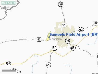
Samuels Field Airport
Address:
Nelson County, KY
Tel:
502-348-5947,
502-348-2099
Images
and information placed above are from
http://www.airport-data.com/airport/BRY/
We
thank them for the data!
|
General Info |
| Country |
United
States |
| State |
KENTUCKY
|
| FAA ID |
BRY
|
| Latitude |
37-48-51.558N |
|
Longitude |
085-29-58.697W |
|
Elevation |
669 feet
|
| Near
City |
BARDSTOWN |
We don't guarantee the information is fresh and accurate. The data may
be wrong or outdated.
For more up-to-date information please refer to other sources.
|
|


