 |
|
|
Location &
QuickFacts
|
FAA
Information Effective: |
2008-09-25 |
|
Airport
Identifier: |
3KY6 |
|
Airport
Status: |
Operational |
|
Longitude/Latitude: |
086-13-54.0000W/38-01-50.0000N
-86.231667/38.030556 (Estimated) |
|
Elevation: |
430 ft / 131.06 m (Estimated) |
|
Land: |
65 acres |
|
From
nearest city: |
4 nautical miles SE of Battletown, KY |
|
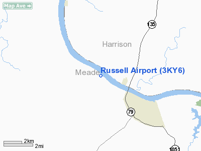
Location: |
Meade County, KY |
|
Magnetic Variation: |
02W () |
Owner & Manager
|
Ownership: |
Privately owned |
|
Owner: |
Mike Russell |
|
Address: |
380 Cosier Road
Battletown, KY 40104 |
|
Phone number: |
502-422-5299 |
|
Manager: |
Mike Russell |
|
Address: |
380 Crosier Road
Battletown, KY 40104 |
|
Phone number: |
501-422-5299 |
Airport
Operations and Facilities
|
Airport
Use: |
Private |
|
Wind
indicator: |
Yes |
|
Segmented Circle: |
No |
|
Control
Tower: |
No |
|
Sectional chart: |
St Louis |
|
Region: |
ASO - Southern |
|
Boundary
ARTCC: |
ZID - Indianapolis |
|
Tie-in
FSS: |
LOU - Louisville |
|
FSS Toll
Free: |
1-800-WX-BRIEF |
|
Runway Information
Runway 15/33
|
Dimension: |
1300 x 100 ft / 396.2 x 30.5 m |
|
Surface: |
TURF, |
|
|
Runway 15
|
Runway 33
|
|
Traffic
Pattern: |
Left |
Left |
|
Radio Navigation Aids
|
ID |
Type |
Name |
Ch |
Freq |
Var |
Dist |
|
GOI |
NDB |
Godman |
|
396.00 |
02W |
12.8 nm |
|
TEL |
NDB |
Tell City |
|
206.00 |
02W |
21.7 nm |
|
FNZ |
NDB |
Ferdinand |
|
239.00 |
00E |
31.5 nm |
|
RRJ |
NDB |
Oranj |
|
368.00 |
02W |
33.0 nm |
|
BRY |
NDB |
Bardstown/dcmsnd |
|
248.00 |
02W |
37.1 nm |
|
BFR |
NDB |
Bedford |
|
344.00 |
02W |
49.6 nm |
|
MYS |
VOR |
Mystic |
|
108.20 |
01W |
8.2 nm |
|
FTK |
VOR/DME |
Fort Knox |
033X |
109.60 |
01W |
14.3 nm |
|
BQM |
VOR/DME |
Bowman |
059X |
112.20 |
01W |
29.4 nm |
|
EWO |
VOR/DME |
New Hope |
045X |
110.80 |
01E |
35.6 nm |
|
HNB |
VOR/DME |
Huntingburg |
029X |
109.20 |
00E |
36.7 nm |
|
OWB |
VOR/DME |
Owensboro |
023X |
108.60 |
01E |
47.6 nm |
|
IIU |
VORTAC |
Louisville |
095X |
114.80 |
01E |
31.3 nm |
|
ABB |
VORTAC |
Nabb |
071X |
112.40 |
01E |
43.8 nm |
|
SDF |
VOT |
Louisville Standifd |
|
111.00 |
|
25.1 nm |
Remarks
-
SEE AIRSPACE CASE
97-MEM-027-NRA.
Based Aircraft
|
Aircraft based
on field: |
3 |
|
Single Engine
Airplanes: |
1 |
|
Helicopters: |
1 |
|
Ultralights: |
1 |
Russell Airport
Address:
Meade County, KY
Tel:
502-422-5299
Images
and information placed above are from
http://www.airport-data.com/airport/3KY6/
We
thank them for the data!
|
General Info |
| Country |
United
States |
| State |
KENTUCKY
|
| FAA ID |
3KY6
|
| Latitude |
38-01-50.000N |
|
Longitude |
086-13-54.000W |
|
Elevation |
430 feet
|
| Near
City |
BATTLETOWN |
We don't guarantee the information is fresh and accurate. The data may
be wrong or outdated.
For more up-to-date information please refer to other sources.
|
|


