|
|
|
 |
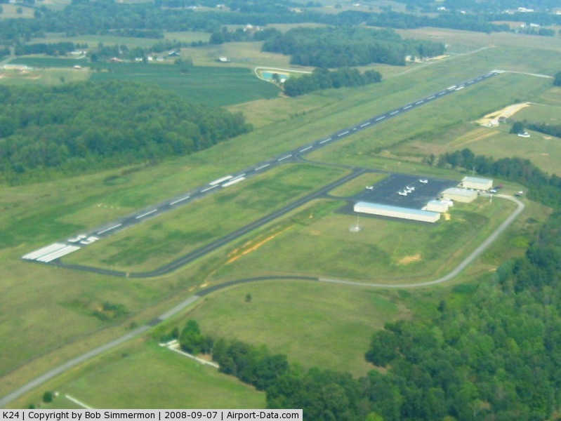
(Click on the photo to enlarge) |
|
 |
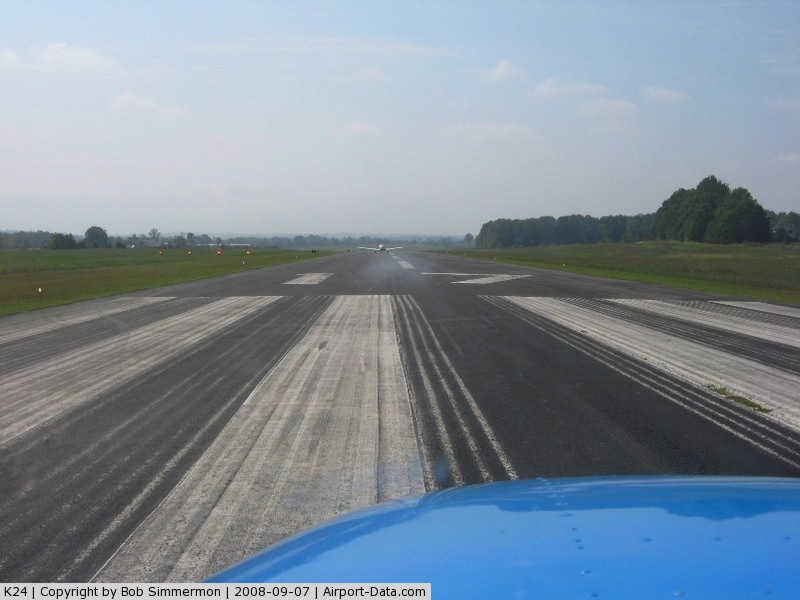
(Click on the photo to enlarge) |
|
 |
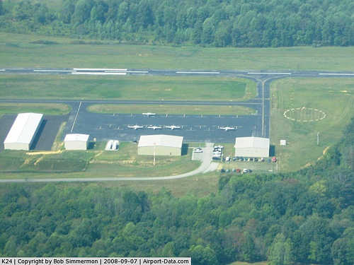
(Click on the photo to enlarge) |
|
Location &
QuickFacts
|
FAA
Information Effective: |
2008-09-25 |
|
Airport
Identifier: |
K24 |
|
Airport
Status: |
Operational |
|
Longitude/Latitude: |
085-06-09.8450W/37-00-34.9100N
-85.102735/37.009697 (Estimated) |
|
Elevation: |
1011 ft / 308.15 m (Surveyed) |
|
Land: |
165 acres |
|
From
nearest city: |
2 nautical miles NW of Jamestown, KY |
|
Location: |
Russell County, KY |
|
Magnetic Variation: |
04W (2005) |
Owner & Manager
|
Ownership: |
Publicly owned |
|
Owner: |
Russell County Airport Board |
|
Address: |
628 C. Smith Road
Jamestown, KY 42629 |
|
Phone
number: |
270-343-6644 |
|
Manager: |
Denzil Mc Ginnis
AIRPORT BOARD CHAIRMAN. |
|
Address: |
Po Box 1633
Russell Springs, KY 42642 |
|
Phone number: |
270-866-3439 |
Airport Operations and Facilities
|
Airport
Use: |
Open to public |
|
Wind
indicator: |
Yes |
|
Segmented Circle: |
Yes |
|
Control
Tower: |
No |
|
Lighting
Schedule: |
DUSK-DAWN
ACTVT MIRL RY 17/35 - CTAF. |
|
Beacon
Color: |
Clear-Green (lighted land airport) |
|
Sectional chart: |
St Louis |
|
Region: |
ASO - Southern |
|
Boundary
ARTCC: |
ZID - Indianapolis |
|
Tie-in
FSS: |
LOU - Louisville |
|
FSS on
Airport: |
No |
|
FSS Toll
Free: |
1-800-WX-BRIEF |
|
NOTAMs
Facility: |
LOU (NOTAM-d service avaliable) |
|
Federal Agreements: |
NGY |
Airport Communications
|
CTAF: |
123.000 |
|
Unicom: |
123.000 |
Airport Services
|
Fuel
available: |
100LLA
FUEL AFTER HRS, CALL 270-343-2739. |
|
Airframe
Repair: |
MAJOR |
|
Power
Plant Repair: |
MAJOR |
|
Runway Information
Runway 17/35
|
Dimension: |
5000 x 75 ft / 1524.0 x 22.9 m |
|
Surface: |
ASPH, Good Condition |
|
Weight Limit: |
Single wheel: 12000 lbs. |
|
Edge Lights: |
Medium |
|
|
Runway 17
|
Runway 35
|
|
Longitude: |
085-06-12.3400W |
085-06-07.3500W |
|
Latitude: |
37-00-59.5500N |
37-00-10.2700N |
|
Elevation: |
1011.00 ft |
958.00 ft |
|
Alignment: |
127 |
127 |
|
Traffic
Pattern: |
Left |
Left |
|
Markings: |
Non-precision instrument, Good Condition |
Non-precision instrument, Good Condition |
|
Crossing
Height: |
37.00 ft |
37.00 ft |
|
VASI: |
4-light PAPI on left side |
4-light PAPI on left side |
|
Visual
Glide Angle: |
4.00° |
3.00° |
|
Runway End
Identifier: |
Yes |
Yes |
|
Obstruction: |
65 ft trees, 2500.0 ft from runway, 100 ft left of
centerline, 35:1 slope to clear |
54 ft trees, 2071.0 ft from runway, 235 ft right of
centerline, 34:1 slope to clear |
|
Radio Navigation Aids
|
ID |
Type |
Name |
Ch |
Freq |
Var |
Dist |
|
EKQ |
NDB |
Elk Spring |
|
290.00 |
03W |
15.1 nm |
|
CDX |
NDB |
Cumberland River |
|
388.00 |
05E |
20.2 nm |
|
TYC |
NDB |
Taylor County |
|
272.00 |
02W |
24.5 nm |
|
DVK |
NDB |
Goodall |
|
311.00 |
03W |
37.7 nm |
|
IKY |
NDB |
Springfield |
|
429.00 |
03W |
38.1 nm |
|
BPO |
NDB |
Piney Grove |
|
403.00 |
05W |
41.3 nm |
|
BVQ |
NDB |
Beaver Creek |
|
260.00 |
02W |
43.5 nm |
|
EWO |
VOR/DME |
New Hope |
045X |
110.80 |
01E |
46.4 nm |
|
LVT |
VORTAC |
Livingston |
021X |
108.40 |
02W |
25.7 nm |
|
LOZ |
VORTAC |
London |
108X |
116.10 |
03W |
47.7 nm |
Remarks
-
DRAG STRIP AT OLD
ARPT, APRXLY 1 MI NE; DO NOT MISTAKE FOR RY.
-
PROVIDED VFR
ONLY; CLEAR 20:1 APCH SLOPE FOR EACH RY; RUSSEL COUNTY ARPT RUSSELL SPRINGS KY
CLOSED CONCURRENTLY; ARPT DESIGNED IAW AC 150/4300-13.
Based Aircraft
|
Aircraft based
on field: |
10 |
|
Single Engine
Airplanes: |
8 |
|
Multi Engine
Airplanes: |
1 |
|
Jet Engine
Airplanes: |
1 |
Operational Statistics
Time Period: 2006-03-22 - 2007-03-22
|
Aircraft
Operations: |
112/Week |
|
Air Taxi: |
3.4% |
|
General
Aviation Local: |
43.1% |
|
General
Aviation Itinerant: |
51.7% |
|
Military: |
1.7% |
Russell County Airport
Address:
Russell County, KY
Tel:
270-343-6644,
270-866-3439
Images
and information placed above are from
http://www.airport-data.com/airport/K24/
We
thank them for the data!
|
General Info |
| Country |
United
States |
| State |
KENTUCKY
|
| FAA ID |
K24
|
| Latitude |
37-00-32.000N |
|
Longitude |
085-06-10.000W |
|
Elevation |
1011
feet |
| Near
City |
JAMESTOWN |
We don't guarantee the information is fresh and accurate. The data may
be wrong or outdated.
For more up-to-date information please refer to other sources.
|
|