|
|
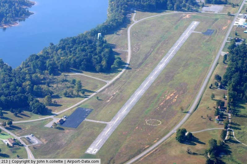
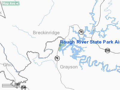
Rough River State Park Airport |
|
 |
(Click on the photo to enlarge) |
|
Location &
QuickFacts
|
FAA
Information Effective: |
2008-09-25 |
|
Airport
Identifier: |
2I3 |
|
Airport
Status: |
Operational |
|
Longitude/Latitude: |
086-30-25.8000W/37-36-35.3000N
-86.507167/37.609806 (Estimated) |
|
Elevation: |
577 ft / 175.87 m (Surveyed) |
|
Land: |
40 acres |
|
From
nearest city: |
3 nautical miles NE of Falls-of-rough, KY |
|
Location: |
Grayson County, KY |
|
Magnetic Variation: |
01W (1985) |
Owner & Manager
|
Ownership: |
Publicly owned |
|
Owner: |
Ky Dept Of Parks |
|
Address: |
Capital Plaza Tower
Frankfort, KY 40601 |
|
Phone
number: |
270-564-2172 |
|
Manager: |
Chuck Tempfer |
|
Address: |
Rough River State Park
Falls Of Rough, KY 40119 |
|
Phone number: |
270-257-2311 |
Airport Operations and Facilities
|
Airport
Use: |
Open to public |
|
Wind
indicator: |
Yes |
|
Segmented Circle: |
Yes |
|
Control
Tower: |
No |
|
Lighting
Schedule: |
DUSK-DAWN |
|
Beacon
Color: |
Clear-Green (lighted land airport) |
|
Landing
fee charge: |
No |
|
Sectional chart: |
St Louis |
|
Region: |
ASO - Southern |
|
Boundary
ARTCC: |
ZID - Indianapolis |
|
Tie-in
FSS: |
LOU - Louisville |
|
FSS on
Airport: |
No |
|
FSS Toll
Free: |
1-800-WX-BRIEF |
|
NOTAMs
Facility: |
LOU (NOTAM-d service avaliable) |
Airport Communications
|
CTAF: |
122.800 |
|
Unicom: |
122.800 |
Airport Services
|
Airframe
Repair: |
NONE |
|
Power
Plant Repair: |
NONE |
|
Bottled
Oxygen: |
NONE |
|
Bulk
Oxygen: |
NONE |
|
Runway Information
Runway 02/20
|
Dimension: |
3200 x 75 ft / 975.4 x 22.9 m |
|
Surface: |
ASPH, Good Condition |
|
Weight Limit: |
Single wheel: 8000 lbs. |
|
Edge Lights: |
Medium |
|
|
Runway 02
|
Runway 20
|
|
Longitude: |
086-30-31.6300W |
086-30-19.9600W |
|
Latitude: |
37-36-20.2100N |
37-36-50.4600N |
|
Traffic
Pattern: |
Left |
Left |
|
Markings: |
Basic, Fair Condition |
Basic, Fair Condition |
|
Crossing
Height: |
0.00 ft |
28.00 ft |
|
VASI: |
|
4-light PAPI on left side |
|
Visual
Glide Angle: |
0.00° |
3.00° |
|
Obstruction: |
13 ft road, 282.0 ft from runway, 130 ft right of
centerline, 6:1 slope to clear |
40 ft tree, 566.0 ft from runway, 121 ft left of
centerline, 9:1 slope to clear |
|
Radio Navigation Aids
|
ID |
Type |
Name |
Ch |
Freq |
Var |
Dist |
|
TEL |
NDB |
Tell City |
|
206.00 |
02W |
25.8 nm |
|
GOI |
NDB |
Godman |
|
396.00 |
02W |
32.8 nm |
|
GMH |
NDB |
Muhlenberg |
|
362.00 |
01E |
38.7 nm |
|
FNZ |
NDB |
Ferdinand |
|
239.00 |
00E |
41.5 nm |
|
BVQ |
NDB |
Beaver Creek |
|
260.00 |
02W |
42.8 nm |
|
MYS |
VOR |
Mystic |
|
108.20 |
01W |
21.2 nm |
|
FTK |
VOR/DME |
Fort Knox |
033X |
109.60 |
01W |
31.1 nm |
|
OWB |
VOR/DME |
Owensboro |
023X |
108.60 |
01E |
32.4 nm |
|
EWO |
VOR/DME |
New Hope |
045X |
110.80 |
01E |
39.6 nm |
|
HNB |
VOR/DME |
Huntingburg |
029X |
109.20 |
00E |
44.0 nm |
|
CCT |
VORTAC |
Central City |
035X |
109.80 |
01W |
38.6 nm |
|
BWG |
VORTAC |
Bowling Green |
126X |
117.90 |
02E |
41.1 nm |
Remarks
Operational Statistics
Time Period: 2005-09-01 - 2006-08-31
|
Aircraft
Operations: |
114/Week |
|
Air Taxi: |
3.4% |
|
General
Aviation Local: |
6.8% |
|
General
Aviation Itinerant: |
84.7% |
|
Military: |
5.1% |
Rough River State Park Airport
Address:
Grayson County, KY
Tel:
270-564-2172,
270-257-2311
Images
and information placed above are from
http://www.airport-data.com/airport/2I3/
We
thank them for the data!
|
General Info |
| Country |
United
States |
| State |
KENTUCKY
|
| FAA ID |
2I3
|
| Latitude |
37-36-35.198N |
|
Longitude |
086-30-24.931W |
|
Elevation |
577 feet
|
| Near
City |
FALLS-OF-ROUGH |
We don't guarantee the information is fresh and accurate. The data may
be wrong or outdated.
For more up-to-date information please refer to other sources.
|
|