 |
|
Regional Medical Center Heliport |
|
|
|
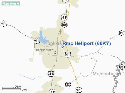
Location &
QuickFacts
|
FAA
Information Effective: |
2008-09-25 |
|
Airport
Identifier: |
60KY |
|
Airport
Status: |
Operational |
|
Longitude/Latitude: |
087-29-14.9970W/37-20-34.1610N
-87.487499/37.342822 (Estimated) |
|
Elevation: |
460 ft / 140.21 m (Estimated) |
|
Land: |
0 acres |
|
From
nearest city: |
0 nautical miles NE of Madisonville, KY |
|
Location: |
Hopkins County, KY |
|
Magnetic Variation: |
00W (1984) |
Owner & Manager
|
Ownership: |
Publicly owned |
|
Owner: |
Regional Medical Center
REGIONAL MEDICAL CENTER OF HOPKINS COUNTY. |
|
Address: |
Hospital Drive
Madisonville, KY 42431 |
|
Phone number: |
502-825-5100 |
|
Manager: |
Bobby H. Dampier |
|
Address: |
Hospital Drive
Madisonville, KY 42431 |
|
Phone number: |
502-825-5100 |
Airport
Operations and Facilities
|
Airport
Use: |
Private
MEDICAL. |
|
Wind
indicator: |
Yes |
|
Segmented Circle: |
No |
|
Control
Tower: |
No |
|
Lighting
Schedule: |
PHONE REQ
FOR PERIMETER LGTS CALL 502-825-5100. |
|
Landing
fee charge: |
No |
|
Sectional chart: |
St Louis |
|
Region: |
ASO - Southern |
|
Boundary
ARTCC: |
ZID - Indianapolis |
|
Tie-in
FSS: |
LOU - Louisville |
|
FSS on
Airport: |
No |
|
FSS Toll
Free: |
1-800-WX-BRIEF |
|
Runway Information
Helipad H1
|
Dimension: |
60 x 60 ft / 18.3 x 18.3 m |
|
Surface: |
CONC, |
|
|
Runway H1
|
Runway
|
|
Traffic
Pattern: |
Left |
Left |
|
Radio Navigation Aids
|
ID |
Type |
Name |
Ch |
Freq |
Var |
Dist |
|
GMH |
NDB |
Muhlenberg |
|
362.00 |
01E |
17.2 nm |
|
TWT |
NDB |
Tradewater |
|
276.00 |
00E |
23.2 nm |
|
HIX |
NDB |
Honey Grove |
|
356.00 |
01W |
28.7 nm |
|
GVA |
NDB |
Geneva |
|
224.00 |
01W |
30.8 nm |
|
FK |
NDB |
Airbe |
|
273.00 |
01W |
36.6 nm |
|
PDW |
NDB |
Evansville |
|
284.00 |
00E |
42.0 nm |
|
HXW |
TACAN |
Screaming Eagle |
096X |
|
01W |
40.1 nm |
|
OWB |
VOR/DME |
Owensboro |
023X |
108.60 |
01E |
28.5 nm |
|
CKV |
VOR/DME |
Clarksville |
043X |
110.60 |
01W |
43.5 nm |
|
CCT |
VORTAC |
Central City |
035X |
109.80 |
01W |
11.0 nm |
|
PXV |
VORTAC |
Pocket City |
080X |
113.30 |
03E |
37.5 nm |
Remarks
Regional Medical Center Heliport
Address:
Hopkins County, KY
Tel:
502-825-5100
Images
and information placed above are from
http://www.airport-data.com/airport/60KY/
We
thank them for the data!
|
General Info |
| Country |
United
States |
| State |
KENTUCKY
|
| FAA ID |
60KY
|
| Latitude |
37-20-34.161N |
|
Longitude |
087-29-14.997W |
|
Elevation |
460 feet
|
| Near
City |
MADISONVILLE |
We don't guarantee the information is fresh and accurate. The data may
be wrong or outdated.
For more up-to-date information please refer to other sources.
|
|


