 |
|
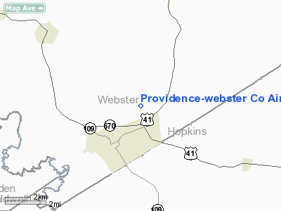
Providence-webster Company Airport |
|
|
|
Location &
QuickFacts
|
FAA
Information Effective: |
2008-09-25 |
|
Airport
Identifier: |
8M9 |
|
Airport
Status: |
Operational |
|
Longitude/Latitude: |
087-44-10.0400W/37-25-29.1600N
-87.736122/37.424767 (Estimated) |
|
Elevation: |
393 ft / 119.79 m (Estimated) |
|
Land: |
43 acres |
|
From
nearest city: |
2 nautical miles NE of Providence, KY |
|
Location: |
Webster County, KY |
|
Magnetic Variation: |
00E (1985) |
Owner & Manager
|
Ownership: |
Publicly owned |
|
Owner: |
Providence/webster Co Arpt Board |
|
Address: |
9020 St Rt 293s
Providence, KY 42450 |
|
Phone
number: |
270-821-3995
AIR BOARD CHAIRMAN, STEVE PERDUE. |
|
Manager: |
Providence-webster Co Arpt Board |
|
Address: |
9020 St Rt 293s
Providence, KY 42450 |
|
Phone number: |
270-667-5028 |
Airport Operations and Facilities
|
Airport
Use: |
Open to public |
|
Wind
indicator: |
Yes
LCTD INSIDE OBJECT FREE AREA. |
|
Segmented Circle: |
Yes |
|
Control
Tower: |
No |
|
Lighting
Schedule: |
DUSK-DAWN
ACTVT MIRL RY 16/34 - CTAF. |
|
Beacon
Color: |
Clear-Green (lighted land airport) |
|
Landing
fee charge: |
No |
|
Sectional chart: |
St Louis |
|
Region: |
ASO - Southern |
|
Boundary
ARTCC: |
ZME - Memphis |
|
Responsible ARTCC: |
ZID - Indianapolis |
|
Tie-in
FSS: |
LOU - Louisville |
|
FSS on
Airport: |
No |
|
FSS Toll
Free: |
1-800-WX-BRIEF |
|
NOTAMs
Facility: |
LOU (NOTAM-d service avaliable) |
Airport Communications
|
CTAF: |
122.800 |
|
Unicom: |
122.800 |
Airport Services
|
Airframe
Repair: |
NONE |
|
Power
Plant Repair: |
NONE |
|
Bottled
Oxygen: |
NONE |
|
Bulk
Oxygen: |
NONE |
|
Runway Information
Runway 16/34
|
Dimension: |
3800 x 70 ft / 1158.2 x 21.3 m |
|
Surface: |
ASPH, Fair Condition
MAJOR CRACKING AND SEPERATION IN ASPHALT. |
|
Weight Limit: |
Single wheel: 7500 lbs. |
|
Edge Lights: |
Medium |
|
|
Runway 16
|
Runway 34
|
|
Traffic
Pattern: |
Left |
Left |
|
Markings: |
Basic, Good Condition |
Basic, Good Condition |
|
Obstruction: |
9 ft trees, 525.0 ft from runway, 36:1 slope to clear |
15 ft trees, 200.0 ft from runway, 30 ft left of
centerline
15 FT TREES 30 FT LEFT OF RY. |
|
Radio Navigation Aids
|
ID |
Type |
Name |
Ch |
Freq |
Var |
Dist |
|
TWT |
NDB |
Tradewater |
|
276.00 |
00E |
10.4 nm |
|
GVA |
NDB |
Geneva |
|
224.00 |
01W |
22.8 nm |
|
GMH |
NDB |
Muhlenberg |
|
362.00 |
01E |
30.0 nm |
|
HIX |
NDB |
Honey Grove |
|
356.00 |
01W |
37.9 nm |
|
PDW |
NDB |
Evansville |
|
284.00 |
00E |
38.3 nm |
|
FK |
NDB |
Airbe |
|
273.00 |
01W |
44.1 nm |
|
CUL |
NDB |
Carmi |
|
332.00 |
01W |
44.1 nm |
|
HSB |
NDB |
Harrisburg-raleigh |
|
230.00 |
00E |
45.0 nm |
|
BDD |
NDB |
Bellgrade |
|
254.00 |
00E |
47.7 nm |
|
HXW |
TACAN |
Screaming Eagle |
096X |
|
01W |
46.5 nm |
|
OWB |
VOR/DME |
Owensboro |
023X |
108.60 |
01E |
33.2 nm |
|
CCT |
VORTAC |
Central City |
035X |
109.80 |
01W |
22.7 nm |
|
PXV |
VORTAC |
Pocket City |
080X |
113.30 |
03E |
30.3 nm |
Remarks
-
POLES, PLINE &
TREES VIOLATE 7:1 ZONE BOTH SIDES OF RWY.
-
ULTRALIGHT ACTVTY
ON AND INVOF ARPT.
-
VFR ONLY.
Based Aircraft
|
Aircraft based
on field: |
6 |
|
Single Engine
Airplanes: |
5 |
|
Ultralights: |
1 |
Operational Statistics
Time Period: 2007-04-03 - 2008-04-01
|
Aircraft
Operations: |
72/Week |
|
Air Taxi: |
6.7% |
|
General
Aviation Local: |
55.0% |
|
General
Aviation Itinerant: |
38.3% |
Providence-webster Company Airport
Address:
Webster County, KY
Tel:
270-821-3995, 270-667-5028
Images
and information placed above are from
http://www.airport-data.com/airport/8M9/
We
thank them for the data!
|
General Info |
| Country |
United
States |
| State |
KENTUCKY
|
| FAA ID |
8M9
|
| Latitude |
37-25-29.160N |
|
Longitude |
087-44-10.040W |
|
Elevation |
393 feet
|
| Near
City |
PROVIDENCE |
We don't guarantee the information is fresh and accurate. The data may
be wrong or outdated.
For more up-to-date information please refer to other sources.
|
|


