 |
|
|
Location &
QuickFacts
|
FAA
Information Effective: |
2008-09-25 |
|
Airport
Identifier: |
2KY3 |
|
Airport
Status: |
Operational |
|
Longitude/Latitude: |
086-27-30.0000W/36-50-05.0000N
-86.458333/36.834722 (Estimated) |
|
Elevation: |
655 ft / 199.64 m (Estimated) |
|
Land: |
0 acres |
|
From
nearest city: |
8 nautical miles S of Bowling Green, KY |
|
Location: |
Warren County, KY |
|
Magnetic Variation: |
02W (1995) |
Owner & Manager
|
Ownership: |
Privately owned |
|
Owner: |
Henry Honaker |
|
Address: |
4918 Woodburn-allen Springs Road
Woodburn, KY 42170 |
|
Phone
number: |
270-781-2470 |
|
Manager: |
Henry Honaker |
|
Address: |
4918 Woodburn-allen Springs Road
Woodburn, KY 42170 |
|
Phone number: |
270-781-2470 |
Airport Operations and Facilities
|
Airport
Use: |
Private |
|
Segmented Circle: |
No |
|
Control
Tower: |
No |
|
Sectional chart: |
St Louis |
|
Region: |
ASO - Southern |
|
Boundary
ARTCC: |
ZME - Memphis |
|
Tie-in
FSS: |
LOU - Louisville |
|
FSS Toll
Free: |
1-800-WX-BRIEF |
|
Runway Information
Runway 03/21
|
Dimension: |
2000 x 80 ft / 609.6 x 24.4 m |
|
Surface: |
TURF, |
|
|
Runway 03
|
Runway 21
|
|
Traffic
Pattern: |
Left |
Left |
|
Obstruction: |
10 ft plines, 500.0 ft from runway |
|
|
Radio Navigation Aids
|
ID |
Type |
Name |
Ch |
Freq |
Var |
Dist |
|
BVQ |
NDB |
Beaver Creek |
|
260.00 |
02W |
24.2 nm |
|
LFB |
NDB |
Lafayette |
|
245.00 |
02W |
27.1 nm |
|
PED |
NDB |
Needmore |
|
221.00 |
01W |
28.5 nm |
|
ON |
NDB |
Music |
|
279.00 |
03W |
34.7 nm |
|
VI |
NDB |
Opery |
|
344.00 |
02W |
39.1 nm |
|
JUE |
NDB |
Lebanon |
|
414.00 |
02W |
39.2 nm |
|
GMH |
NDB |
Muhlenberg |
|
362.00 |
01E |
41.1 nm |
|
HIX |
NDB |
Honey Grove |
|
356.00 |
01W |
42.4 nm |
|
FK |
NDB |
Airbe |
|
273.00 |
01W |
46.4 nm |
|
CKV |
VOR/DME |
Clarksville |
043X |
110.60 |
01W |
47.7 nm |
|
BWG |
VORTAC |
Bowling Green |
126X |
117.90 |
02E |
5.7 nm |
|
BNA |
VORTAC |
Nashville |
088X |
114.10 |
02W |
43.3 nm |
|
BNA |
VOT |
Nashville Metropoln |
|
108.60 |
|
43.9 nm |
|
MQY |
VOT |
Smyrna |
|
110.20 |
|
49.8 nm |
Remarks
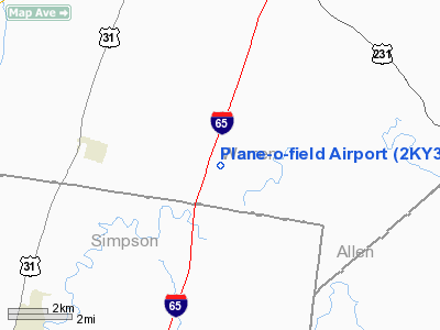
Plane-o-field Airport
Address:
Warren County, KY
Tel:
270-781-2470
Images
and information placed above are from
http://www.airport-data.com/airport/2KY3/
We
thank them for the data!
| General Info |
| Country |
United States |
| State |
KENTUCKY |
| FAA ID |
2KY3 |
| Latitude |
36-50-05.000N |
| Longitude |
086-27-30.000W |
| Elevation |
800 feet |
| Near City |
BOWLING GREEN |
We don't guarantee the information is fresh and accurate. The data may
be wrong or outdated.
For more up-to-date information please refer to other sources.
|
|


