 |
|
|
|
|
|
|
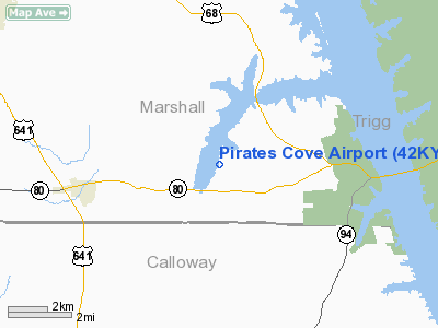
Location &
QuickFacts
|
FAA
Information Effective: |
2008-09-25 |
|
Airport
Identifier: |
42KY |
|
Airport
Status: |
Operational |
|
Longitude/Latitude: |
088-13-20.1170W/36-46-35.1960N
-88.222255/36.776443 (Estimated) |
|
Elevation: |
380 ft / 115.82 m (Surveyed) |
|
Land: |
0 acres |
|
From
nearest city: |
9 nautical miles SE of Benton, KY |
|
Location: |
Marshall County, KY |
|
Magnetic Variation: |
01E (1985) |
Owner & Manager
|
Ownership: |
Privately owned |
|
Owner: |
Owners Assn Pirates Cove |
|
Address: |
500 Pirates Cove Rd
Hardin, KY 42048 |
|
Phone
number: |
502-354-9066 |
|
Manager: |
Robert Webster |
|
Address: |
500 Pirates Cove Rd
Hardin, KY 42048 |
|
Phone number: |
502-354-9066 |
Airport Operations and Facilities
|
Airport Use: |
Private |
|
Wind indicator: |
Yes |
|
Segmented Circle: |
Yes |
|
Control Tower: |
No |
|
Lighting Schedule: |
DUSK-2200
REIL RY 36 OPER 0600-0000. |
|
Landing fee charge: |
Yes |
|
Sectional chart: |
St Louis |
|
Region: |
ASO - Southern |
|
Boundary ARTCC: |
ZME - Memphis |
|
Tie-in FSS: |
LOU - Louisville |
|
FSS on Airport: |
No |
|
FSS Toll Free: |
1-800-WX-BRIEF |
Airport
Communications
Airport Services
|
Airframe
Repair: |
NONE |
|
Power
Plant Repair: |
NONE |
|
Runway Information
Runway 18/36
|
Dimension: |
3000 x 32 ft / 914.4 x 9.8 m |
|
Surface: |
ASPH, |
|
Edge Lights: |
Low |
|
|
Runway 18
|
Runway 36
|
|
Traffic
Pattern: |
Left |
Left |
|
Runway End
Identifier: |
|
Yes |
|
Radio Navigation Aids
|
ID |
Type |
Name |
Ch |
Freq |
Var |
Dist |
|
GGK |
NDB |
Mayfield |
|
401.00 |
00E |
18.6 nm |
|
BDD |
NDB |
Bellgrade |
|
254.00 |
00E |
30.9 nm |
|
TIQ |
NDB |
Trainer |
|
410.00 |
00E |
33.0 nm |
|
FK |
NDB |
Airbe |
|
273.00 |
01W |
39.0 nm |
|
HZD |
NDB |
Huntingdon |
|
217.00 |
00E |
43.0 nm |
|
HIX |
NDB |
Honey Grove |
|
356.00 |
01W |
43.0 nm |
|
TWT |
NDB |
Tradewater |
|
276.00 |
00E |
43.5 nm |
|
AEY |
NDB |
Waverly |
|
329.00 |
00E |
46.0 nm |
|
UC |
NDB |
Obion |
|
212.00 |
00E |
47.1 nm |
|
HXW |
TACAN |
Screaming Eagle |
096X |
|
01W |
35.6 nm |
|
CKV |
VOR/DME |
Clarksville |
043X |
110.60 |
01W |
40.1 nm |
|
CNG |
VORTAC |
Cunningham |
078X |
113.10 |
03E |
32.7 nm |
Remarks
Pirates Cove Airport
Address:
Marshall County, KY
Tel:
502-354-9066
Images
and information placed above are from
http://www.airport-data.com/airport/42KY/
We
thank them for the data!
|
General Info |
| Country |
United
States |
| State |
KENTUCKY
|
| FAA ID |
42KY
|
| Latitude |
36-46-35.196N |
|
Longitude |
088-13-20.117W |
|
Elevation |
380 feet
|
| Near
City |
BENTON
|
We don't guarantee the information is fresh and accurate. The data may
be wrong or outdated.
For more up-to-date information please refer to other sources.
|
|


