 |
|
|
Location &
QuickFacts
|
FAA
Information Effective: |
2008-09-25 |
|
Airport
Identifier: |
77KY |
|
Airport
Status: |
Operational |
|
Longitude/Latitude: |
083-52-24.7150W/38-06-40.2830N
-83.873532/38.111190 (Estimated) |
|
Elevation: |
1000 ft / 304.80 m (Estimated) |
|
Land: |
0 acres |
|
From
nearest city: |
6 nautical miles NE of Mount Sterling/owingsville, KY |
|
Location: |
Montgomery County, KY |
|
Magnetic Variation: |
04W (1985) |
Owner & Manager
|
Ownership: |
Privately owned |
|
Owner: |
Lebaron T. Follett |
|
Address: |
4500 Owingsville Rd
Mount Sterling, KY 40353 |
|
Phone
number: |
606-498-2201 |
|
Manager: |
Lebaron T Follett |
|
Address: |
Airport Road
Mount Sterling, KY 40353 |
|
Phone number: |
606-498-1000 |
Airport Operations and Facilities
|
Airport
Use: |
Private |
|
Wind
indicator: |
Yes |
|
Segmented Circle: |
No |
|
Control
Tower: |
No |
|
Sectional chart: |
Cincinnati |
|
Region: |
ASO - Southern |
|
Boundary
ARTCC: |
ZID - Indianapolis |
|
Tie-in
FSS: |
LOU - Louisville |
|
FSS Toll
Free: |
1-800-WX-BRIEF |
|
Runway Information
Runway 17/35
|
Dimension: |
1600 x 75 ft / 487.7 x 22.9 m |
|
Surface: |
TURF, |
|
|
Runway 17
|
Runway 35
|
|
Traffic
Pattern: |
Left |
Left |
|
Radio Navigation Aids
|
ID |
Type |
Name |
Ch |
Freq |
Var |
Dist |
|
IOB |
NDB |
Mount Sterling |
|
210.00 |
04W |
6.0 nm |
|
XYC |
NDB |
Seco |
|
393.00 |
03W |
22.5 nm |
|
XW |
NDB |
Flmng |
|
400.00 |
05W |
29.8 nm |
|
LE |
NDB |
Blayd |
|
242.00 |
04W |
38.0 nm |
|
FEU |
NDB |
Arnold |
|
521.00 |
03W |
45.2 nm |
|
AMT |
NDB |
West Union |
|
359.00 |
04W |
47.1 nm |
|
FFT |
VOR |
Frankfort |
|
109.40 |
03W |
49.1 nm |
|
FLM |
VOR/DME |
Falmouth |
117X |
117.00 |
04W |
38.4 nm |
|
HYK |
VORTAC |
Lexington |
073X |
112.60 |
00E |
29.7 nm |
|
ECB |
VORTAC |
Newcombe |
041X |
110.40 |
02W |
45.6 nm |
Remarks
-
PRVDD VFR,
PRIVATE USE ONLY.
Based Aircraft
|
Aircraft based
on field: |
2 |
|
Single Engine
Airplanes: |
2 |
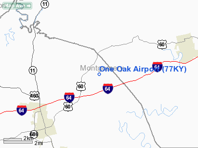
One Oak Airport
Address:
Montgomery County, KY
Tel:
606-498-2201,
606-498-1000
Images
and information placed above are from
http://www.airport-data.com/airport/77KY/
We
thank them for the data!
|
General Info |
| Country |
United
States |
| State |
KENTUCKY
|
| FAA ID |
77KY
|
| Latitude |
38-06-40.283N |
|
Longitude |
083-52-24.715W |
|
Elevation |
1000
feet |
| Near
City |
MOUNT
STERLING/OWINGSVILLE |
We don't guarantee the information is fresh and accurate. The data may
be wrong or outdated.
For more up-to-date information please refer to other sources.
|
|


