 |
|
|
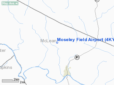
Location &
QuickFacts
|
FAA
Information Effective: |
2008-09-25 |
|
Airport
Identifier: |
4KY4 |
|
Airport
Status: |
Operational |
|
Longitude/Latitude: |
087-16-52.0000W/37-35-33.0000N
-87.281111/37.592500 (Estimated) |
|
Elevation: |
395 ft / 120.40 m (Estimated) |
|
Land: |
0 acres |
|
From
nearest city: |
3 nautical miles NW of Calhoun, KY |
|
Location: |
Mc Lean County, KY |
|
Magnetic Variation: |
01W () |
Owner & Manager
|
Ownership: |
Privately owned |
|
Owner: |
Darrell Moseley |
|
Address: |
400 Golf View Circle
Owensboro, KY 42303 |
|
Phone
number: |
270-685-3618 |
|
Manager: |
Tim Moseley
ADDL PHONE AMGR 270-929-4904. |
|
Address: |
150 Highway 81
Calhoun, KY 42327 |
|
Phone number: |
270-273-5815 |
Airport
Operations and Facilities
|
Airport
Use: |
Private |
|
Wind
indicator: |
Yes |
|
Segmented Circle: |
No |
|
Control
Tower: |
No |
|
Sectional chart: |
St Louis |
|
Region: |
ASO - Southern |
|
Boundary
ARTCC: |
ZID - Indianapolis |
|
Tie-in
FSS: |
LOU - Louisville |
|
FSS Toll
Free: |
1-800-WX-BRIEF |
|
Runway Information
Runway 01/19
|
Dimension: |
2000 x 75 ft / 609.6 x 22.9 m |
|
Surface: |
TURF, |
|
|
Runway 01
|
Runway 19
|
|
Traffic
Pattern: |
Left |
Left |
|
Radio Navigation Aids
|
ID |
Type |
Name |
Ch |
Freq |
Var |
Dist |
|
GMH |
NDB |
Muhlenberg |
|
362.00 |
01E |
22.7 nm |
|
GVA |
NDB |
Geneva |
|
224.00 |
01W |
26.5 nm |
|
PDW |
NDB |
Evansville |
|
284.00 |
00E |
29.4 nm |
|
TWT |
NDB |
Tradewater |
|
276.00 |
00E |
32.6 nm |
|
TEL |
NDB |
Tell City |
|
206.00 |
02W |
37.8 nm |
|
HIX |
NDB |
Honey Grove |
|
356.00 |
01W |
42.9 nm |
|
FNZ |
NDB |
Ferdinand |
|
239.00 |
00E |
44.7 nm |
|
CUL |
NDB |
Carmi |
|
332.00 |
01W |
49.9 nm |
|
OWB |
VOR/DME |
Owensboro |
023X |
108.60 |
01E |
10.6 nm |
|
HNB |
VOR/DME |
Huntingburg |
029X |
109.20 |
00E |
42.4 nm |
|
CCT |
VORTAC |
Central City |
035X |
109.80 |
01W |
12.7 nm |
|
PXV |
VORTAC |
Pocket City |
080X |
113.30 |
03E |
30.5 nm |
Remarks
-
PRVDD ALL APCH/DEP
IN AN AREA ALIGNED 010 DEGS & 190 DEGS, AREA IS MKD, WIND INDICATOR IS
MAINTAINED, BE ADVISED OF MILITARY ACTVTY IN AREA.
Moseley Field Airport
Address:
Mc Lean County, KY
Tel:
270-685-3618,
270-273-5815
Images
and information placed above are from
http://www.airport-data.com/airport/4KY4/
We
thank them for the data!
|
General Info |
| Country |
United
States |
| State |
KENTUCKY
|
| FAA ID |
4KY4
|
| Latitude |
37-35-33.000N |
|
Longitude |
087-16-52.000W |
|
Elevation |
395 feet
|
| Near
City |
CALHOUN
|
We don't guarantee the information is fresh and accurate. The data may
be wrong or outdated.
For more up-to-date information please refer to other sources.
|
|


