 |
|
Morehead-Rowan County Clyde A. Thomas Regional Airport |
Morehead-Rowan County
Clyde A. Thomas Regional Airport |
| IATA: none – ICAO: none – FAA LID: M97 |
| Summary |
| Airport type |
Public |
| Owner |
Morehead-Rowan County Airport Board |
| Serves |
Morehead, Kentucky |
| Elevation AMSL |
1,028 ft / 313 m |
| Coordinates |
38°12′54″N 083°35′15″W / 38.215°N 83.5875°W / 38.215; -83.5875 (Morehead-Rowan County Clyde A. Thomas Regional Airport (M97)) |
| Runways |
| Direction |
Length |
Surface |
| ft |
m |
| 2/20 |
5,500 |
1,676 |
Asphalt |
| Source: Federal Aviation Administration |
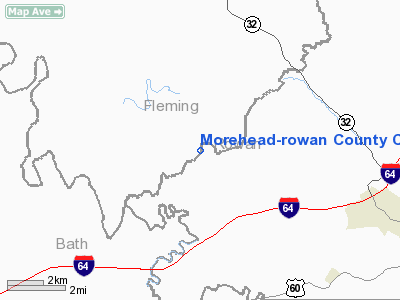
Morehead-Rowan County Clyde A. Thomas Regional Airport (FAA LID: M97) is a public airport located seven nautical miles (13 km) northwest of the central business district of Morehead, a city in Rowan County, Kentucky, United States. It is owned by the Morehead-Rowan County Airport Board.
The airport board began construction on this airport in 2003, in order to accommodate a longer runway than the existing Morehead-Rowan County Airport (FAA LID: I32) at 38°08′00″N 83°32′17″W / 38.1333333°N 83.53806°W / 38.1333333; -83.53806 (Morehead-Rowan County Airport (I32)). The new airport opened in 2007, which resulted in the closure of the old airport.
Facilities and aircraft
Morehead-Rowan County Clyde A. Thomas Regional Airport covers an area of 325 acres (132 ha) which contains one runway designated 2/20 with a 5,500 x 100 ft (1,676 x 30 m) asphalt surface.
The above content comes from Wikipedia and is published under free licenses – click here to read more.
|
Location &
QuickFacts
|
FAA
Information Effective: |
2008-09-25 |
|
Airport
Identifier: |
M97 |
|
Airport
Status: |
Operational |
|
Longitude/Latitude: |
083-35-15.4000W/38-12-54.0000N
-83.587611/38.215000 (Estimated) |
|
Elevation: |
1028 ft / 313.33 m (Estimated) |
|
Land: |
325 acres |
|
From
nearest city: |
4 nautical miles SE of Morehead, KY |
|
Location: |
Rowan County, KY |
|
Magnetic Variation: |
() |
Owner & Manager
|
Ownership: |
Publicly owned |
|
Owner: |
Morehead-rowan County Airport Board |
|
Address: |
221, Roselawn Lane
Morehead, KY 40351 |
|
Phone number: |
606-356-6444 |
|
Address: |
|
Airport
Operations and Facilities
|
Airport
Use: |
Open to public |
|
Wind
indicator: |
Yes |
|
Segmented Circle: |
Yes |
|
Control
Tower: |
No |
|
Lighting
Schedule: |
DUSK-DAWN
ACTVT MIRL RY 02/20 - CTAF. |
|
Beacon
Color: |
Clear-Green (lighted land airport) |
|
Sectional chart: |
Cincinnati |
|
Region: |
ASO - Southern |
|
Boundary
ARTCC: |
ZID - Indianapolis |
|
Tie-in
FSS: |
LOU - Louisville |
|
FSS Toll Free: |
1-800-WX-BRIEF |
Airport Communications
|
CTAF: |
122.800 |
|
Unicom: |
122.800 |
|
Runway Information
Runway 02/20
|
Dimension: |
5500 x 100 ft / 1676.4 x 30.5 m |
|
Surface: |
ASPH, |
|
Weight Limit: |
Single wheel: 30000 lbs. |
|
Edge Lights: |
Medium |
|
|
Runway 02
|
Runway 20
|
|
Longitude: |
083-35-26.9642W |
083-35-03.8551W |
|
Latitude: |
38-12-28.3746N |
38-13-19.5840N |
|
Elevation: |
1028.00 ft |
1010.00 ft |
|
Traffic
Pattern: |
Left |
Left |
|
Markings: |
Non-precision instrument, Good Condition |
Non-precision instrument, Good Condition |
|
VASI: |
4-light PAPI on left side
OTS INDEFLY. |
4-light PAPI on left side
OTS INDEFLY. |
|
Runway End
Identifier: |
Yes |
Yes |
|
Radio Navigation Aids
|
ID |
Type |
Name |
Ch |
Freq |
Var |
Dist |
|
AJY |
FAN MARKER |
Ashland |
|
|
03W |
42.6 nm |
|
IOB |
NDB |
Mount Sterling |
|
210.00 |
04W |
20.8 nm |
|
XW |
NDB |
Flmng |
|
400.00 |
05W |
21.7 nm |
|
XYC |
NDB |
Seco |
|
393.00 |
03W |
34.6 nm |
|
AMT |
NDB |
West Union |
|
359.00 |
04W |
38.5 nm |
|
PZO |
NDB |
Peebles |
|
329.00 |
02W |
44.2 nm |
|
PMH |
NDB |
Portsmouth |
|
373.00 |
04W |
48.8 nm |
|
FLM |
VOR/DME |
Falmouth |
117X |
117.00 |
04W |
42.9 nm |
|
ECB |
VORTAC |
Newcombe |
041X |
110.40 |
02W |
32.2 nm |
|
YRK |
VORTAC |
York |
075X |
112.80 |
05W |
38.6 nm |
|
HYK |
VORTAC |
Lexington |
073X |
112.60 |
00E |
44.5 nm |
Remarks
-
(CONTACT TITLE)
JAMES FLUTY - AIRPORT BOARD CHAIRMAN.
Based Aircraft
|
Aircraft based
on field: |
10 |
|
Single Engine
Airplanes: |
10 |
Morehead-rowan County Clyde A. Thomas
Regional Airport
Address:
Rowan County, KY
Tel:
606-356-6444
Images
and information placed above are from
http://www.airport-data.com/airport/M97/
We
thank them for the data!
|
|


