 |
|
|
Location &
QuickFacts
|
FAA
Information Effective: |
2008-09-25 |
|
Airport
Identifier: |
13KY |
|
Airport
Status: |
Operational |
|
Longitude/Latitude: |
087-09-21.9910W/37-42-20.1710N
-87.156109/37.705603 (Estimated) |
|
Elevation: |
407 ft / 124.05 m (Estimated) |
|
Land: |
0 acres |
|
From
nearest city: |
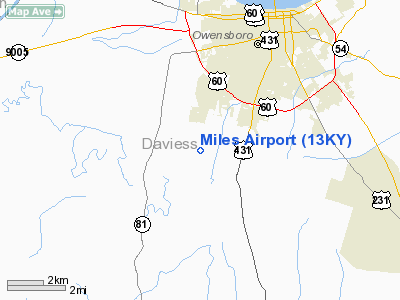
3 nautical miles S of Owensboro, KY |
|
Location: |
Daviess County, KY |
|
Magnetic Variation: |
01W (1985) |
Owner & Manager
|
Ownership: |
Privately owned |
|
Address: |
|
|
Manager: |
T. R. Rourke |
|
Address: |
2764 Keller Rd
Owensboro, KY 42301 |
|
Phone number: |
502-962-1634 |
Airport Operations and Facilities
|
Airport Use: |
Private |
|
Wind indicator: |
Yes |
|
Segmented Circle: |
No |
|
Control Tower: |
No |
|
Landing fee charge: |
No |
|
Sectional chart: |
St Louis |
|
Region: |
ASO - Southern |
|
Boundary ARTCC: |
ZID - Indianapolis |
|
Tie-in FSS: |
LOU - Louisville |
|
FSS on Airport: |
No |
|
FSS Toll Free: |
1-800-WX-BRIEF |
Airport Services
|
Airframe
Repair: |
NONE |
|
Power
Plant Repair: |
NONE |
|
Runway Information
Runway 18/36
|
Dimension: |
2000 x 100 ft / 609.6 x 30.5 m |
|
Surface: |
TURF, |
|
|
Runway 18
|
Runway 36
|
|
Traffic
Pattern: |
Left |
Left |
|
Radio Navigation Aids
|
ID |
Type |
Name |
Ch |
Freq |
Var |
Dist |
|
PDW |
NDB |
Evansville |
|
284.00 |
00E |
26.8 nm |
|
GMH |
NDB |
Muhlenberg |
|
362.00 |
01E |
28.8 nm |
|
TEL |
NDB |
Tell City |
|
206.00 |
02W |
28.9 nm |
|
GVA |
NDB |
Geneva |
|
224.00 |
01W |
29.8 nm |
|
FNZ |
NDB |
Ferdinand |
|
239.00 |
00E |
36.0 nm |
|
TWT |
NDB |
Tradewater |
|
276.00 |
00E |
40.3 nm |
|
MYS |
VOR |
Mystic |
|
108.20 |
01W |
44.8 nm |
|
OWB |
VOR/DME |
Owensboro |
023X |
108.60 |
01E |
2.3 nm |
|
HNB |
VOR/DME |
Huntingburg |
029X |
109.20 |
00E |
34.1 nm |
|
CCT |
VORTAC |
Central City |
035X |
109.80 |
01W |
20.1 nm |
|
PXV |
VORTAC |
Pocket City |
080X |
113.30 |
03E |
31.7 nm |
Remarks
-
VFR PERSONAL USE
ONLY; ALL OPS E OF CENTERLINE; MAINTAIN RDO CTC WITH TWR IN CZ; COORDINATE USE
WITH CHIEF, CONTROL TWR.
Based Aircraft
|
Aircraft based
on field: |
3 |
|
Single Engine
Airplanes: |
3 |
Miles Airport
Address:
Daviess County, KY
Tel:
502-962-1634
Images
and information placed above are from
http://www.airport-data.com/airport/13KY/
We
thank them for the data!
|
General Info |
| Country |
United
States |
| State |
KENTUCKY
|
| FAA ID |
13KY
|
| Latitude |
37-42-20.171N |
|
Longitude |
087-09-21.991W |
|
Elevation |
407 feet
|
| Near
City |
OWENSBORO |
We don't guarantee the information is fresh and accurate. The data may
be wrong or outdated.
For more up-to-date information please refer to other sources.
|
|


